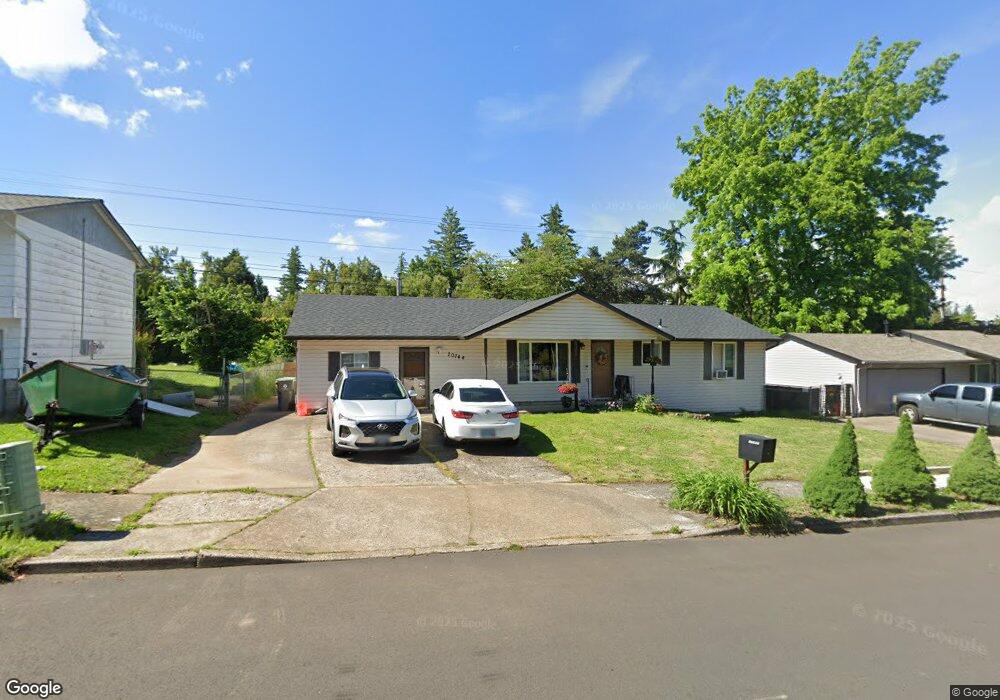
20744 SE Main Dr Gresham, OR 97030
North Central NeighborhoodEstimated Value: $425,735 - $474,000
5
Beds
2
Baths
1,782
Sq Ft
$247/Sq Ft
Est. Value
About This Home
This home is located at 20744 SE Main Dr, Gresham, OR 97030 and is currently estimated at $440,684, approximately $247 per square foot. 20744 SE Main Dr is a home located in Multnomah County with nearby schools including North Gresham Elementary School, Clear Creek Middle School, and Gresham High School.
Ownership History
Date
Name
Owned For
Owner Type
Purchase Details
Closed on
Sep 29, 2023
Sold by
Peck Mary Ann and Peck Thomas
Bought by
Hines Russell Christopher and Peck Alexandra Michelle
Current Estimated Value
Home Financials for this Owner
Home Financials are based on the most recent Mortgage that was taken out on this home.
Original Mortgage
$309,294
Outstanding Balance
$301,723
Interest Rate
6.87%
Mortgage Type
FHA
Estimated Equity
$138,961
Purchase Details
Closed on
Dec 12, 2017
Sold by
Peck Charlotte M
Bought by
Peck Mary Ann and Peck Thomas
Home Financials for this Owner
Home Financials are based on the most recent Mortgage that was taken out on this home.
Original Mortgage
$125,000
Interest Rate
3.94%
Mortgage Type
New Conventional
Purchase Details
Closed on
Dec 11, 2017
Sold by
Peck Charlotte M
Bought by
Peck Mary Ann and Peck Thomas
Home Financials for this Owner
Home Financials are based on the most recent Mortgage that was taken out on this home.
Original Mortgage
$125,000
Interest Rate
3.94%
Mortgage Type
New Conventional
Create a Home Valuation Report for This Property
The Home Valuation Report is an in-depth analysis detailing your home's value as well as a comparison with similar homes in the area
Home Values in the Area
Average Home Value in this Area
Purchase History
| Date | Buyer | Sale Price | Title Company |
|---|---|---|---|
| Hines Russell Christopher | $315,000 | Chicago Title | |
| Peck Mary Ann | -- | None Available | |
| Peck Mary Ann | -- | None Available |
Source: Public Records
Mortgage History
| Date | Status | Borrower | Loan Amount |
|---|---|---|---|
| Open | Hines Russell Christopher | $309,294 | |
| Previous Owner | Peck Mary Ann | $125,000 | |
| Previous Owner | Peck Mary Ann | $125,000 |
Source: Public Records
Tax History
| Year | Tax Paid | Tax Assessment Tax Assessment Total Assessment is a certain percentage of the fair market value that is determined by local assessors to be the total taxable value of land and additions on the property. | Land | Improvement |
|---|---|---|---|---|
| 2025 | $4,125 | $202,700 | -- | -- |
| 2024 | $3,949 | $196,800 | -- | -- |
| 2023 | $3,597 | $191,070 | $0 | $0 |
| 2022 | $3,497 | $185,510 | $0 | $0 |
| 2021 | $3,409 | $180,110 | $0 | $0 |
| 2020 | $3,207 | $174,870 | $0 | $0 |
| 2019 | $3,124 | $169,780 | $0 | $0 |
| 2018 | $2,978 | $164,840 | $0 | $0 |
| 2017 | $2,857 | $160,040 | $0 | $0 |
| 2016 | $2,519 | $155,380 | $0 | $0 |
Source: Public Records
Map
Nearby Homes
- 2013 NW Bella Vista Dr
- 1811 NW 19th St
- 1861 NW Wonderview Ave
- 21033 SE Clay Ct
- 21016 SE Stark St Unit 71
- 21016 SE Stark St Unit 69
- 21260 SE Stark St
- 1596 NW Riverview Ave
- 21400 SE Stark St Unit 2
- 21532 SE Alder St
- 0 SE Burnside St
- 19776 SE Stark St Unit 147
- 209 SE 214th Ave
- 522 SE 199th Ave
- 1387 NW Riverview Ave Unit 14B
- 805 SE 197th Ave
- 70 NW Birdsdale Ave
- 21525 SE Oak St
- 132 SE 214th Ave
- 21553 SE Ankeny Terrace
- 20816 SE Main Dr
- 20732 SE Main Dr
- 1251 SE 209th Ave
- 1222 SE 208th Ave
- 20724 SE Main Dr
- 1235 SE 208th Ave
- 1235 SE 209th Ave
- 20633 SE Burnside Ct
- 1210 SE 208th Ave
- 20707 SE Burnside Ct
- 20720 SE Main Dr
- 20729 SE Main Dr
- 1240 SE 209th Ave
- 1201 SE 209th Ave
- 1752 NW Burnside Rd
- 20717 SE Burnside Ct
- 1125 SE 208th Ave
- 1120 SE 208th Ave
- 20909 SE Main Dr
Your Personal Tour Guide
Ask me questions while you tour the home.