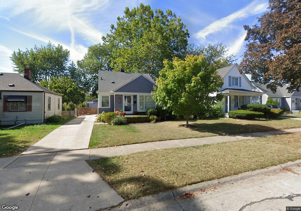
2075 Buckingham Ave Berkley, MI 48072
Estimated Value: $296,341 - $385,000
4
Beds
1
Bath
1,117
Sq Ft
$300/Sq Ft
Est. Value
About This Home
This home is located at 2075 Buckingham Ave, Berkley, MI 48072 and is currently estimated at $335,085, approximately $299 per square foot. 2075 Buckingham Ave is a home located in Oakland County with nearby schools including Angell Elementary School, Anderson Middle School, and Berkley High School.
Ownership History
Date
Name
Owned For
Owner Type
Purchase Details
Closed on
Sep 30, 2014
Sold by
Vanmegroet Robert Victor and Janney Kelly
Bought by
Koerner Timothy A and Koerner Virginia L
Current Estimated Value
Home Financials for this Owner
Home Financials are based on the most recent Mortgage that was taken out on this home.
Original Mortgage
$154,156
Outstanding Balance
$117,023
Interest Rate
4.07%
Mortgage Type
FHA
Estimated Equity
$218,062
Purchase Details
Closed on
Jun 25, 2013
Sold by
Megroet Megroet R and Megroet Marian
Bought by
Vanmegroet Robert Victor and Janney Kelly
Purchase Details
Closed on
Jan 8, 1996
Sold by
Megroet Marian
Bought by
Megroet Marian
Create a Home Valuation Report for This Property
The Home Valuation Report is an in-depth analysis detailing your home's value as well as a comparison with similar homes in the area
Home Values in the Area
Average Home Value in this Area
Purchase History
| Date | Buyer | Sale Price | Title Company |
|---|---|---|---|
| Koerner Timothy A | $157,000 | First American Title Ins Co | |
| Vanmegroet Robert Victor | -- | None Available | |
| Megroet Marian | -- | -- |
Source: Public Records
Mortgage History
| Date | Status | Borrower | Loan Amount |
|---|---|---|---|
| Open | Koerner Timothy A | $154,156 |
Source: Public Records
Tax History
| Year | Tax Paid | Tax Assessment Tax Assessment Total Assessment is a certain percentage of the fair market value that is determined by local assessors to be the total taxable value of land and additions on the property. | Land | Improvement |
|---|---|---|---|---|
| 2025 | $4,977 | $135,010 | $0 | $0 |
| 2024 | $4,783 | $127,440 | $0 | $0 |
| 2023 | $4,402 | $117,270 | $0 | $0 |
| 2022 | $4,578 | $107,840 | $0 | $0 |
| 2021 | $4,153 | $103,180 | $0 | $0 |
| 2020 | $3,018 | $98,110 | $0 | $0 |
| 2019 | $4,540 | $92,310 | $0 | $0 |
| 2018 | $3,809 | $87,550 | $0 | $0 |
| 2017 | $3,931 | $84,690 | $0 | $0 |
| 2016 | $3,577 | $80,480 | $0 | $0 |
| 2015 | -- | $74,100 | $0 | $0 |
| 2014 | -- | $66,950 | $0 | $0 |
| 2011 | -- | $61,850 | $0 | $0 |
Source: Public Records
Map
Nearby Homes
- 2260 Buckingham Ave
- 1799 Phillips Ave
- 1888 Griffith Ave
- 2266 Robina Ave
- 14611 Kingston St
- 2893 Harvard Rd
- 1975 Kipling Ave
- 2654 Royal Ave
- 2863 Columbia Rd
- 2076 Thomas Ave
- 3050 Catalpa Dr
- 14421 Labelle St
- 2679 Oxford Rd
- 14670 Talbot St
- 2795 Robina Ave
- 14710 Loretta Place
- 2828 Robina Ave
- 2813 Kipling Ave
- 2941 Robina Ave
- 2438 Columbia Rd
- 2059 Buckingham Ave
- 2091 Buckingham Ave
- 2043 Buckingham Ave
- 2111 Buckingham Ave
- 2076 Royal Ave
- 2060 Royal Ave
- 2127 Buckingham Ave
- 2092 Royal Ave
- 2044 Royal Ave
- 2112 Royal Ave
- 2011 Buckingham Ave
- 2028 Royal Ave
- 2143 Buckingham Ave
- 2086 Buckingham Ave
- 2098 Buckingham Ave
- 2128 Royal Ave
- 2062 Buckingham Ave
- 2116 Buckingham Ave
- 2012 Royal Ave
- 2036 Buckingham Ave
Your Personal Tour Guide
Ask me questions while you tour the home.