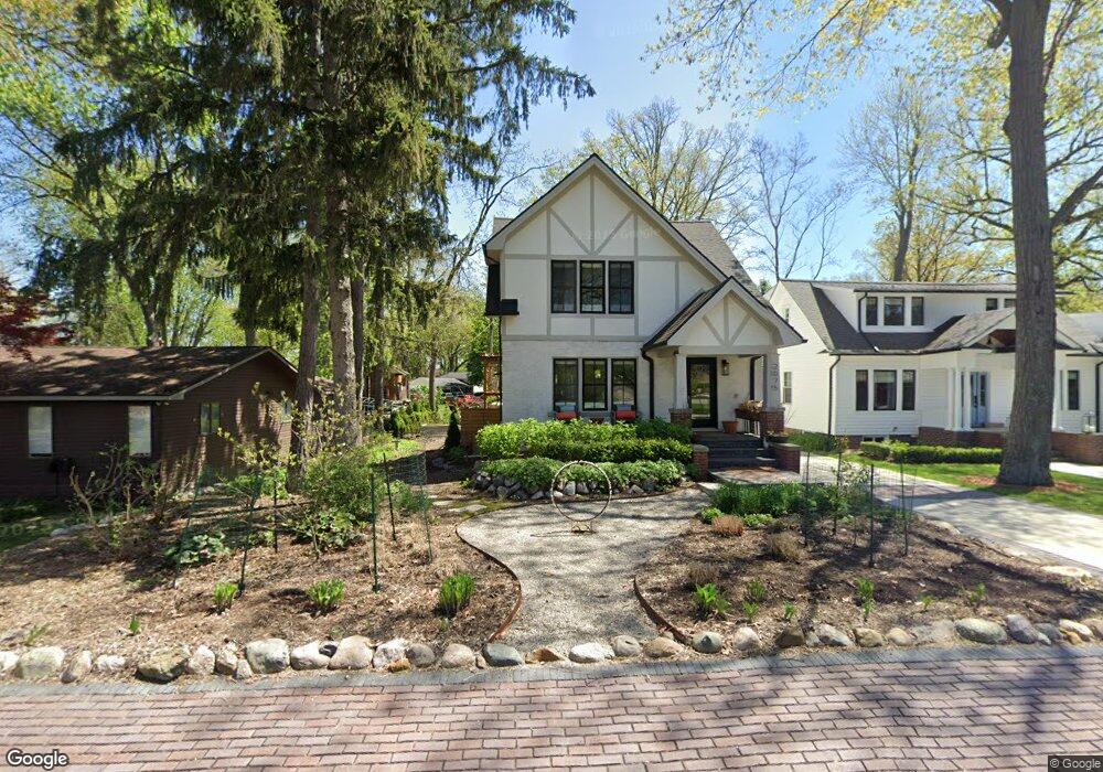
2075 Garland St Unit Bldg-Unit Sylvan Lake, MI 48320
Estimated Value: $366,000 - $436,290
4
Beds
2
Baths
1,598
Sq Ft
$253/Sq Ft
Est. Value
About This Home
This home is located at 2075 Garland St Unit Bldg-Unit, Sylvan Lake, MI 48320 and is currently estimated at $404,323, approximately $253 per square foot. 2075 Garland St Unit Bldg-Unit is a home located in Oakland County with nearby schools including Walt Whitman Elementary School, Pontiac Middle School, and Pontiac High School.
Ownership History
Date
Name
Owned For
Owner Type
Purchase Details
Closed on
May 17, 2021
Sold by
Genn Thomas V
Bought by
Boyce Robert J and Robert J Boyce Revocable Trust
Current Estimated Value
Purchase Details
Closed on
Aug 10, 2020
Sold by
Weisman Austin
Bought by
Boyce Robert J and Robert J Boyce Revocable Trust
Purchase Details
Closed on
Aug 18, 2015
Sold by
Aidem Arlene D and Young Arlene D
Bought by
Weisman Austin
Create a Home Valuation Report for This Property
The Home Valuation Report is an in-depth analysis detailing your home's value as well as a comparison with similar homes in the area
Home Values in the Area
Average Home Value in this Area
Purchase History
| Date | Buyer | Sale Price | Title Company |
|---|---|---|---|
| Boyce Robert J | -- | None Available | |
| Boyce Robert J | $262,500 | Capital Title Ins Agcy Inc | |
| Weisman Austin | $225,000 | None Available |
Source: Public Records
Tax History Compared to Growth
Tax History
| Year | Tax Paid | Tax Assessment Tax Assessment Total Assessment is a certain percentage of the fair market value that is determined by local assessors to be the total taxable value of land and additions on the property. | Land | Improvement |
|---|---|---|---|---|
| 2024 | $6,082 | $194,000 | $0 | $0 |
| 2023 | $8,341 | $174,540 | $0 | $0 |
| 2022 | $8,421 | $151,910 | $0 | $0 |
| 2021 | $8,004 | $142,510 | $0 | $0 |
| 2020 | $7,331 | $133,750 | $0 | $0 |
| 2019 | $7,573 | $128,110 | $0 | $0 |
| 2018 | $7,408 | $134,850 | $0 | $0 |
| 2017 | $7,332 | $130,810 | $0 | $0 |
| 2016 | $7,376 | $121,880 | $0 | $0 |
| 2015 | -- | $106,260 | $0 | $0 |
| 2014 | -- | $87,130 | $0 | $0 |
| 2011 | -- | $63,230 | $0 | $0 |
Source: Public Records
Map
Nearby Homes
- 49 Canal Dr Unit 300-049
- 21 Canal Dr Unit 300-021
- 27 Riverbank Dr Unit 300-127
- 25 Riverbank Dr Unit 300-125
- 14 Riverbank Dr Unit 300-114
- 26 Edna Ave
- 1160 Dorchester Ave
- 1061 Dorchester Ave
- 1075 Canterbury Dr
- 1785 Ward Rd
- 8 Myra Ave
- 990 Voorheis Rd
- 1205 Leinbach Ave
- 1796 Briarcliff St
- 147 Draper Ave
- 10 Wenonah Dr
- 207 Navajo Ave
- 1030 Menominee Rd
- 0000 Ward Road Ward Rd
- 181 Navajo Ave
- 2075 Garland St
- 2065 Garland St
- 2079 Garland St
- 1338 Avondale St
- 1356 Avondale St
- 2085 Garland St
- 1331 Avondale St
- 1315 Avondale St
- 0 Ferndale St
- 1349 Avondale St
- 1301 Avondale St
- 1364 Avondale St
- 1359 Avondale St
- 1403 Glenwood Dr
- 1374 Avondale St
- 2035 Garland St
- 2070 Garland St
- 2068 Garland St Unit Bldg-Unit
- 2068 Garland St
- 2072 Garland St