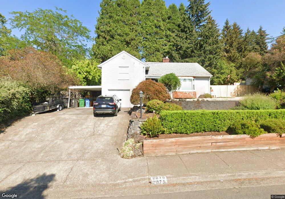
2075 Todd St Eugene, OR 97405
Churchill NeighborhoodEstimated Value: $593,000 - $647,000
4
Beds
2
Baths
1,844
Sq Ft
$332/Sq Ft
Est. Value
About This Home
This home is located at 2075 Todd St, Eugene, OR 97405 and is currently estimated at $611,516, approximately $331 per square foot. 2075 Todd St is a home located in Lane County with nearby schools including McCornack Elementary School, Kennedy Middle School, and Churchill High School.
Ownership History
Date
Name
Owned For
Owner Type
Purchase Details
Closed on
Mar 3, 2008
Sold by
Hunt Darren T and Hunt Karma
Bought by
Hunt Darren and Hunt Karma
Current Estimated Value
Home Financials for this Owner
Home Financials are based on the most recent Mortgage that was taken out on this home.
Original Mortgage
$264,000
Interest Rate
5.41%
Mortgage Type
Purchase Money Mortgage
Purchase Details
Closed on
Dec 8, 2007
Sold by
Hunt Dennis M and Hunt Myra J
Bought by
Hunt Darren T and Hunt Karma
Create a Home Valuation Report for This Property
The Home Valuation Report is an in-depth analysis detailing your home's value as well as a comparison with similar homes in the area
Home Values in the Area
Average Home Value in this Area
Purchase History
| Date | Buyer | Sale Price | Title Company |
|---|---|---|---|
| Hunt Darren | $330,000 | Evergreen Land Title Co | |
| Hunt Darren T | -- | None Available |
Source: Public Records
Mortgage History
| Date | Status | Borrower | Loan Amount |
|---|---|---|---|
| Closed | Hunt Darren | $264,000 |
Source: Public Records
Tax History
| Year | Tax Paid | Tax Assessment Tax Assessment Total Assessment is a certain percentage of the fair market value that is determined by local assessors to be the total taxable value of land and additions on the property. | Land | Improvement |
|---|---|---|---|---|
| 2025 | $6,070 | $311,544 | -- | -- |
| 2024 | $5,995 | $302,470 | -- | -- |
| 2023 | $5,995 | $293,661 | $0 | $0 |
| 2022 | $5,616 | $285,108 | $0 | $0 |
| 2021 | $5,275 | $276,804 | $0 | $0 |
| 2020 | $5,293 | $268,742 | $0 | $0 |
| 2019 | $5,112 | $260,915 | $0 | $0 |
| 2018 | $4,812 | $245,938 | $0 | $0 |
| 2017 | $4,429 | $245,938 | $0 | $0 |
| 2016 | $4,216 | $238,775 | $0 | $0 |
| 2015 | $4,022 | $231,820 | $0 | $0 |
| 2014 | $3,946 | $225,068 | $0 | $0 |
Source: Public Records
Map
Nearby Homes
- 2145 Hawkins Ln Unit 30
- 3423 W 25th Ave
- 3315 W 18th Ave
- 3534 Westleigh St
- 1945 Sunrise Blvd
- 1910 Hawkins Ln
- 0 W 18th Ave Unit LOT 2
- 0 W 18th Ave Unit LOT 3
- 2610 Park Forest Dr
- 2665 E Wilshire Dr
- 3823 Wilshire Ln
- 1438 Quaker St
- 2953 W 15th Ave
- 1432 Fetters Loop
- 0 Hallmark Ln
- 2490 Panorama Dr
- 1365 Quaker St
- 3574 Colony Oaks Dr Unit 6
- 3586 Colony Oaks Dr Unit 5
- 2728 Hallmark Ln
- 2087 Todd St
- 2049 Todd St
- 2080 Buck St
- 2060 Buck St
- 2096 Buck St
- 0 Todd St Unit 13451513
- 0 Todd St Unit 13207093
- 0 Todd St Unit 14306517
- 0 Todd St Unit 14124396
- 0 Todd St Unit 65 15121463
- 0 Todd St Unit 55
- 2105 Todd St
- 2033 Todd St
- 2074 Todd St
- 2090 Todd St
- 2052 Todd St
- 2040 Buck St
- 2108 Todd St
- 2111 Todd St
- 2030 Todd St
Your Personal Tour Guide
Ask me questions while you tour the home.