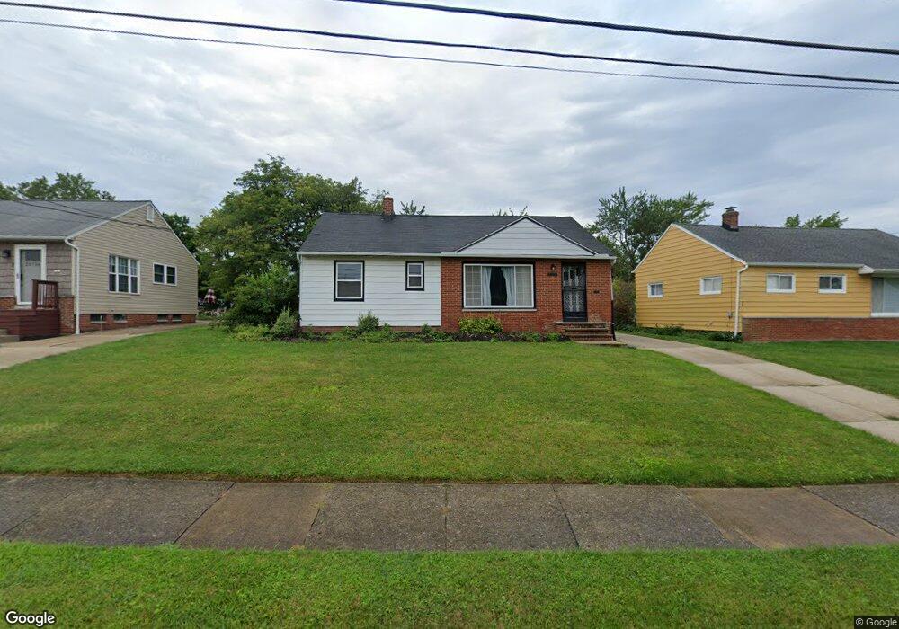
20752 Applegate Rd Maple Heights, OH 44137
Estimated Value: $128,000 - $167,000
3
Beds
1
Bath
1,033
Sq Ft
$137/Sq Ft
Est. Value
About This Home
This home is located at 20752 Applegate Rd, Maple Heights, OH 44137 and is currently estimated at $141,955, approximately $137 per square foot. 20752 Applegate Rd is a home located in Cuyahoga County with nearby schools including Abraham Lincoln Elementary School, Rockside/ J.F. Kennedy School, and Barack Obama School.
Ownership History
Date
Name
Owned For
Owner Type
Purchase Details
Closed on
Jun 18, 2021
Sold by
Vkcd Properties Llc
Bought by
Sims Khara
Current Estimated Value
Purchase Details
Closed on
Nov 23, 1983
Sold by
Sorma Paul and Sorma Lucy
Bought by
Aikens Roy L
Purchase Details
Closed on
Jan 1, 1975
Bought by
Sorma Paul and Sorma Lucy
Create a Home Valuation Report for This Property
The Home Valuation Report is an in-depth analysis detailing your home's value as well as a comparison with similar homes in the area
Home Values in the Area
Average Home Value in this Area
Purchase History
| Date | Buyer | Sale Price | Title Company |
|---|---|---|---|
| Sims Khara | -- | Bohm Marvin W | |
| Aikens Roy L | $54,000 | -- | |
| Sorma Paul | -- | -- |
Source: Public Records
Tax History
| Year | Tax Paid | Tax Assessment Tax Assessment Total Assessment is a certain percentage of the fair market value that is determined by local assessors to be the total taxable value of land and additions on the property. | Land | Improvement |
|---|---|---|---|---|
| 2024 | $3,772 | $41,965 | $9,520 | $32,445 |
| 2023 | $2,727 | $25,590 | $6,300 | $19,290 |
| 2022 | $2,717 | $30,100 | $6,300 | $23,800 |
| 2021 | $3,296 | $30,100 | $6,300 | $23,800 |
| 2020 | $1,793 | $22,790 | $4,760 | $18,030 |
| 2019 | $1,778 | $65,100 | $13,600 | $51,500 |
| 2018 | $1,846 | $22,790 | $4,760 | $18,030 |
| 2017 | $1,967 | $24,330 | $4,730 | $19,600 |
| 2016 | $1,896 | $24,330 | $4,730 | $19,600 |
| 2015 | $6,154 | $24,330 | $4,730 | $19,600 |
| 2014 | $6,154 | $26,740 | $5,180 | $21,560 |
Source: Public Records
Map
Nearby Homes
- 5424 Fairtree Rd
- 21607 Libby Rd
- 123 Willard Ave
- 21202 Gardenview Dr
- 54 Willard Ave
- 66 Hubbell Way
- 58 Hubbell Way
- 62 Hubbell Way
- 54 Hubbell Way
- 61 Hubbell Way
- 0 Hubbell Cir
- 57 Hubbell Way
- 339 Grand Blvd
- 419 Center Rd
- 19113 Watercrest Ave
- 20806 Clare Ave
- 21202 Hillgrove Ave
- 21860 Louis Rd
- 5385 Bartlett Rd
- 21600 Franklin Rd
- 20748 Applegate Rd
- 20756 Applegate Rd
- 20744 Applegate Rd
- 20751 Applegate Rd
- 20740 Applegate Rd
- 20755 Applegate Rd
- 20736 Applegate Rd
- 5500 Northfield Rd Unit 2
- 5500 Northfield Rd Unit 1
- 5500 Northfield Rd Unit 40
- 20758 Bowling Green Rd
- 20777 Bowling Green Rd
- 20754 Bowling Green Rd
- 20747 Donny Brook Rd
- 20751 Donny Brook Rd
- 20743 Donny Brook Rd
- 20755 Donny Brook Rd
- 20728 Applegate Rd
- 20773 Bowling Green Rd
- 20735 Applegate Rd
Your Personal Tour Guide
Ask me questions while you tour the home.