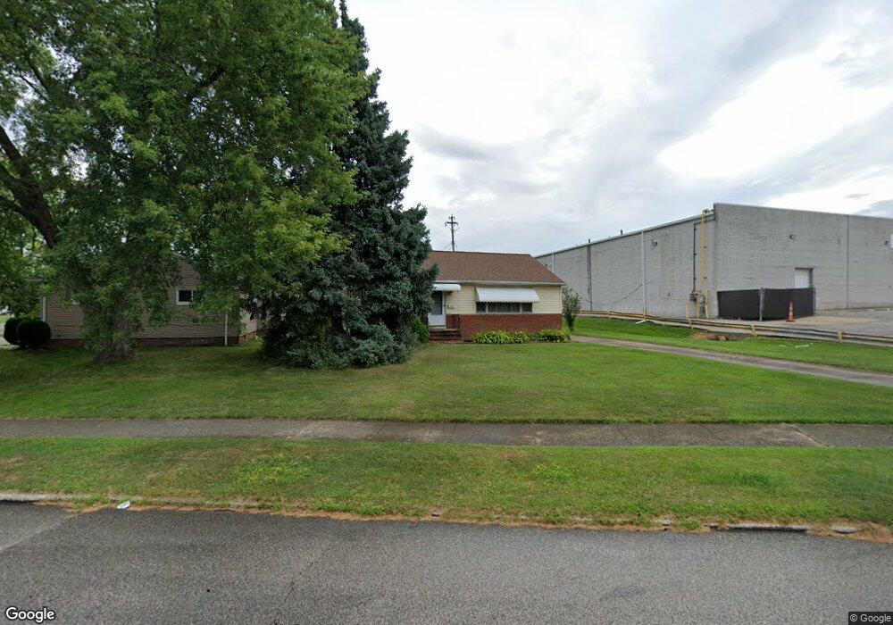
20755 Applegate Rd Maple Heights, OH 44137
Estimated Value: $125,000 - $132,000
3
Beds
1
Bath
1,006
Sq Ft
$127/Sq Ft
Est. Value
About This Home
This home is located at 20755 Applegate Rd, Maple Heights, OH 44137 and is currently estimated at $128,192, approximately $127 per square foot. 20755 Applegate Rd is a home located in Cuyahoga County with nearby schools including Abraham Lincoln Elementary School, Rockside/ J.F. Kennedy School, and Barack Obama School.
Ownership History
Date
Name
Owned For
Owner Type
Purchase Details
Closed on
Oct 26, 2006
Sold by
Gongos Ella Mae and Gongos Joseph R
Bought by
Gongos Joseph R
Current Estimated Value
Purchase Details
Closed on
Jul 15, 1993
Sold by
Gongos Joseph R
Bought by
Gongos Joseph R
Purchase Details
Closed on
Apr 8, 1991
Sold by
Gongos Joseph F
Bought by
Gongos Joseph R
Purchase Details
Closed on
Dec 1, 1978
Sold by
Thompson Howard O and Thompson Marcella
Bought by
Gongos Joseph F
Purchase Details
Closed on
Jan 1, 1975
Bought by
Thompson Howard O and Thompson Marcella
Create a Home Valuation Report for This Property
The Home Valuation Report is an in-depth analysis detailing your home's value as well as a comparison with similar homes in the area
Home Values in the Area
Average Home Value in this Area
Purchase History
| Date | Buyer | Sale Price | Title Company |
|---|---|---|---|
| Gongos Joseph R | -- | None Available | |
| Gongos Joseph R | -- | -- | |
| Gongos Joseph R | $40,000 | -- | |
| Gongos Joseph F | $45,500 | -- | |
| Thompson Howard O | -- | -- |
Source: Public Records
Tax History
| Year | Tax Paid | Tax Assessment Tax Assessment Total Assessment is a certain percentage of the fair market value that is determined by local assessors to be the total taxable value of land and additions on the property. | Land | Improvement |
|---|---|---|---|---|
| 2024 | $3,911 | $42,280 | $8,225 | $34,055 |
| 2023 | $3,109 | $28,810 | $5,390 | $23,420 |
| 2022 | $3,098 | $28,805 | $5,390 | $23,415 |
| 2021 | $3,308 | $28,810 | $5,390 | $23,420 |
| 2020 | $2,822 | $21,840 | $4,100 | $17,750 |
| 2019 | $2,805 | $62,400 | $11,700 | $50,700 |
| 2018 | $2,792 | $21,840 | $4,100 | $17,750 |
| 2017 | $2,939 | $22,680 | $4,060 | $18,620 |
| 2016 | $2,839 | $22,680 | $4,060 | $18,620 |
| 2015 | $2,861 | $22,680 | $4,060 | $18,620 |
| 2014 | $2,861 | $24,920 | $4,480 | $20,440 |
Source: Public Records
Map
Nearby Homes
- 5424 Fairtree Rd
- 21607 Libby Rd
- 21202 Gardenview Dr
- 123 Willard Ave
- 54 Willard Ave
- 66 Hubbell Way
- 58 Hubbell Way
- 62 Hubbell Way
- 54 Hubbell Way
- 0 Hubbell Cir
- 61 Hubbell Way
- 339 Grand Blvd
- 57 Hubbell Way
- 20806 Clare Ave
- 21202 Hillgrove Ave
- 21860 Louis Rd
- 19113 Watercrest Ave
- 419 Center Rd
- 5385 Bartlett Rd
- 21600 Franklin Rd
- 20751 Applegate Rd
- 20777 Bowling Green Rd
- 20773 Bowling Green Rd
- 20752 Applegate Rd
- 20748 Applegate Rd
- 20756 Applegate Rd
- 20744 Applegate Rd
- 20758 Bowling Green Rd
- 20769 Bowling Green Rd
- 20754 Bowling Green Rd
- 20740 Applegate Rd
- 20765 Bowling Green Rd
- 20736 Applegate Rd
- 20746 Bowling Green Rd
- 20735 Applegate Rd
- 5500 Northfield Rd Unit 2
- 5500 Northfield Rd Unit 1
- 5500 Northfield Rd Unit 40
- 20732 Applegate Rd
- 20742 Bowling Green Rd
Your Personal Tour Guide
Ask me questions while you tour the home.