Estimated Value: $174,000 - $190,413
3
Beds
2
Baths
1,766
Sq Ft
$103/Sq Ft
Est. Value
About This Home
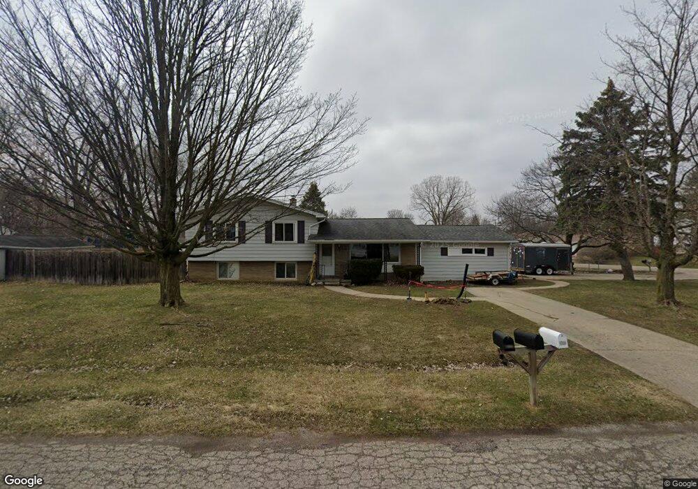
This home is located at 2076 Deerfield Dr, Flint, MI 48532 and is currently estimated at $182,103, approximately $103 per square foot. 2076 Deerfield Dr is a home located in Genesee County with nearby schools including Carman-Ainsworth High School, Genesee STEM Academy, and First Flint Seventh-day Adventist Christian School.
Ownership History
Date
Name
Owned For
Owner Type
Purchase Details
Closed on
Nov 20, 2017
Sold by
Kuczera David
Bought by
Kuczera Gena and Kuczera David
Current Estimated Value
Home Financials for this Owner
Home Financials are based on the most recent Mortgage that was taken out on this home.
Original Mortgage
$82,400
Outstanding Balance
$45,326
Interest Rate
3.88%
Mortgage Type
New Conventional
Estimated Equity
$136,777
Purchase Details
Closed on
May 22, 2000
Sold by
Azelton Wayne E and Azelton Patricia L
Bought by
Kuczera David
Create a Home Valuation Report for This Property
The Home Valuation Report is an in-depth analysis detailing your home's value as well as a comparison with similar homes in the area
Home Values in the Area
Average Home Value in this Area
Purchase History
| Date | Buyer | Sale Price | Title Company |
|---|---|---|---|
| Kuczera Gena | -- | None Available | |
| Kuczera David | $110,000 | Sargents Title Company |
Source: Public Records
Mortgage History
| Date | Status | Borrower | Loan Amount |
|---|---|---|---|
| Open | Kuczera Gena | $82,400 |
Source: Public Records
Tax History
| Year | Tax Paid | Tax Assessment Tax Assessment Total Assessment is a certain percentage of the fair market value that is determined by local assessors to be the total taxable value of land and additions on the property. | Land | Improvement |
|---|---|---|---|---|
| 2025 | $2,353 | $95,200 | $0 | $0 |
| 2024 | $1,213 | $96,900 | $0 | $0 |
| 2023 | $1,158 | $84,300 | $0 | $0 |
| 2022 | $996 | $71,300 | $0 | $0 |
| 2021 | $2,064 | $61,600 | $0 | $0 |
| 2020 | $1,040 | $54,600 | $0 | $0 |
| 2019 | $1,025 | $49,700 | $0 | $0 |
| 2018 | $1,966 | $46,000 | $0 | $0 |
| 2017 | $1,838 | $46,000 | $0 | $0 |
| 2016 | $1,886 | $44,600 | $0 | $0 |
| 2015 | $1,722 | $44,600 | $0 | $0 |
| 2014 | $1,021 | $42,800 | $0 | $0 |
| 2012 | -- | $41,900 | $41,900 | $0 |
Source: Public Records
Map
Nearby Homes
- 2052 S Dye Rd
- 5323 Elmsford Dr
- 5290 Brobeck St
- 5227 Dania St
- 5423 Meadowcrest Dr
- 0000 Reuben Reuben St
- 1460 S Dye Rd
- 5200 Elko St
- 5151 Brobeck St
- 1417 Grassmere Ave
- 5526 Corunna Rd
- 6007 Corunna Rd
- 2521 White Oak Place
- 1455 S Linden Rd
- 2356 S Dye Rd
- 4480 Corunna Rd
- 4474 Corunna Rd
- 3.9 Acres W Court St
- 10 Acres T A Mansour Blvd
- 6090 Lancaster Dr
- 5331 Westchester Dr
- 5312 Westchester Dr
- 2079 Deerfield Dr
- 5328 Westchester Dr
- 2073 Deerfield Dr
- 5297 Westchester Dr Unit Bldg-Unit
- 5297 Westchester Dr
- 2090 Deerfield Dr
- 5335 Westchester Dr
- 2085 Deerfield Dr
- 5318 Westchester Dr
- 5334 Westchester Dr
- 2091 Deerfield Dr
- 5304 Westchester Dr
- 2096 Deerfield Dr
- 5298 Westchester Dr
- 5340 Westchester Dr
- 5341 Westchester Dr
- 5349 Westchester Dr
- 2121 Penway Ct
Your Personal Tour Guide
Ask me questions while you tour the home.