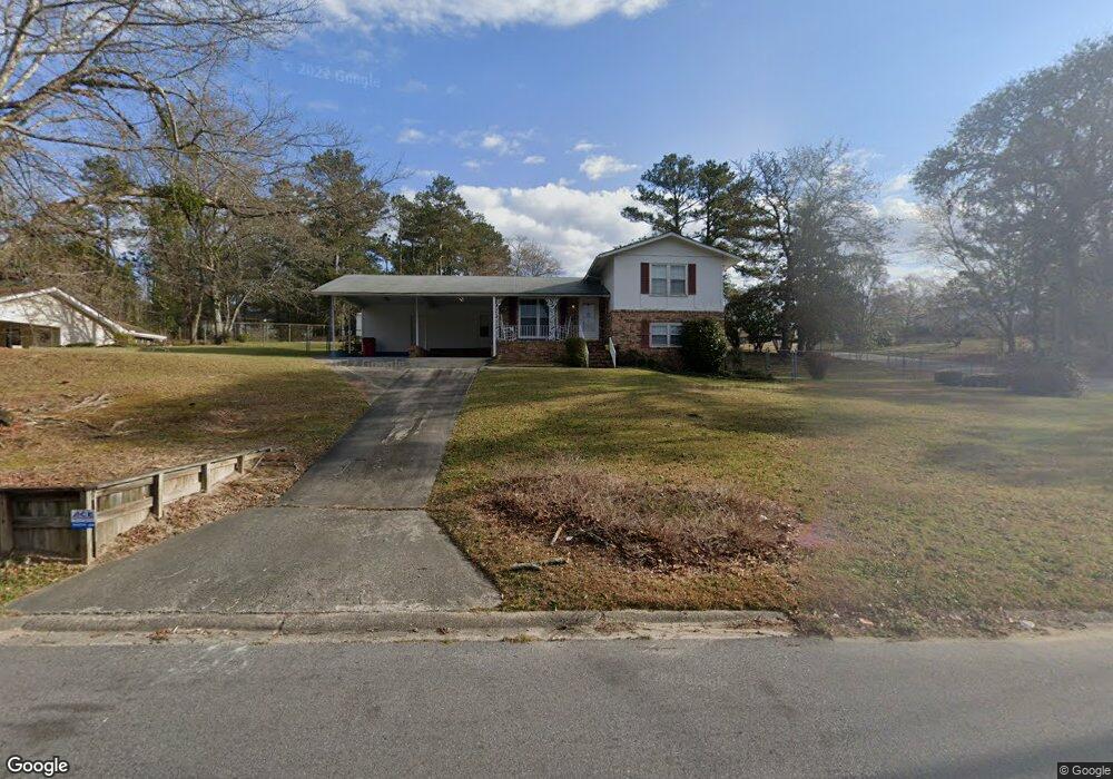
2076 Manson Rd MacOn, GA 31217
Estimated Value: $130,000 - $143,000
3
Beds
2
Baths
1,700
Sq Ft
$80/Sq Ft
Est. Value
About This Home
This home is located at 2076 Manson Rd, MacOn, GA 31217 and is currently estimated at $136,708, approximately $80 per square foot. 2076 Manson Rd is a home located in Bibb County with nearby schools including Martin Luther King Jr. Elementary School, Appling Middle School, and Northeast High School.
Ownership History
Date
Name
Owned For
Owner Type
Purchase Details
Closed on
Sep 30, 2025
Sold by
Moore Betty Ruth and Moore Betty S
Bought by
Ak Management Llc
Current Estimated Value
Home Financials for this Owner
Home Financials are based on the most recent Mortgage that was taken out on this home.
Original Mortgage
$105,000
Outstanding Balance
$105,000
Interest Rate
6.58%
Mortgage Type
New Conventional
Estimated Equity
$31,708
Purchase Details
Closed on
Jul 2, 2001
Sold by
Moore James M Jr By Extr
Bought by
Moore Betty S
Create a Home Valuation Report for This Property
The Home Valuation Report is an in-depth analysis detailing your home's value as well as a comparison with similar homes in the area
Home Values in the Area
Average Home Value in this Area
Purchase History
| Date | Buyer | Sale Price | Title Company |
|---|---|---|---|
| Ak Management Llc | $140,000 | None Listed On Document | |
| Moore Betty S | -- | -- |
Source: Public Records
Mortgage History
| Date | Status | Borrower | Loan Amount |
|---|---|---|---|
| Open | Ak Management Llc | $105,000 |
Source: Public Records
Tax History Compared to Growth
Tax History
| Year | Tax Paid | Tax Assessment Tax Assessment Total Assessment is a certain percentage of the fair market value that is determined by local assessors to be the total taxable value of land and additions on the property. | Land | Improvement |
|---|---|---|---|---|
| 2025 | $865 | $35,212 | $3,360 | $31,852 |
| 2024 | $894 | $35,212 | $3,360 | $31,852 |
| 2023 | $834 | $32,852 | $3,360 | $29,492 |
| 2022 | $1,027 | $29,660 | $4,994 | $24,666 |
| 2021 | $777 | $20,447 | $2,247 | $18,200 |
| 2020 | $466 | $19,010 | $2,247 | $16,763 |
| 2019 | $189 | $11,826 | $2,247 | $9,579 |
| 2018 | $469 | $11,826 | $2,247 | $9,579 |
| 2017 | $181 | $11,826 | $2,247 | $9,579 |
| 2016 | $167 | $11,826 | $2,247 | $9,579 |
| 2015 | $354 | $14,221 | $2,247 | $11,974 |
| 2014 | $939 | $22,755 | $4,794 | $17,961 |
Source: Public Records
Map
Nearby Homes
- 3380 Warpath Rd
- 1940 Manson Rd
- 2035 Fairway Dr
- 1669 Griswoldville Rd
- 299 E Virginia Ln
- 0 Shady Road Plaza
- 2940 Shurling Dr
- 3145 Pasadena Dr
- 157 Country World Dr
- 144 Country World Dr
- 134 Country World Dr
- 148 Country World Dr
- 0 Shady Rd
- 3048 Bethune Ave
- 2954 Tyler Place
- 132 Spradley Dr
- 2750 Lakeshore Dr
- 2720 Jordan Ave
- 3576 Confederate Dr
- 3204 Masseyville Rd
- 3410 Warpath Rd
- 2064 Manson Rd
- 3418 Warpath Rd
- 2062 Manson Rd
- 2079 Apache Ct
- 3411 Warpath Rd
- 2069 Manson Rd
- 3426 Warpath Rd
- 3379 Warpath Rd
- 3372 Warpath Rd
- 3417 Warpath Rd
- 2054 Manson Rd
- 2067 Apache Ct
- 2080 Apache Ct
- 3425 Warpath Rd
- 2055 Manson Rd
- 3436 Warpath Rd
- 2055 Apache Ct
- 3366 Warpath Rd
- 3365 Warpath Rd