Estimated Value: $76,943 - $155,000
3
Beds
1
Bath
900
Sq Ft
$130/Sq Ft
Est. Value
About This Home
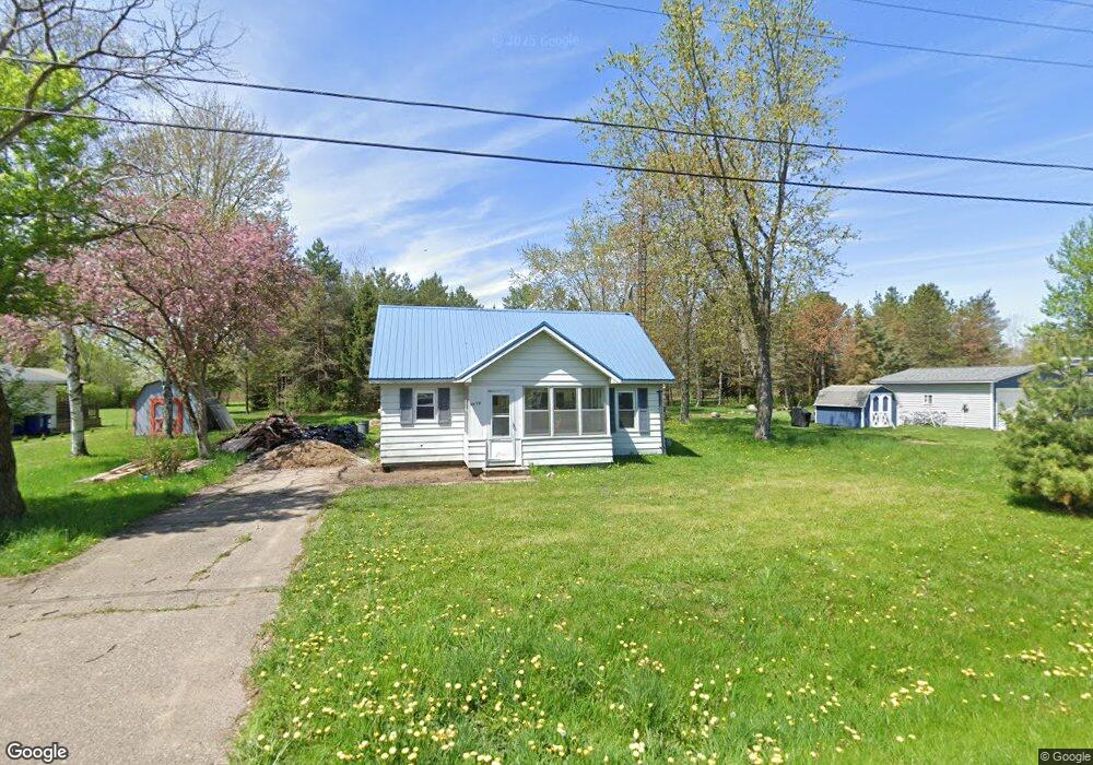
This home is located at 2076 Roland Ave, Flint, MI 48532 and is currently estimated at $117,236, approximately $130 per square foot. 2076 Roland Ave is a home located in Genesee County with nearby schools including Carman-Ainsworth High School, Genesee STEM Academy, and Genesee Academy.
Ownership History
Date
Name
Owned For
Owner Type
Purchase Details
Closed on
Oct 8, 2024
Sold by
Greene Michael Dale
Bought by
Smith Jacob D
Current Estimated Value
Purchase Details
Closed on
Mar 10, 2021
Sold by
Olson Joyce
Bought by
Smith Jacob D
Purchase Details
Closed on
Jun 8, 2017
Sold by
Greene Michael Dale and Greene Rachel E
Bought by
Greene Michael Dale and Olson Joyce Ann
Purchase Details
Closed on
Aug 28, 2002
Sold by
Greene Rachel E and Greene Harvey G
Bought by
Greene Rachel E and Greene Michael D
Create a Home Valuation Report for This Property
The Home Valuation Report is an in-depth analysis detailing your home's value as well as a comparison with similar homes in the area
Home Values in the Area
Average Home Value in this Area
Purchase History
| Date | Buyer | Sale Price | Title Company |
|---|---|---|---|
| Smith Jacob D | -- | None Listed On Document | |
| Smith Jacob D | -- | None Listed On Document | |
| Smith Jacob D | $6,200 | None Listed On Document | |
| Smith Jacob D | $6,200 | None Listed On Document | |
| Greene Michael Dale | -- | None Available | |
| Greene Rachel E | -- | -- |
Source: Public Records
Tax History
| Year | Tax Paid | Tax Assessment Tax Assessment Total Assessment is a certain percentage of the fair market value that is determined by local assessors to be the total taxable value of land and additions on the property. | Land | Improvement |
|---|---|---|---|---|
| 2025 | $2,000 | $27,400 | $0 | $0 |
| 2024 | $1,069 | $24,300 | $0 | $0 |
| 2023 | $524 | $21,400 | $0 | $0 |
| 2022 | $687 | $19,600 | $0 | $0 |
| 2021 | $1,103 | $18,900 | $0 | $0 |
| 2020 | $585 | $18,700 | $0 | $0 |
| 2019 | $580 | $18,600 | $0 | $0 |
| 2018 | $1,075 | $16,300 | $0 | $0 |
| 2017 | $1,154 | $16,300 | $0 | $0 |
| 2016 | $1,170 | $16,200 | $0 | $0 |
| 2015 | $606 | $16,300 | $0 | $0 |
| 2014 | $360 | $15,600 | $0 | $0 |
| 2012 | -- | $14,500 | $14,500 | $0 |
Source: Public Records
Map
Nearby Homes
- 00 Corunna Rd
- 000 Corunna Rd
- 6172 W Court St
- 6007 Corunna Rd
- 6507 Corunna Rd Unit 6493 Corunna Rd.
- 5526 Corunna Rd
- 6272 W Court St
- 1442 Mintola Ave
- 7040 Lou Mac Dr
- 6090 Lancaster Dr
- 1417 Mintola Ave
- 5423 Meadowcrest Dr
- 1417 Grassmere Ave
- 0000 Corunna Rd
- 7035 Saratoga Dr
- 6074 Lennon Rd
- 5323 Elmsford Dr
- 7030 Saratoga Dr
- 7075 Saratoga Dr
- 7042 Saratoga Dr
- 2076 Roland Ave
- 2076 Roland Ave
- 2062 Roland Ave
- 2062 Roland Ave
- 2073 Roland Ave
- 2084 Roland Ave
- 2087 Roland Ave
- 2087 Roland Ave
- 2061 Roland Ave
- 2048 Roland Ave
- 6252 Bailey St
- 6252 Bailey St
- 2072 Roslyn Ave
- 2053 Roland Ave
- 2056 Roslyn Ave
- 6226 Bailey St
- 2043 Roland Ave
- 2052 Roslyn Ave
- 2036 Roland Ave
- 2046 Roslyn Ave
Your Personal Tour Guide
Ask me questions while you tour the home.