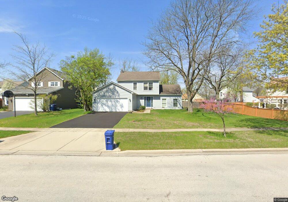
2076 Scottdale Cir Wheaton, IL 60189
Estimated Value: $443,977 - $537,000
3
Beds
3
Baths
1,636
Sq Ft
$311/Sq Ft
Est. Value
About This Home
This home is located at 2076 Scottdale Cir, Wheaton, IL 60189 and is currently estimated at $508,244, approximately $310 per square foot. 2076 Scottdale Cir is a home located in DuPage County with nearby schools including Arbor View Elementary School, Glen Crest Middle School, and Glenbard South High School.
Ownership History
Date
Name
Owned For
Owner Type
Purchase Details
Closed on
Nov 23, 2010
Sold by
Clark Alan L and Clark Robyn M
Bought by
Clark Alan L
Current Estimated Value
Home Financials for this Owner
Home Financials are based on the most recent Mortgage that was taken out on this home.
Original Mortgage
$169,400
Outstanding Balance
$111,482
Interest Rate
4.22%
Mortgage Type
Stand Alone Refi Refinance Of Original Loan
Estimated Equity
$396,762
Purchase Details
Closed on
Dec 14, 1999
Sold by
Clark Alan L and Clark Robyn M
Bought by
Clark Alan L and Clark Robyn M
Purchase Details
Closed on
Jun 9, 1999
Sold by
Malham Randolph James R and Malham Randolph Mary Laura
Bought by
Clark Alan L and Fullmer Robyn M
Home Financials for this Owner
Home Financials are based on the most recent Mortgage that was taken out on this home.
Original Mortgage
$187,625
Interest Rate
7.43%
Create a Home Valuation Report for This Property
The Home Valuation Report is an in-depth analysis detailing your home's value as well as a comparison with similar homes in the area
Home Values in the Area
Average Home Value in this Area
Purchase History
| Date | Buyer | Sale Price | Title Company |
|---|---|---|---|
| Clark Alan L | -- | Ctic | |
| Clark Alan L | -- | -- | |
| Clark Alan L | $197,500 | -- |
Source: Public Records
Mortgage History
| Date | Status | Borrower | Loan Amount |
|---|---|---|---|
| Open | Clark Alan L | $169,400 | |
| Closed | Clark Alan L | $187,625 |
Source: Public Records
Tax History
| Year | Tax Paid | Tax Assessment Tax Assessment Total Assessment is a certain percentage of the fair market value that is determined by local assessors to be the total taxable value of land and additions on the property. | Land | Improvement |
|---|---|---|---|---|
| 2024 | $9,288 | $130,954 | $36,970 | $93,984 |
| 2023 | $8,864 | $120,540 | $34,030 | $86,510 |
| 2022 | $8,499 | $113,920 | $32,160 | $81,760 |
| 2021 | $8,499 | $111,220 | $31,400 | $79,820 |
| 2020 | $8,582 | $110,190 | $31,110 | $79,080 |
| 2019 | $8,358 | $107,280 | $30,290 | $76,990 |
| 2018 | $8,460 | $107,290 | $28,540 | $78,750 |
| 2017 | $7,873 | $103,330 | $27,490 | $75,840 |
| 2016 | $7,752 | $99,200 | $26,390 | $72,810 |
| 2015 | $7,692 | $94,640 | $25,180 | $69,460 |
| 2014 | $7,874 | $95,330 | $26,290 | $69,040 |
| 2013 | $7,636 | $95,620 | $26,370 | $69,250 |
Source: Public Records
Map
Nearby Homes
- 1580 College Ln S
- 23W070 Mulberry Ln
- 23W160 Woodcroft Dr
- 2S744 Lakeside Dr Unit 21
- 1922 Cambridge Ln
- 3S481 Osage Dr
- 22W425 Arbor Ln
- 3S240 Burr Oak Dr
- 953 Cordova Ct
- 448 Raintree Ct Unit 1C
- 453 Raintree Dr Unit 5A
- 453 Raintree Dr Unit 1H
- 470 Fawell Blvd Unit 203
- 429 Sandhurst Cir Unit 1
- 131 Christina Cir
- 1010 Heathrow Ct
- 440 Raintree Ct Unit 1G
- 478 Raintree Ct Unit 2B
- 450 Raintree Ct Unit 2M
- 450 Raintree Ct Unit 2B
- 2068 Scottdale Cir
- 2092 Appaloosa Ct W
- 2078 Appaloosa Ct W
- 2011 Stallion Ct
- 2062 Appaloosa Ct W
- 2041 Stallion Ct
- 2027 Stallion Ct
- 2073 Scottdale Cir Unit 5
- 2065 Scottdale Cir
- 2079 Scottdale Cir
- 2106 Appaloosa Ct E
- 2152 Blacksmith Dr
- 2003 Stallion Ct
- 2030 Appaloosa Ct W
- 2118 Appaloosa Ct E Unit 5
- 2089 Appaloosa Ct W
- 2077 Appaloosa Ct W
- 2178 Acorn Ct
- 2170 Acorn Ct
- 2158 Blacksmith Dr