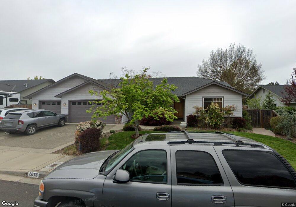
2076 SW Nebraska Ave Grants Pass, OR 97527
Estimated Value: $409,000 - $426,835
3
Beds
2
Baths
1,805
Sq Ft
$232/Sq Ft
Est. Value
About This Home
This home is located at 2076 SW Nebraska Ave, Grants Pass, OR 97527 and is currently estimated at $417,918, approximately $231 per square foot. 2076 SW Nebraska Ave is a home located in Josephine County with nearby schools including Allen Dale Elementary School, South Middle School, and Grants Pass High School.
Ownership History
Date
Name
Owned For
Owner Type
Purchase Details
Closed on
Jun 13, 2025
Sold by
Tedsen Rani
Bought by
Tedsen Rani and Tedsen Taryn Nicole
Current Estimated Value
Purchase Details
Closed on
Oct 6, 2015
Sold by
Tedsen Bryan and Tedsen Rani
Bought by
Tedsen Rani
Home Financials for this Owner
Home Financials are based on the most recent Mortgage that was taken out on this home.
Original Mortgage
$209,600
Interest Rate
3.78%
Mortgage Type
New Conventional
Create a Home Valuation Report for This Property
The Home Valuation Report is an in-depth analysis detailing your home's value as well as a comparison with similar homes in the area
Home Values in the Area
Average Home Value in this Area
Purchase History
| Date | Buyer | Sale Price | Title Company |
|---|---|---|---|
| Tedsen Rani | -- | None Listed On Document | |
| Tedsen Rani | -- | None Available |
Source: Public Records
Mortgage History
| Date | Status | Borrower | Loan Amount |
|---|---|---|---|
| Previous Owner | Tedsen Rani | $209,600 |
Source: Public Records
Tax History Compared to Growth
Tax History
| Year | Tax Paid | Tax Assessment Tax Assessment Total Assessment is a certain percentage of the fair market value that is determined by local assessors to be the total taxable value of land and additions on the property. | Land | Improvement |
|---|---|---|---|---|
| 2025 | $3,515 | $270,660 | -- | -- |
| 2024 | $3,515 | $262,780 | -- | -- |
| 2023 | $3,310 | $255,130 | $0 | $0 |
| 2022 | $3,326 | $247,700 | -- | -- |
| 2021 | $3,124 | $240,490 | $0 | $0 |
| 2020 | $3,034 | $233,490 | $0 | $0 |
| 2019 | $2,946 | $226,690 | $0 | $0 |
| 2018 | $2,998 | $220,090 | $0 | $0 |
| 2017 | $2,975 | $213,680 | $0 | $0 |
| 2016 | $2,616 | $207,460 | $0 | $0 |
| 2015 | $2,530 | $201,420 | $0 | $0 |
| 2014 | $2,461 | $195,560 | $0 | $0 |
Source: Public Records
Map
Nearby Homes
- 1048 W Harbeck Rd
- 855 SW West Harbeck Rd
- 1969 SW Allen Creek Rd
- 1010 Hemlock Ln
- 15577 Oregon 238
- 681 W Harbeck Rd
- 1830 SW Allen Creek Rd
- 214 SE Sapphire Ct
- 1762 SW Allen Creek Rd
- 0 Ramsey Southwest Ave SW Unit 220201654
- 0 Sylvan Dr Unit Lot 10 220196204
- 1346 Sunny Slope Dr
- 2957 Sylvan Dr
- 109 Shoemaker Way
- 2704 Denton Trail
- 2708 Denton Trail
- 2700 Denton Trail
- 2732 Denton Trail
- Lot 5 Sylvan Dr
- 1382 Andy Griffith Dr
- 2076 Nebraska Ave
- 2064 Nebraska Ave
- 2064 SW Nebraska Ave
- 2088 Nebraska Ave
- 1000 SW Princeton Place
- 2075 Nebraska Ave
- 2075 SW Nebraska Ave
- 984 SW Princeton Place
- 2141 Cullison Ln
- 2063 Nebraska Ave
- 2052 Nebraska Ave
- 2063 SW Nebraska Ave
- 1004 SW Princeton Place
- 2137 Cullison Ln
- 2051 Nebraska Ave
- 1008 SW Princeton Place
- 978 SW Princeton Place
- 1003 SW Princeton Place
- 972 SW Princeton Place
- 2177 Cullison Ln