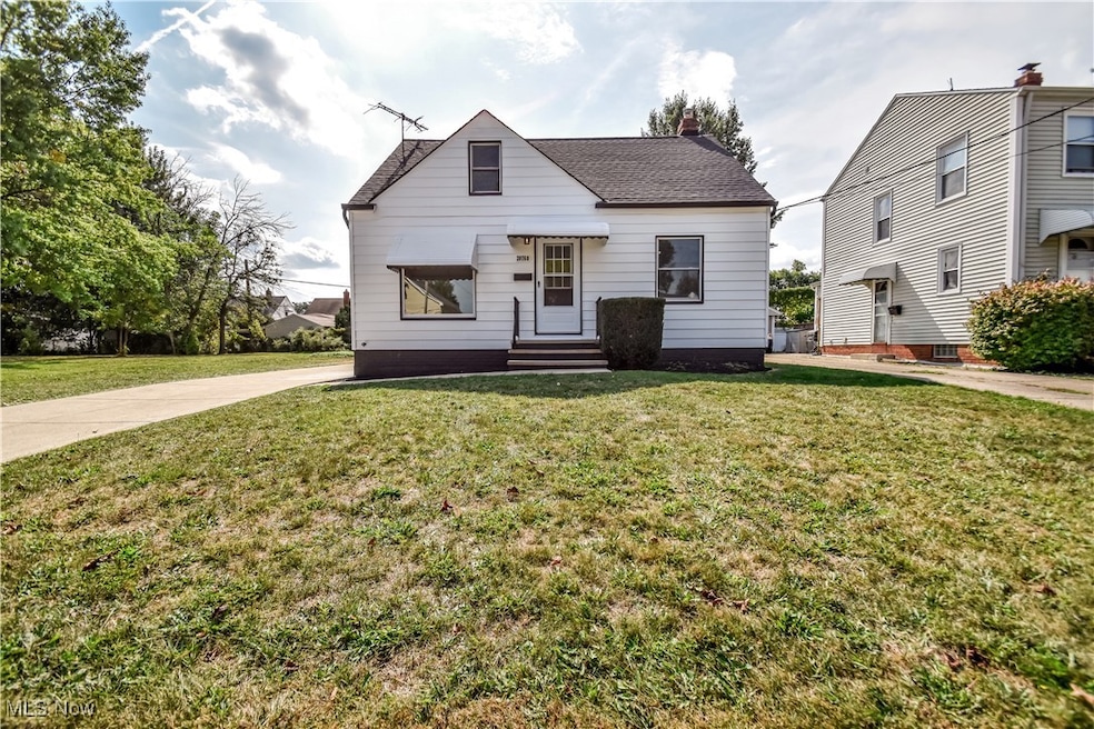
20760 Westport Ave Euclid, OH 44123
Estimated payment $1,067/month
Highlights
- No HOA
- Double Pane Windows
- Bungalow
- 2 Car Detached Garage
- Storage
- Forced Air Heating and Cooling System
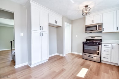
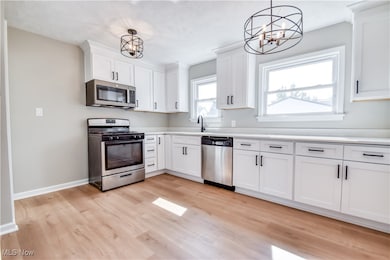
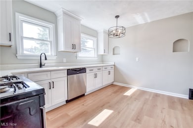
About This Home
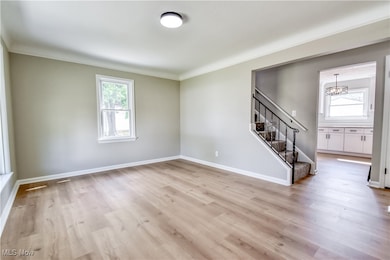
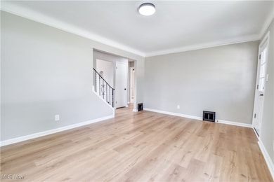
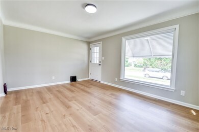
This home compares to new construction. This is total rehab. You will be impressed with the workmanship and sizes of the rooms. The kitchen is amazing with newer cabinets, flooring, granite counters, and luxury vinyl flooring. nice-sized bedrooms on the first floor, upstairs is a huge master with built-ins. Finished basement with a newer full bath. Detached 2-car garage, great lot, freshly painted ina and out. Nothing to do but move in and enjoy. Special assistance available if buyer qualifies
Listing Agent
Platinum Real Estate Brokerage Email: georgespiesman@gmail.com, 440-478-2601 License #388372 Listed on: 10/20/2025

Home Details
Home Type
- Single Family
Est. Annual Taxes
- $2,141
Year Built
- Built in 1953 | Remodeled
Lot Details
- 5,175 Sq Ft Lot
- Level Lot
Parking
- 2 Car Detached Garage
- Garage Door Opener
- Driveway
Home Design
- Bungalow
- Block Foundation
- Fiberglass Roof
- Asphalt Roof
- Wood Siding
- Aluminum Siding
Interior Spaces
- 2-Story Property
- Double Pane Windows
- Storage
Bedrooms and Bathrooms
- 3 Bedrooms | 2 Main Level Bedrooms
- 2 Full Bathrooms
Partially Finished Basement
- Basement Fills Entire Space Under The House
- Laundry in Basement
Utilities
- Forced Air Heating and Cooling System
- High Speed Internet
Community Details
- No Home Owners Association
- Mix King & Gibbs Subdivision
Listing and Financial Details
- Home warranty included in the sale of the property
- Assessor Parcel Number 642-23-114
Map
Home Values in the Area
Average Home Value in this Area
Tax History
| Year | Tax Paid | Tax Assessment Tax Assessment Total Assessment is a certain percentage of the fair market value that is determined by local assessors to be the total taxable value of land and additions on the property. | Land | Improvement |
|---|---|---|---|---|
| 2024 | $2,141 | $40,145 | $8,015 | $32,130 |
| 2023 | $1,459 | $25,070 | $6,340 | $18,730 |
| 2022 | $1,461 | $71,600 | $18,100 | $53,500 |
| 2021 | $1,613 | $25,060 | $6,340 | $18,730 |
| 2020 | $1,159 | $18,970 | $4,800 | $14,180 |
| 2019 | $1,036 | $54,200 | $13,700 | $40,500 |
| 2018 | $946 | $18,970 | $4,800 | $14,180 |
| 2017 | $915 | $16,070 | $3,190 | $12,880 |
| 2016 | $916 | $16,070 | $3,190 | $12,880 |
| 2015 | $842 | $16,070 | $3,190 | $12,880 |
| 2014 | $842 | $16,070 | $3,190 | $12,880 |
Property History
| Date | Event | Price | List to Sale | Price per Sq Ft |
|---|---|---|---|---|
| 10/29/2025 10/29/25 | Price Changed | $169,000 | -2.9% | $119 / Sq Ft |
| 10/20/2025 10/20/25 | For Sale | $174,000 | -- | $122 / Sq Ft |
Purchase History
| Date | Type | Sale Price | Title Company |
|---|---|---|---|
| Warranty Deed | $60,000 | Enterprise Title | |
| Deed | $42,500 | -- | |
| Deed | -- | -- |
Mortgage History
| Date | Status | Loan Amount | Loan Type |
|---|---|---|---|
| Open | $85,000 | Construction |
Source: MLS Now
MLS Number: 5166182
APN: 642-23-114
Disclaimer: Certain information contained herein is derived from information provided by parties other than Homes.com. All information provided is deemed reliable, but is not guaranteed to be accurate and should be independently verified.
![]() IDX information is provided exclusively for personal, non-commercial use, and may not be used for any purpose other than to identify prospective properties consumers may be interested in purchasing. Information is deemed reliable but not guaranteed.
IDX information is provided exclusively for personal, non-commercial use, and may not be used for any purpose other than to identify prospective properties consumers may be interested in purchasing. Information is deemed reliable but not guaranteed.
- 20921 Westport Ave
- 20801 Morris Ave
- 20561 Westport Ave
- 21051 Westport Ave
- 20800 Morris Ave
- 20590 Morris Ave
- 20540 Fuller Ave
- 21050 Fuller Ave
- 21181 Ball Ave
- 20830 Tracy Ave
- 21170 Wilmore Ave
- 21030 Priday Ave
- 21051 Nicholas Ave
- 20571 Naumann Ave
- 21481 Ball Ave
- 311 E 197th St
- 21670 Wilmore Ave
- 21700 Westport Ave
- 275 E 200th St
- 21051 S Lake Shore Blvd
- 20770 Wilmore Ave
- 20520 Ball Ave Unit 2
- 20500 Priday Ave
- 21000 Priday Ave
- 20541 Arbor Ave
- 21750 Westport Ave
- 251 E 200th St Unit 1/DN
- 19901 Naumann Ave
- 21372 Milan Dr
- 174 E 196th St
- 19130 Meredith Ave
- 19620 Ormiston Ave Unit ID1061059P
- 415 E 222nd St
- 18751 Monterey Ave Unit 2/up
- 18751 Monterey Ave Unit 1/DN
- 792 E 232nd St
- 4 Gateway
- 651 Voelker Ave
- 150 E 217th St Unit ID1061048P
- 18709 Arrowhead Ave