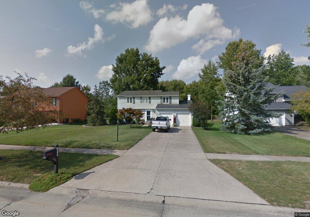
20764 Rudy Dr Strongsville, OH 44149
Estimated Value: $351,818 - $408,000
4
Beds
3
Baths
1,992
Sq Ft
$190/Sq Ft
Est. Value
About This Home
This home is located at 20764 Rudy Dr, Strongsville, OH 44149 and is currently estimated at $379,455, approximately $190 per square foot. 20764 Rudy Dr is a home located in Cuyahoga County with nearby schools including Strongsville High School and Sts Joseph & John Interparochial School.
Ownership History
Date
Name
Owned For
Owner Type
Purchase Details
Closed on
Apr 6, 1984
Bought by
Bryant Clifford R and Bryant Sharon A
Current Estimated Value
Purchase Details
Closed on
Jan 15, 1981
Bought by
Sunrise Development Co
Purchase Details
Closed on
Jan 1, 1978
Bought by
Tiffany Homes Inc
Create a Home Valuation Report for This Property
The Home Valuation Report is an in-depth analysis detailing your home's value as well as a comparison with similar homes in the area
Home Values in the Area
Average Home Value in this Area
Purchase History
| Date | Buyer | Sale Price | Title Company |
|---|---|---|---|
| Bryant Clifford R | $17,100 | -- | |
| Ryan Homes Inc | -- | -- | |
| Sunrise Development Co | -- | -- | |
| Tiffany Homes Inc | -- | -- |
Source: Public Records
Tax History Compared to Growth
Tax History
| Year | Tax Paid | Tax Assessment Tax Assessment Total Assessment is a certain percentage of the fair market value that is determined by local assessors to be the total taxable value of land and additions on the property. | Land | Improvement |
|---|---|---|---|---|
| 2024 | $5,060 | $107,765 | $18,865 | $88,900 |
| 2023 | $5,275 | $84,250 | $15,960 | $68,290 |
| 2022 | $5,237 | $84,250 | $15,960 | $68,290 |
| 2021 | $5,196 | $84,250 | $15,960 | $68,290 |
| 2020 | $4,814 | $69,060 | $13,090 | $55,970 |
| 2019 | $4,673 | $197,300 | $37,400 | $159,900 |
| 2018 | $4,171 | $69,060 | $13,090 | $55,970 |
| 2017 | $4,177 | $62,970 | $13,160 | $49,810 |
| 2016 | $4,143 | $62,970 | $13,160 | $49,810 |
| 2015 | $4,081 | $62,970 | $13,160 | $49,810 |
| 2014 | $4,081 | $61,150 | $12,780 | $48,370 |
Source: Public Records
Map
Nearby Homes
- 20684 Albion Rd
- 10839 Prospect Rd
- 21176 Hickory Branch Trail
- 20424 Scotch Pine Way
- 21355 Hickory Branch Trail
- 20050 Idlewood Trail
- 19997 Idlewood Trail
- 10353 Oak Branch Trail
- 19890 Idlewood Trail
- 10986 Fawn Meadow Ln
- 12651 Alameda Dr
- 11179 Fawn Meadow Ln
- 12647 Edgepark Cir
- 0 Priem Rd
- 12385 Corinth Ct
- 12694 Ionia Ct
- 11030 Southwind Ct
- 9401 Pheasant Run Place
- 19240 Briarwood Ln
- 22300 Rock Creek Cir