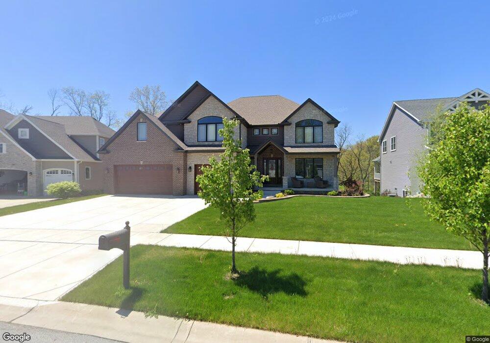
2077 Nolan Ave Crown Point, IN 46307
Estimated Value: $719,000 - $947,000
3
Beds
4
Baths
4,336
Sq Ft
$199/Sq Ft
Est. Value
About This Home
This home is located at 2077 Nolan Ave, Crown Point, IN 46307 and is currently estimated at $861,899, approximately $198 per square foot. 2077 Nolan Ave is a home with nearby schools including Lake Street Elementary School, Robert Taft Middle School, and Crown Point High School.
Ownership History
Date
Name
Owned For
Owner Type
Purchase Details
Closed on
Apr 7, 2017
Sold by
Mcfs Development Llc
Bought by
Jovanoski Robert and Jovanoski Venesa
Current Estimated Value
Home Financials for this Owner
Home Financials are based on the most recent Mortgage that was taken out on this home.
Original Mortgage
$67,800
Outstanding Balance
$12,720
Interest Rate
4.21%
Mortgage Type
Commercial
Estimated Equity
$849,179
Create a Home Valuation Report for This Property
The Home Valuation Report is an in-depth analysis detailing your home's value as well as a comparison with similar homes in the area
Home Values in the Area
Average Home Value in this Area
Purchase History
| Date | Buyer | Sale Price | Title Company |
|---|---|---|---|
| Jovanoski Robert | -- | Chicago Title Insurance Co |
Source: Public Records
Mortgage History
| Date | Status | Borrower | Loan Amount |
|---|---|---|---|
| Open | Jovanoski Robert | $67,800 |
Source: Public Records
Tax History Compared to Growth
Tax History
| Year | Tax Paid | Tax Assessment Tax Assessment Total Assessment is a certain percentage of the fair market value that is determined by local assessors to be the total taxable value of land and additions on the property. | Land | Improvement |
|---|---|---|---|---|
| 2024 | $20,946 | $832,900 | $97,500 | $735,400 |
| 2023 | $8,528 | $762,100 | $97,500 | $664,600 |
| 2022 | $7,857 | $696,300 | $92,100 | $604,200 |
| 2021 | $7,684 | $681,400 | $84,200 | $597,200 |
| 2020 | $539 | $84,200 | $84,200 | $0 |
| 2019 | $2,038 | $84,200 | $84,200 | $0 |
| 2018 | $2,146 | $84,200 | $84,200 | $0 |
| 2017 | $31 | $1,200 | $1,200 | $0 |
Source: Public Records
Map
Nearby Homes
- 834 Copper Creek Dr
- 12715 Cedar Lake Rd
- 12812 Whitcomb St
- 3721 W 133rd Ave
- 12201 Cedar Lake Rd
- 4422 W 133rd Ave
- 12860 Baker Ct
- 1575 S Feather Rock Dr
- 12768 Ellsworth Place
- The Cottonwood Plan at Golden Meadow
- The Magnolia Plan at Golden Meadow
- The Birch Plan at Golden Meadow
- 1540 Brackenbury Ln
- The Willow Plan at Golden Meadow
- 2725 W 127th Ln
- 11498 Hancock Dr
- 283 Nomo Place
- 253 Nomo Place
- The Ganby Plan at Sawgrass
- The Monarch Plan at Sawgrass
- 2087 Nolan Ave
- 2097 Nolan Ave
- 942 Schilling Dr
- 2082 Nolan Ave
- 2062 Nolan Ave
- 956 Schilling Dr
- 996 Sylvia Ln
- 956 Sylvia Ln
- 947 Schilling Dr
- 950 Schilling Dr
- 986 Sylvia Ln
- 983 Sylvia Ln
- 973 Sylvia Ln
- 913 Sylvia Ln
- 927 Schilling Dr
- 937 Schilling Dr
- 963 Sylvia Ln
- 936 Sylvia Ln
- 946 Sylvia Ln
- 953 Sylvia Ln