Estimated Value: $610,000 - $628,554
4
Beds
3
Baths
2,621
Sq Ft
$236/Sq Ft
Est. Value
About This Home
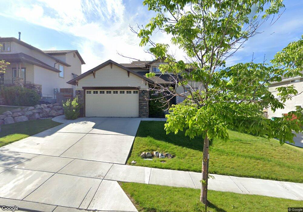
This home is located at 2077 W Pheasant Ridge Trail, Lehi, UT 84043 and is currently estimated at $618,889, approximately $236 per square foot. 2077 W Pheasant Ridge Trail is a home located in Utah County with nearby schools including Traverse Mountain Elementary School, Skyridge High School, and Ignite Entrepreneurship Academy.
Ownership History
Date
Name
Owned For
Owner Type
Purchase Details
Closed on
Aug 15, 2019
Sold by
Robinson Michael Koplin and Robinson Amy
Bought by
Haws Joshua
Current Estimated Value
Home Financials for this Owner
Home Financials are based on the most recent Mortgage that was taken out on this home.
Original Mortgage
$366,605
Outstanding Balance
$321,078
Interest Rate
3.7%
Mortgage Type
New Conventional
Estimated Equity
$297,811
Purchase Details
Closed on
Nov 1, 2012
Sold by
Koplinrobinson Michael
Bought by
Robinson Michael Koplin and Robinson Amy
Home Financials for this Owner
Home Financials are based on the most recent Mortgage that was taken out on this home.
Original Mortgage
$225,834
Interest Rate
3.25%
Mortgage Type
FHA
Create a Home Valuation Report for This Property
The Home Valuation Report is an in-depth analysis detailing your home's value as well as a comparison with similar homes in the area
Home Values in the Area
Average Home Value in this Area
Purchase History
| Date | Buyer | Sale Price | Title Company |
|---|---|---|---|
| Haws Joshua | -- | Inwest Title Orem | |
| Robinson Michael Koplin | -- | Artisan Title | |
| Robinson Michael Koplin | -- | Eagle Pointe Title Insurance |
Source: Public Records
Mortgage History
| Date | Status | Borrower | Loan Amount |
|---|---|---|---|
| Open | Haws Joshua | $366,605 | |
| Previous Owner | Robinson Michael Koplin | $225,834 |
Source: Public Records
Tax History Compared to Growth
Tax History
| Year | Tax Paid | Tax Assessment Tax Assessment Total Assessment is a certain percentage of the fair market value that is determined by local assessors to be the total taxable value of land and additions on the property. | Land | Improvement |
|---|---|---|---|---|
| 2025 | $2,540 | $310,860 | $223,800 | $341,400 |
| 2024 | $2,540 | $297,275 | $0 | $0 |
| 2023 | $2,400 | $304,920 | $0 | $0 |
| 2022 | $2,438 | $300,300 | $0 | $0 |
| 2021 | $2,178 | $405,600 | $129,500 | $276,100 |
| 2020 | $2,053 | $377,900 | $119,900 | $258,000 |
| 2019 | $1,899 | $363,400 | $119,900 | $243,500 |
| 2018 | $1,862 | $336,900 | $112,700 | $224,200 |
| 2017 | $1,678 | $161,370 | $0 | $0 |
| 2016 | $1,706 | $152,240 | $0 | $0 |
| 2015 | $1,724 | $146,080 | $0 | $0 |
| 2014 | $1,614 | $135,905 | $0 | $0 |
Source: Public Records
Map
Nearby Homes
- 4394 N Foxtrail Dr
- 4293 N Cresthaven Ln
- 1961 Woodview Dr
- 4205 N Cresthaven Ln
- 4379 N Ridge View Way
- 4425 N Ridge View Way
- 2297 W New Harvest Ln
- 1474 N 1700 W Unit 103
- Eleanor Plan at La Ringhiera
- Spruce Pantry Plan at La Ringhiera
- Redwood Plan at La Ringhiera
- Mesquite Plan at La Ringhiera
- Madison Plan at La Ringhiera
- Basswood Plan at La Ringhiera
- Willow Plus Plan at La Ringhiera
- Merriwood Plan at La Ringhiera
- Sycamore Plan at La Ringhiera
- Linden Plan at La Ringhiera
- Roosevelt Plan at La Ringhiera
- Washington Plan at La Ringhiera
- 2077 Pheasant Ridge Trail
- 2089 Pheasant Ridge Trail
- 2067 W Pheasant Ridge Trail
- 2089 W Pheasant Ridge Trail
- 2067 Pheasant Ridge Trail
- 2044 Woodview Dr
- 2097 Pheasant Ridge Trail
- 2097 W Pheasant Ridge Trail
- 2057 Pheasant Ridge Trail
- 2054 Woodview Dr
- 4258 N Pheasant Run Ct
- 2034 Woodview Dr
- 2022 Woodview Dr
- 2022 Woodview Dr W
- 2064 Woodview Dr
- 2064 Woodview Dr Unit 4
- 2111 Pheasant Ridge Trail
- 4297 N Pheasant Ridge Trail
- 4297 Pheasant Ridge Trail
- 2111 W Pheasant Ridge Trail