
Seller's Agent in 2025
Nicole Yoder-Barnhart
Howard Hanna Real Estate Serv
(614) 679-3412
273 Total Sales
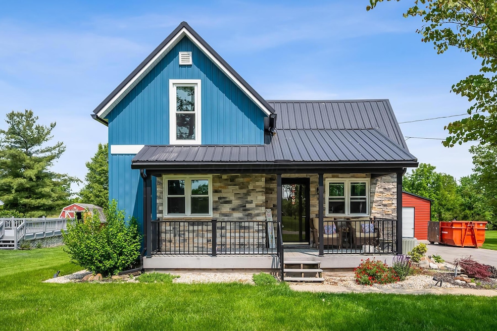
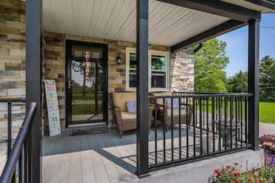

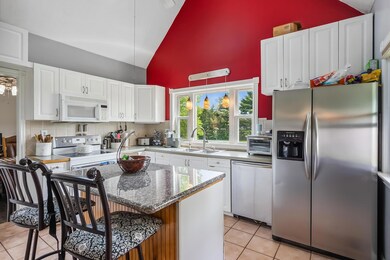
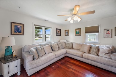
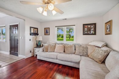
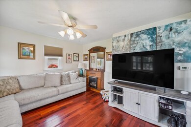
Photos are being taken 6/3/25. We have received multiple offers - sellers are calling for the highest and best offer by Wednesday, June 4th, 2025. All offers are to be left open for acceptance through June 5th, 2025. Charming home sitting on just under an acre outside of Raymond. Located 6.5 miles from East Liberty Honda Plant and 6 miles from Marysville. With brand new storm windows, siding, and metal roof in 2022. Large pole barn with party room - Pool table, wall decor, bar, refridgerator, sound system and TV stays with the property.
Last Agent to Sell the Property
Howard Hanna Real Estate Serv License #406627 Listed on: 06/02/2025
Last Buyer's Agent
Drake White
Gallery Homes Real Estate LLC License #2024000248
| Date | Type | Sale Price | Title Company |
|---|---|---|---|
| Deed | $240,000 | None Listed On Document | |
| Quit Claim Deed | -- | None Listed On Document | |
| Deed | $75,000 | -- | |
| Deed | $68,000 | -- | |
| Deed | $71,000 | -- |
| Date | Status | Loan Amount | Loan Type |
|---|---|---|---|
| Open | $140,000 | New Conventional | |
| Previous Owner | $75,680 | New Conventional | |
| Previous Owner | $67,536 | FHA |
| Date | Event | Price | List to Sale | Price per Sq Ft |
|---|---|---|---|---|
| 06/27/2025 06/27/25 | Sold | $240,000 | +14.3% | $234 / Sq Ft |
| 06/02/2025 06/02/25 | For Sale | $210,000 | -- | $205 / Sq Ft |
| Year | Tax Paid | Tax Assessment Tax Assessment Total Assessment is a certain percentage of the fair market value that is determined by local assessors to be the total taxable value of land and additions on the property. | Land | Improvement |
|---|---|---|---|---|
| 2024 | $3,400 | $54,430 | $5,530 | $48,900 |
| 2023 | $3,080 | $54,430 | $5,530 | $48,900 |
| 2022 | $2,747 | $35,930 | $5,530 | $30,400 |
| 2021 | $2,626 | $28,560 | $4,250 | $24,310 |
| 2020 | $2,499 | $28,560 | $4,250 | $24,310 |
| 2019 | $2,605 | $28,560 | $4,250 | $24,310 |
| 2018 | $1,220 | $22,240 | $4,250 | $17,990 |
| 2017 | $1,151 | $22,240 | $4,250 | $17,990 |
| 2016 | $1,147 | $22,240 | $4,250 | $17,990 |
| 2015 | $1,303 | $23,480 | $4,250 | $19,230 |
| 2014 | $1,279 | $23,480 | $4,250 | $19,230 |
| 2013 | $1,205 | $23,480 | $4,250 | $19,230 |
Seller's Agent in 2025
Nicole Yoder-Barnhart
Howard Hanna Real Estate Serv
(614) 679-3412
273 Total Sales
G
Seller Co-Listing Agent in 2025
Grace Garrison
Howard Hanna Real Estate Serv
(937) 243-3856
5 Total Sales
D
Buyer's Agent in 2025
Drake White
Gallery Homes Real Estate LLC
Source: Columbus and Central Ohio Regional MLS
MLS Number: 225019138
APN: 22-0021057-0000
Disclaimer: Certain information contained herein is derived from information provided by parties other than Homes.com. All information provided is deemed reliable, but is not guaranteed to be accurate and should be independently verified.
![]() IDX information is provided exclusively for personal, non-commercial use, and may not be used for any purpose other than to identify prospective properties consumers may be interested in purchasing.
IDX information is provided exclusively for personal, non-commercial use, and may not be used for any purpose other than to identify prospective properties consumers may be interested in purchasing.
Information is deemed reliable but not guaranteed.
Ask me questions while you tour the home.