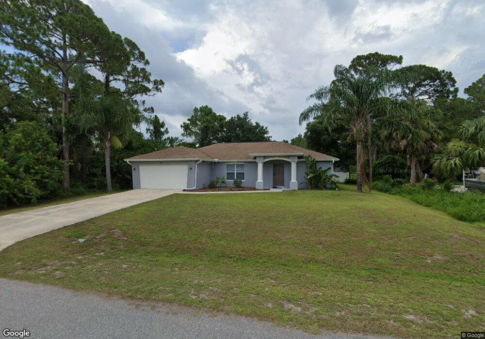
2078 Smyer Ave Unit 15 North Port, FL 34288
Estimated Value: $279,000 - $312,000
3
Beds
2
Baths
1,482
Sq Ft
$198/Sq Ft
Est. Value
About This Home
This home is located at 2078 Smyer Ave Unit 15, North Port, FL 34288 and is currently estimated at $293,994, approximately $198 per square foot. 2078 Smyer Ave Unit 15 is a home located in Sarasota County with nearby schools including Atwater Elementary School, North Port High School, and Woodland Middle School.
Ownership History
Date
Name
Owned For
Owner Type
Purchase Details
Closed on
Mar 1, 2024
Sold by
Amherst Cpi and Amherst Sfr Program
Bought by
Cpi/Amherst Sfr Program Ii Rs Llc
Current Estimated Value
Purchase Details
Closed on
Jun 3, 2021
Sold by
Arvm 5 Llc
Bought by
Cpi Amherst Sfr Program Ii Owner Llc
Purchase Details
Closed on
Dec 21, 2020
Sold by
Haller Jessica Marie and Haller Jessica Marie
Bought by
Arvm 5 Llc
Purchase Details
Closed on
Jun 14, 2019
Sold by
Thibodeas Wilfred R
Bought by
Haller Jessica M
Home Financials for this Owner
Home Financials are based on the most recent Mortgage that was taken out on this home.
Original Mortgage
$173,076
Interest Rate
5.75%
Mortgage Type
FHA
Purchase Details
Closed on
Aug 5, 2002
Sold by
Bartolucci Emilio C
Bought by
Thibodeau Wilfred R
Create a Home Valuation Report for This Property
The Home Valuation Report is an in-depth analysis detailing your home's value as well as a comparison with similar homes in the area
Home Values in the Area
Average Home Value in this Area
Purchase History
| Date | Buyer | Sale Price | Title Company |
|---|---|---|---|
| Cpi/Amherst Sfr Program Ii Rs Llc | $100 | None Listed On Document | |
| Cpi Amherst Sfr Program Ii Owner Llc | $3,651,000 | Bchh Inc | |
| Arvm 5 Llc | $217,500 | Turner Jarrod | |
| Haller Jessica M | $189,000 | Attorney | |
| Thibodeau Wilfred R | $1,800 | -- |
Source: Public Records
Mortgage History
| Date | Status | Borrower | Loan Amount |
|---|---|---|---|
| Previous Owner | Haller Jessica M | $173,076 |
Source: Public Records
Tax History Compared to Growth
Tax History
| Year | Tax Paid | Tax Assessment Tax Assessment Total Assessment is a certain percentage of the fair market value that is determined by local assessors to be the total taxable value of land and additions on the property. | Land | Improvement |
|---|---|---|---|---|
| 2024 | $4,679 | $255,800 | $18,000 | $237,800 |
| 2023 | $4,679 | $263,100 | $18,400 | $244,700 |
| 2022 | $4,401 | $244,900 | $20,200 | $224,700 |
| 2021 | $3,230 | $163,200 | $9,100 | $154,100 |
| 2020 | $2,388 | $146,800 | $8,800 | $138,000 |
| 2019 | $2,972 | $146,100 | $9,300 | $136,800 |
| 2018 | $2,700 | $138,800 | $8,700 | $130,100 |
| 2017 | $2,537 | $123,848 | $0 | $0 |
| 2016 | $2,393 | $117,400 | $5,600 | $111,800 |
| 2015 | $2,275 | $105,900 | $4,500 | $101,400 |
| 2014 | $2,080 | $84,590 | $0 | $0 |
Source: Public Records
Map
Nearby Homes
- 0 Kowal Ave
- Lot 16 Brancusi Ave
- 0 Prosch Cir Unit MFRA4641672
- 0 Prosch Cir Unit MFRA4646491
- 5 Varden Terrace
- 0 Northland Ave Unit MFRC7516229
- 0 Northland Ave Unit MFRA4656304
- 0 Varden Terrace
- 2017 Lovoy Ct
- 2177 Northland Ave
- 1889 Northland Ave
- 0 Hightower Rd Unit MFRC7514108
- 0 Hightower Rd Unit C7448539
- 0 Hightower Rd Unit MFRC7506192
- 0 Argonne Ct Unit MFRN6139149
- 0 Andris Ct Unit 2025010834
- 00 Andris St
- 4661 Fairlane Dr
- 5509 Fairlane Dr
- 0 Arley Rd Unit MFRC7513703
- 2078 Smyer Ave
- 2078 Smyer Ave
- 0 Smyer Ave Unit 225043870
- 0 Smyer Ave Unit 224058554
- 0 Smyer Ave
- 2073 Kowal Ave
- 2053 Kowal Ave
- 2122 Smyer Ave
- 2034 Smyer Ave
- 2033 Kowal Ave
- 2119 Smyer Ave
- 2037 Kowal Ave
- 2144 Smyer Ave
- 2033 Smyer Ave
- 0000 Kowal Ave
- 2013 Kowal Ave
- 2122 Brancusi Ave
- 2013 Smyer Ave
- 2070 Brancusi Ave
- 2166 Smyer Ave