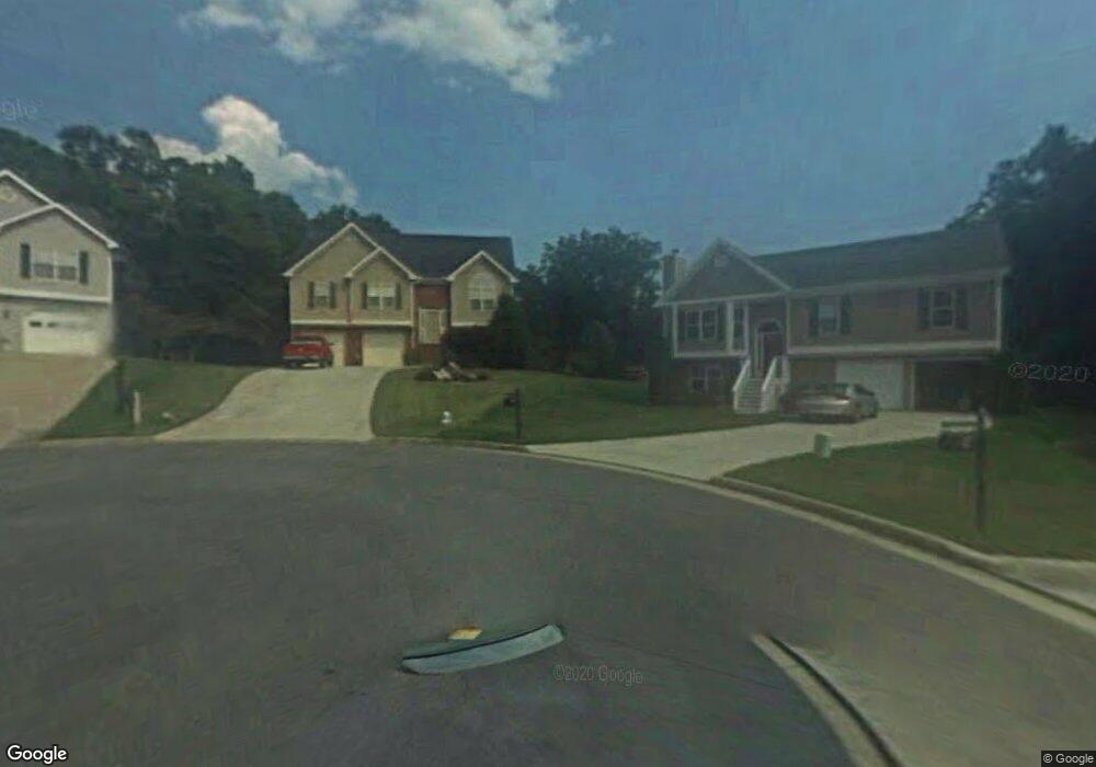
2078 Under Ct Unit 7 Sugar Hill, GA 30518
Estimated Value: $417,000 - $444,000
4
Beds
3
Baths
1,406
Sq Ft
$304/Sq Ft
Est. Value
About This Home
This home is located at 2078 Under Ct Unit 7, Sugar Hill, GA 30518 and is currently estimated at $427,401, approximately $303 per square foot. 2078 Under Ct Unit 7 is a home located in Gwinnett County with nearby schools including Sugar Hill Elementary School, Lanier Middle School, and Lanier High School.
Ownership History
Date
Name
Owned For
Owner Type
Purchase Details
Closed on
Feb 24, 2021
Sold by
Martin Philip Lee
Bought by
Martin Benny Ray
Current Estimated Value
Purchase Details
Closed on
May 21, 2020
Sold by
Martin Benny Ray
Bought by
Martin Philip Lee
Purchase Details
Closed on
Dec 10, 1998
Sold by
Mclin Constr Inc
Bought by
Martin Benny R
Home Financials for this Owner
Home Financials are based on the most recent Mortgage that was taken out on this home.
Original Mortgage
$126,176
Interest Rate
6.94%
Mortgage Type
FHA
Create a Home Valuation Report for This Property
The Home Valuation Report is an in-depth analysis detailing your home's value as well as a comparison with similar homes in the area
Home Values in the Area
Average Home Value in this Area
Purchase History
| Date | Buyer | Sale Price | Title Company |
|---|---|---|---|
| Martin Benny Ray | -- | -- | |
| Martin Philip Lee | -- | -- | |
| Martin Benny R | $137,500 | -- |
Source: Public Records
Mortgage History
| Date | Status | Borrower | Loan Amount |
|---|---|---|---|
| Previous Owner | Martin Benny R | $126,176 |
Source: Public Records
Tax History Compared to Growth
Tax History
| Year | Tax Paid | Tax Assessment Tax Assessment Total Assessment is a certain percentage of the fair market value that is determined by local assessors to be the total taxable value of land and additions on the property. | Land | Improvement |
|---|---|---|---|---|
| 2024 | $1,323 | $156,160 | $32,000 | $124,160 |
| 2023 | $1,323 | $155,360 | $28,000 | $127,360 |
| 2022 | $1,323 | $130,120 | $24,000 | $106,120 |
| 2021 | $3,640 | $101,960 | $18,400 | $83,560 |
| 2020 | $980 | $93,240 | $18,400 | $74,840 |
| 2019 | $889 | $84,680 | $16,000 | $68,680 |
| 2018 | $855 | $75,800 | $12,800 | $63,000 |
| 2016 | $824 | $68,520 | $12,800 | $55,720 |
| 2015 | $815 | $61,840 | $10,000 | $51,840 |
| 2014 | $818 | $60,800 | $10,000 | $50,800 |
Source: Public Records
Map
Nearby Homes
- 965 Under Ct
- 5152 Park Vale Dr
- 4950 Rolling Rock Dr
- 5248 Arbor View Ln
- 4812 Moonview Ln Unit 4
- 5008 Hidden Branch Dr
- 345 Sugarview Rd
- 343 Sugarview Rd
- 339 Sugarview Rd
- 1181 Chastain Dr
- 850 Long Branch Cir
- 338 Sugarview Rd
- 332 Sugarview Rd Unit 16
- 965 Garner Spring Ln
- 5109 Dogwood Hills Dr
- Homestead Collection Plan at Skyview on Broad
- Rooftop Collection Plan at Skyview on Broad
- 5000 Sugar Creek Dr
- 2075 Under Ct
- 2058 Under Ct
- 2065 Under Ct Unit 7
- 954 Whitehead Rd
- 2015 Under Ct Unit 7
- 2048 Under Ct Unit 7
- 974 Whitehead Rd
- 960 Whitehead Rd
- 950 Whitehead Rd
- 1095 Under Ct
- 5115 Thorin Oak Cir Unit 7
- 5125 Thorin Oak Cir Unit 7
- 1085 Under Ct
- 2038 Under Ct
- 2028 Under Ct Unit 7
- 5105 Thorin Oak Cir
- 2018 Under Ct
- 2008 Under Ct
- 975 Whitehead Rd
- 5135 Thorin Oak Cir