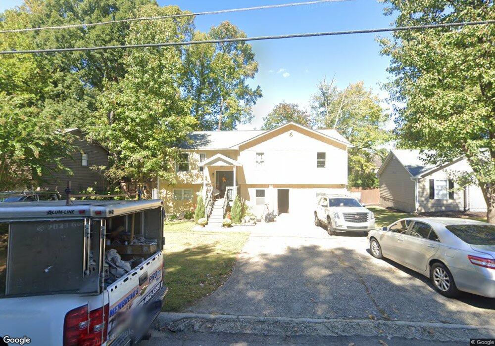
2079 Atkinson Ln Lawrenceville, GA 30043
Estimated Value: $342,000 - $374,000
3
Beds
3
Baths
1,333
Sq Ft
$268/Sq Ft
Est. Value
About This Home
This home is located at 2079 Atkinson Ln, Lawrenceville, GA 30043 and is currently estimated at $357,813, approximately $268 per square foot. 2079 Atkinson Ln is a home located in Gwinnett County with nearby schools including Jackson Elementary School, Northbrook Middle School, and Peachtree Ridge High School.
Ownership History
Date
Name
Owned For
Owner Type
Purchase Details
Closed on
Mar 6, 2019
Sold by
Snow Eddie G
Bought by
Solano Talledos Sara
Current Estimated Value
Home Financials for this Owner
Home Financials are based on the most recent Mortgage that was taken out on this home.
Original Mortgage
$179,007
Outstanding Balance
$157,062
Interest Rate
4.5%
Mortgage Type
FHA
Estimated Equity
$200,751
Purchase Details
Closed on
Mar 3, 2008
Sold by
Patillar Courtney
Bought by
Snow Eddie G and Snow Deloris
Create a Home Valuation Report for This Property
The Home Valuation Report is an in-depth analysis detailing your home's value as well as a comparison with similar homes in the area
Home Values in the Area
Average Home Value in this Area
Purchase History
| Date | Buyer | Sale Price | Title Company |
|---|---|---|---|
| Solano Talledos Sara | $182,310 | -- | |
| Snow Eddie G | $52,000 | -- |
Source: Public Records
Mortgage History
| Date | Status | Borrower | Loan Amount |
|---|---|---|---|
| Open | Solano Talledos Sara | $179,007 |
Source: Public Records
Tax History Compared to Growth
Tax History
| Year | Tax Paid | Tax Assessment Tax Assessment Total Assessment is a certain percentage of the fair market value that is determined by local assessors to be the total taxable value of land and additions on the property. | Land | Improvement |
|---|---|---|---|---|
| 2025 | $4,302 | $156,800 | $26,280 | $130,520 |
| 2024 | $4,137 | $142,360 | $28,000 | $114,360 |
| 2023 | $4,137 | $125,320 | $24,800 | $100,520 |
| 2022 | $3,746 | $125,320 | $24,800 | $100,520 |
| 2021 | $3,040 | $89,160 | $17,160 | $72,000 |
| 2020 | $2,709 | $72,920 | $15,680 | $57,240 |
| 2019 | $2,791 | $71,240 | $15,080 | $56,160 |
| 2018 | $2,596 | $65,720 | $12,200 | $53,520 |
| 2016 | $2,166 | $53,080 | $9,600 | $43,480 |
| 2015 | $2,189 | $53,080 | $9,600 | $43,480 |
| 2014 | -- | $32,760 | $9,600 | $23,160 |
Source: Public Records
Map
Nearby Homes
- 1771 Kristi Dr
- 1702 Herrington Rd
- 1694 Herrington Rd
- 2070 Stoneoak Dr
- 1923 Thomas Pointe Trace
- 1943 Thomas Pointe Trace
- 2261 Ewell Park Dr
- 1915 Westfield Dr
- 2210 Atkinson Park Dr
- 2180 Atkinson Park Dr
- 2163 Pebble Beach Dr
- 579 Collections Dr
- 2174 Pebble Beach Dr
- 2116 Tidal Cove
- 1622 Halliard Dr
- 1587 Herrington Rd
- 2404 Malster Ln
- 2412 Malster Ln
- 2085 Atkinson Ln
- 2073 Atkinson Ln
- 1805 Stoneoak Cir
- 2067 Atkinson Ln
- 1795 Stoneoak Cir
- 1815 Stoneoak Cir Unit 2
- 1825 Stoneoak Cir
- 0 Atkinson Ln Unit 3226438
- 0 Atkinson Ln Unit 3204794
- 0 Atkinson Ln Unit 8648327
- 0 Atkinson Ln Unit 3226244
- 2080 Atkinson Ln
- 2097 Atkinson Ln
- 1785 Stoneoak Cir Unit II
- 1761 Kristi Dr
- 2074 Atkinson Ln
- 1796 Herrington Rd
- 1835 Stoneoak Cir Unit 2
- 1802 Herrington Rd
- 1802 Herrington Rd