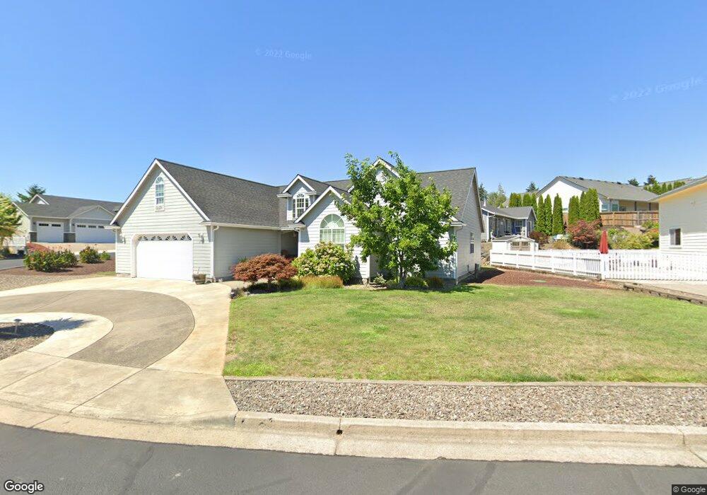
2079 Culver Loop Sutherlin, OR 97479
Estimated Value: $440,000 - $543,000
3
Beds
2
Baths
2,210
Sq Ft
$223/Sq Ft
Est. Value
About This Home
This home is located at 2079 Culver Loop, Sutherlin, OR 97479 and is currently estimated at $491,783, approximately $222 per square foot. 2079 Culver Loop is a home located in Douglas County with nearby schools including East Sutherlin Primary School, West Sutherlin Intermediate School, and Sutherlin Middle School.
Ownership History
Date
Name
Owned For
Owner Type
Purchase Details
Closed on
Jun 26, 2020
Sold by
Toll Duane W
Bought by
Toll Duane W and Webster Diana Lynne
Current Estimated Value
Purchase Details
Closed on
Jun 3, 2004
Sold by
Picknell Kevin and Picknell Janie
Bought by
Toll Duane W
Home Financials for this Owner
Home Financials are based on the most recent Mortgage that was taken out on this home.
Original Mortgage
$150,000
Outstanding Balance
$71,866
Interest Rate
5.92%
Mortgage Type
Purchase Money Mortgage
Estimated Equity
$419,917
Purchase Details
Closed on
Jan 2, 2004
Sold by
Picknell Kevin
Bought by
Picknell Janie
Home Financials for this Owner
Home Financials are based on the most recent Mortgage that was taken out on this home.
Original Mortgage
$192,000
Interest Rate
5.88%
Mortgage Type
Unknown
Create a Home Valuation Report for This Property
The Home Valuation Report is an in-depth analysis detailing your home's value as well as a comparison with similar homes in the area
Home Values in the Area
Average Home Value in this Area
Purchase History
| Date | Buyer | Sale Price | Title Company |
|---|---|---|---|
| Toll Duane W | -- | None Available | |
| Toll Duane W | $235,000 | Amerititle Inc | |
| Picknell Janie | -- | Douglas County Title Co |
Source: Public Records
Mortgage History
| Date | Status | Borrower | Loan Amount |
|---|---|---|---|
| Open | Toll Duane W | $150,000 | |
| Previous Owner | Picknell Janie | $192,000 |
Source: Public Records
Tax History
| Year | Tax Paid | Tax Assessment Tax Assessment Total Assessment is a certain percentage of the fair market value that is determined by local assessors to be the total taxable value of land and additions on the property. | Land | Improvement |
|---|---|---|---|---|
| 2025 | $3,947 | $332,498 | -- | -- |
| 2024 | $3,862 | $322,814 | -- | -- |
| 2023 | $3,751 | $313,412 | $0 | $0 |
| 2022 | $3,643 | $304,284 | $0 | $0 |
| 2021 | $3,539 | $295,422 | $0 | $0 |
| 2020 | $3,435 | $286,818 | $0 | $0 |
| 2019 | $3,335 | $278,465 | $0 | $0 |
| 2018 | $3,237 | $270,355 | $0 | $0 |
| 2017 | $3,318 | $262,481 | $0 | $0 |
| 2016 | $3,221 | $254,836 | $0 | $0 |
| 2015 | $3,124 | $247,414 | $0 | $0 |
| 2014 | $3,035 | $240,208 | $0 | $0 |
| 2013 | -- | $233,212 | $0 | $0 |
Source: Public Records
Map
Nearby Homes
- 702 Divot Loop
- 832 Sand Pines Ave
- 0 Scardi Blvd Unit Lot 101
- 0 Scardi Blvd Unit Lot 1
- 811 Pebble Creek St
- 582 Fairway Estates Dr
- 881 Medina Ave
- 324 Dakota St
- 607 Wildcat Canyon Rd
- 941 Sand Pines Ave
- 1716 Scardi Blvd Unit 174
- 376 Bentgrass Ct
- 909 Durham Ave
- 303 Ashwood St
- 135 Elkton St
- 126 Coles Valley St
- 2657 Greyfox Dr
- 157 Elkton St
- 1688 W Central Ave
- 181 SW Hutchins St
- 2081 Culver Loop
- 2077 Culver Loop
- 2070 Culver Loop
- 2068 Culver Loop
- 2083 Culver Loop
- 2076 Culver Loop
- 547 St Andrews Ct
- 2074 Culver Loop
- 2066 Culver Loop
- 536 St Andrews Ct
- 2078 Culver Loop
- 2044 Sawgrass Ct
- 2080 Culver Loop
- 2075 Culver Loop
- 523 St Andrews Ct
- 2082 Culver Loop
- 514 St Andrews Ct
- 2084 Culver Loop
- 1958 Culver Loop
- 501 St Andrews Ct
Your Personal Tour Guide
Ask me questions while you tour the home.