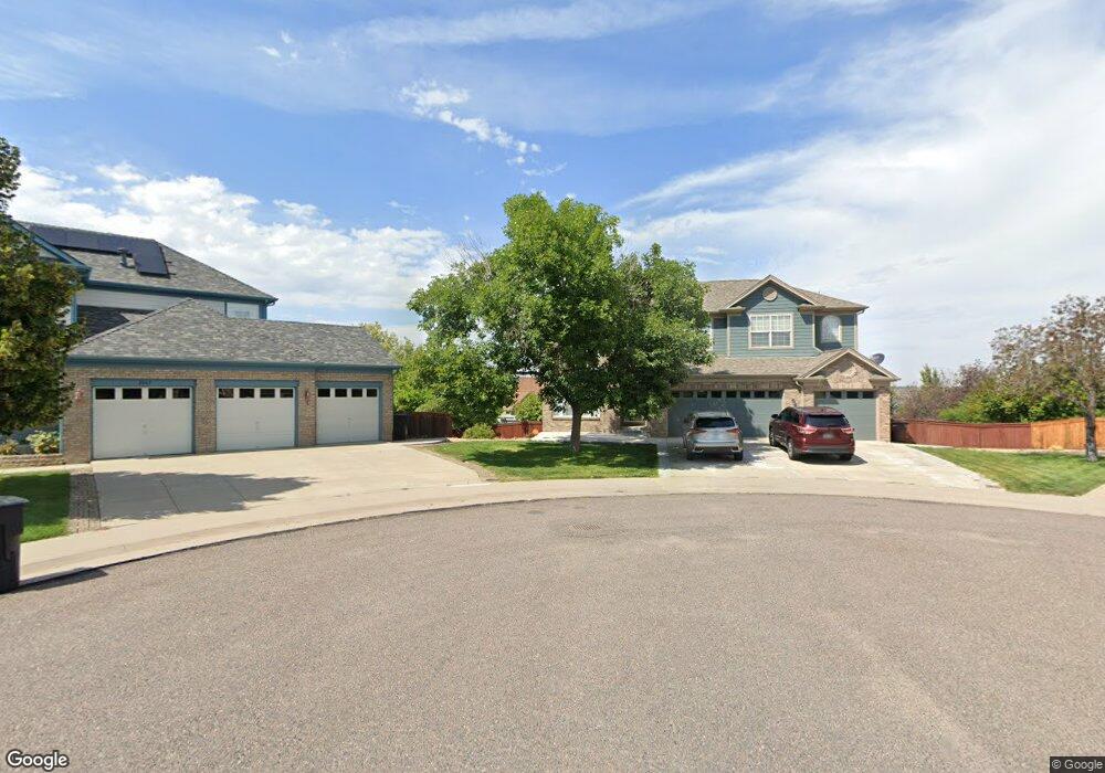
2079 E 101st Way Thornton, CO 80229
Quimby NeighborhoodEstimated Value: $640,000 - $724,788
7
Beds
4
Baths
4,308
Sq Ft
$162/Sq Ft
Est. Value
About This Home
This home is located at 2079 E 101st Way, Thornton, CO 80229 and is currently estimated at $696,197, approximately $161 per square foot. 2079 E 101st Way is a home located in Adams County with nearby schools including Thornton Elementary School, Thornton Middle School, and Thornton High School.
Ownership History
Date
Name
Owned For
Owner Type
Purchase Details
Closed on
Jan 15, 2021
Sold by
Mccoy Kirk D and Mccoy Joanne
Bought by
William Shaheen and William Javeed
Current Estimated Value
Home Financials for this Owner
Home Financials are based on the most recent Mortgage that was taken out on this home.
Original Mortgage
$452,000
Outstanding Balance
$399,700
Interest Rate
2.71%
Mortgage Type
New Conventional
Estimated Equity
$296,497
Purchase Details
Closed on
Jun 26, 2006
Sold by
Office Park Llc
Bought by
Gallo Shawn J
Purchase Details
Closed on
Apr 28, 2006
Sold by
Gallo Shawn
Bought by
Office Park Llc
Purchase Details
Closed on
Dec 31, 2001
Sold by
Pulte Home Corp
Bought by
Gallo Shawn J
Home Financials for this Owner
Home Financials are based on the most recent Mortgage that was taken out on this home.
Original Mortgage
$296,810
Interest Rate
7.03%
Mortgage Type
Stand Alone First
Create a Home Valuation Report for This Property
The Home Valuation Report is an in-depth analysis detailing your home's value as well as a comparison with similar homes in the area
Home Values in the Area
Average Home Value in this Area
Purchase History
| Date | Buyer | Sale Price | Title Company |
|---|---|---|---|
| William Shaheen | $565,000 | Fidelity National Title | |
| Gallo Shawn J | -- | None Available | |
| Office Park Llc | -- | None Available | |
| Gallo Shawn J | $296,810 | Land Title Guarantee Company |
Source: Public Records
Mortgage History
| Date | Status | Borrower | Loan Amount |
|---|---|---|---|
| Open | William Shaheen | $452,000 | |
| Previous Owner | Gallo Shawn J | $296,810 |
Source: Public Records
Tax History
| Year | Tax Paid | Tax Assessment Tax Assessment Total Assessment is a certain percentage of the fair market value that is determined by local assessors to be the total taxable value of land and additions on the property. | Land | Improvement |
|---|---|---|---|---|
| 2025 | $4,650 | $47,120 | $9,180 | $37,940 |
| 2024 | $4,650 | $43,320 | $8,440 | $34,880 |
| 2023 | $4,603 | $48,640 | $7,640 | $41,000 |
| 2022 | $4,239 | $38,480 | $7,850 | $30,630 |
| 2021 | $4,380 | $38,480 | $7,850 | $30,630 |
| 2020 | $3,861 | $34,610 | $8,080 | $26,530 |
| 2019 | $3,869 | $34,610 | $8,080 | $26,530 |
| 2018 | $3,774 | $32,800 | $6,120 | $26,680 |
| 2017 | $3,432 | $32,800 | $6,120 | $26,680 |
| 2016 | $3,035 | $28,240 | $4,860 | $23,380 |
| 2015 | $3,031 | $28,240 | $4,860 | $23,380 |
| 2014 | $2,791 | $25,280 | $4,460 | $20,820 |
Source: Public Records
Map
Nearby Homes
- 2244 E 101st Ave
- 10221 York Place
- 10099 Williams St
- 10067 Williams Way
- 2285 E 103rd Place
- 9755 High St
- 2631 E 102nd Place
- 1838 E 98th Ave
- 2632 E 103rd Ave
- 2651 E 102nd Place
- 2652 E 103rd Ave
- 2690 E 102nd Place
- 2742 E 103rd Ave
- 2702 E 103rd Ave
- 1501 E 98th Ave
- 2083 E 97th Place
- 1792 E 97th Ave
- 2621 E 98th Ave
- 10394 Detroit St
- 1696 E 96th Way
- 2089 E 101st Way
- 2069 E 101st Way
- 10184 Vine Ct
- 10174 Vine Ct
- 2056 E 102nd Ave
- 2076 E 102nd Ave
- 2046 E 102nd Ave
- 10164 Vine Ct
- 2096 E 102nd Ave
- 2099 E 101st Way
- 2059 E 101st Way
- 10154 Vine Ct
- 2129 E 101st Way
- 2106 E 102nd Ave
- 10175 Vine Ct
- 10134 Vine Ct
- 10165 Vine Ct
- 10185 Vine Ct
- 2149 E 101st Way
- 10155 Vine Ct
Your Personal Tour Guide
Ask me questions while you tour the home.