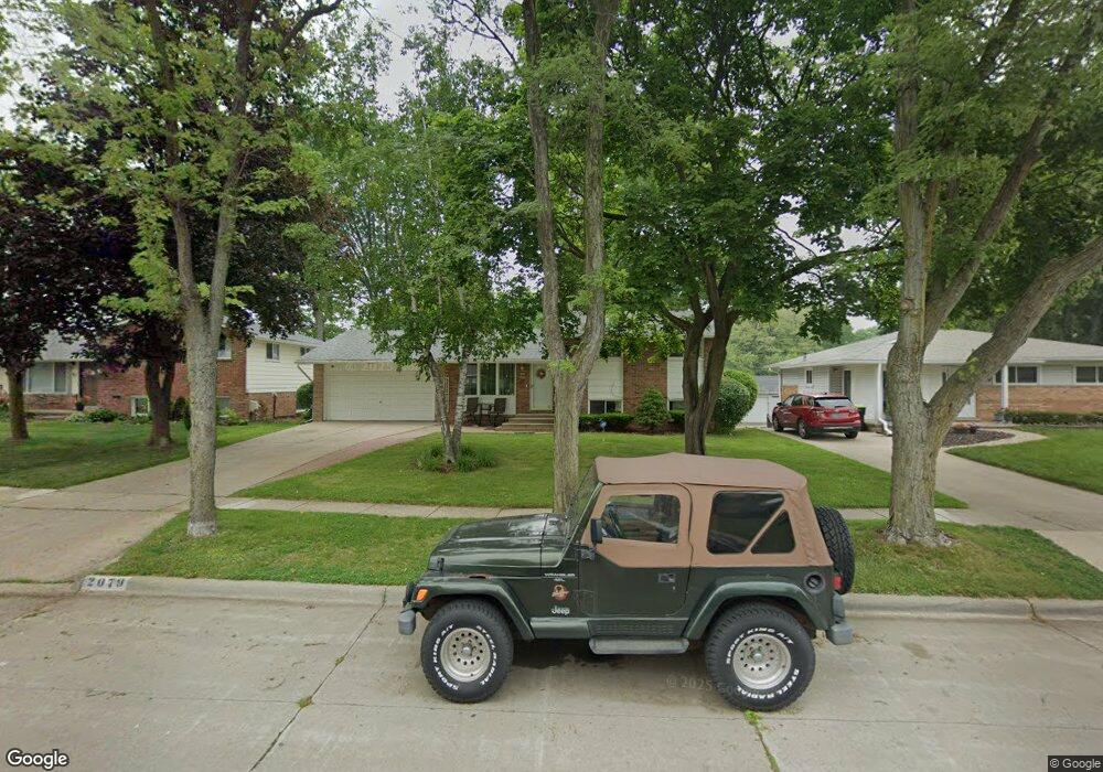
2079 Hempstead Rd Auburn Hills, MI 48326
Estimated Value: $281,977 - $364,000
3
Beds
2
Baths
1,701
Sq Ft
$188/Sq Ft
Est. Value
About This Home
This home is located at 2079 Hempstead Rd, Auburn Hills, MI 48326 and is currently estimated at $320,494, approximately $188 per square foot. 2079 Hempstead Rd is a home located in Oakland County with nearby schools including R. Grant Graham Elementary School, Avondale Middle School, and Avondale High School.
Ownership History
Date
Name
Owned For
Owner Type
Purchase Details
Closed on
Sep 11, 2017
Sold by
Stegar Saundra C
Bought by
Latham Bernard and Latham Marshella L
Current Estimated Value
Home Financials for this Owner
Home Financials are based on the most recent Mortgage that was taken out on this home.
Original Mortgage
$135,327
Outstanding Balance
$113,669
Interest Rate
4.12%
Mortgage Type
FHA
Estimated Equity
$206,825
Purchase Details
Closed on
Dec 9, 2013
Sold by
Stegar Saundra C
Bought by
Stegar Saundra C and Stegar Prentice E
Purchase Details
Closed on
Oct 1, 2010
Sold by
Stegar Prentice E
Bought by
Stegar Saundra C
Purchase Details
Closed on
Dec 1, 2006
Sold by
The Estate Of Norah Parent
Bought by
Stegar Prentice E
Create a Home Valuation Report for This Property
The Home Valuation Report is an in-depth analysis detailing your home's value as well as a comparison with similar homes in the area
Home Values in the Area
Average Home Value in this Area
Purchase History
| Date | Buyer | Sale Price | Title Company |
|---|---|---|---|
| Latham Bernard | $140,000 | None Available | |
| Stegar Saundra C | -- | None Available | |
| Stegar Saundra C | -- | None Available | |
| Stegar Prentice E | $120,000 | Greco |
Source: Public Records
Mortgage History
| Date | Status | Borrower | Loan Amount |
|---|---|---|---|
| Open | Latham Bernard | $135,327 |
Source: Public Records
Tax History Compared to Growth
Tax History
| Year | Tax Paid | Tax Assessment Tax Assessment Total Assessment is a certain percentage of the fair market value that is determined by local assessors to be the total taxable value of land and additions on the property. | Land | Improvement |
|---|---|---|---|---|
| 2024 | $1,578 | $101,750 | $0 | $0 |
| 2023 | $1,505 | $94,140 | $0 | $0 |
| 2022 | $3,204 | $86,500 | $0 | $0 |
| 2021 | $2,803 | $83,300 | $0 | $0 |
| 2020 | $1,379 | $80,880 | $0 | $0 |
| 2019 | $2,881 | $77,220 | $0 | $0 |
| 2018 | $2,530 | $69,570 | $0 | $0 |
| 2017 | $2,088 | $68,720 | $0 | $0 |
| 2016 | $2,486 | $60,370 | $0 | $0 |
| 2015 | -- | $52,860 | $0 | $0 |
| 2014 | -- | $46,510 | $0 | $0 |
| 2011 | -- | $51,920 | $0 | $0 |
Source: Public Records
Map
Nearby Homes
- 0 Oaknoll St
- 2551 Crofthill Dr
- 1564 Georgetown Place
- 1524 Georgetown Dr Unit 32
- 1522 Tannahill Ln
- 2667 Williamsburg Cir Unit 31
- 466 Rolling Rock Rd
- 833 Bloomfield Village Blvd Unit A
- 833 Bloomfield Village Blvd Unit D
- 833 Bloomfield Village Blvd Unit B
- 758 Huntclub Blvd
- 1987 Hunters Ridge Dr
- 870 Huntclub Blvd
- 1545 S Hill Blvd
- 1737 S Hill Blvd
- 1696 S Hill Blvd Unit 46
- 2931 Auburn Rd
- 1717 Brandywine Dr
- 440 Martin Luther King Junior Blvd S
- 655 S Spinningwheel Ln
- 2091 Hempstead Rd
- 2067 Hempstead Rd
- 2115 Hempstead Rd
- 2055 Hempstead Rd
- 2127 Hempstead Rd Unit Bldg-Unit
- 2127 Hempstead Rd
- 2029 Hempstead Rd
- 2139 Hempstead Rd
- 2072 Hempstead Rd
- 2086 Hempstead Rd
- 2058 Hempstead Rd
- 2124 Hempstead Rd
- 2036 Hempstead Rd
- 2151 Hempstead Rd
- 610 Ashburnham St
- 2136 Hempstead Rd
- 2150 Hempstead Rd
- 616 Ashburnham St
- 2163 Hempstead Rd
- 613 Ashburnham St