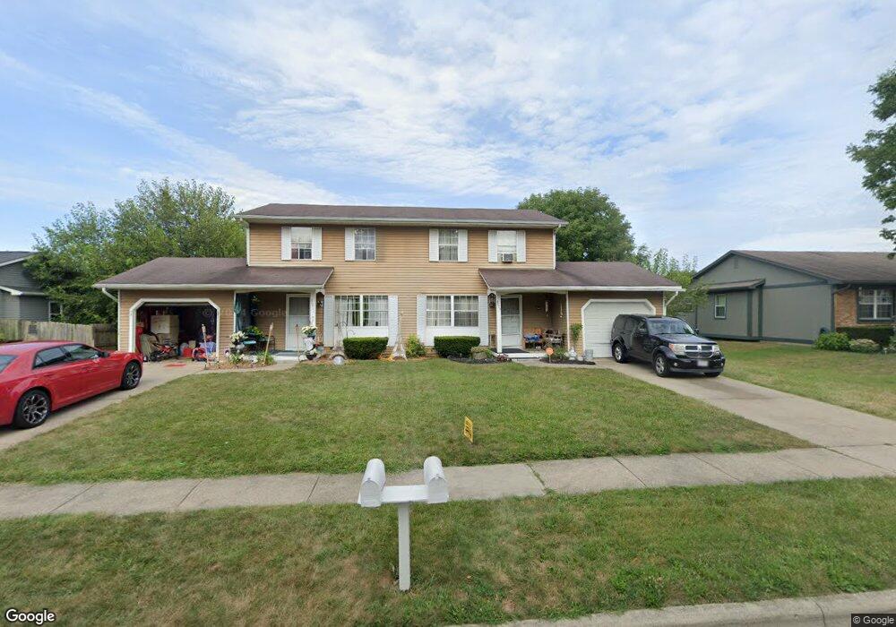
2079 Lynbridge Dr Unit 81 Reynoldsburg, OH 43068
Estimated Value: $292,759 - $331,000
4
Beds
4
Baths
2,080
Sq Ft
$150/Sq Ft
Est. Value
About This Home
This home is located at 2079 Lynbridge Dr Unit 81, Reynoldsburg, OH 43068 and is currently estimated at $312,190, approximately $150 per square foot. 2079 Lynbridge Dr Unit 81 is a home located in Franklin County with nearby schools including Slate Ridge Elementary School, Baldwin Road Junior High School, and Hannah J Ashton Middle School.
Ownership History
Date
Name
Owned For
Owner Type
Purchase Details
Closed on
Oct 11, 2023
Sold by
Swad Wilmer L and Swad Barbara S
Bought by
Barbara S Swad Trust and Swad
Current Estimated Value
Purchase Details
Closed on
Feb 7, 1991
Bought by
Swad Wilmer L
Purchase Details
Closed on
Dec 22, 1989
Purchase Details
Closed on
Jan 9, 1989
Create a Home Valuation Report for This Property
The Home Valuation Report is an in-depth analysis detailing your home's value as well as a comparison with similar homes in the area
Home Values in the Area
Average Home Value in this Area
Purchase History
| Date | Buyer | Sale Price | Title Company |
|---|---|---|---|
| Barbara S Swad Trust | -- | None Listed On Document | |
| Swad Wilmer L | $88,400 | -- | |
| -- | $90,000 | -- | |
| -- | -- | -- |
Source: Public Records
Tax History Compared to Growth
Tax History
| Year | Tax Paid | Tax Assessment Tax Assessment Total Assessment is a certain percentage of the fair market value that is determined by local assessors to be the total taxable value of land and additions on the property. | Land | Improvement |
|---|---|---|---|---|
| 2024 | $4,505 | $85,930 | $21,040 | $64,890 |
| 2023 | $4,305 | $85,930 | $21,040 | $64,890 |
| 2022 | $3,580 | $54,040 | $9,870 | $44,170 |
| 2021 | $3,594 | $54,040 | $9,870 | $44,170 |
| 2020 | $3,667 | $54,040 | $9,870 | $44,170 |
| 2019 | $3,377 | $45,050 | $8,230 | $36,820 |
| 2018 | $3,413 | $45,050 | $8,230 | $36,820 |
| 2017 | $3,409 | $45,050 | $8,230 | $36,820 |
| 2016 | $3,479 | $41,480 | $7,420 | $34,060 |
| 2015 | $3,374 | $41,480 | $7,420 | $34,060 |
| 2014 | $3,283 | $41,480 | $7,420 | $34,060 |
| 2013 | $1,879 | $47,250 | $8,715 | $38,535 |
Source: Public Records
Map
Nearby Homes
- 6549 Santa Cruz Place
- 6348 E Livingston Ave
- 0 Brice Rd
- 6682 Woodsedge Dr
- 0 Radekin Rd Unit 225029852
- 1550 Idlewild Dr
- 6728 Greenbush Dr
- 6772 Gilette Dr
- 6658 Furth Dr
- 6584 Benjamin Dr
- 1888 Birkdale Dr
- 1324 Idlewild Dr
- 1334 Manor Dr
- 1328 Manor Dr
- 1603 Hallworth Ct Unit 16038
- 6793 Laird Ave
- 1748 Sunapple Way Unit 1748
- 1826-1828 Bairsford Dr
- 6775 Centennial Dr
- 1481 Riverton Ct E
- 2065 Lynbridge Dr Unit 67
- 2091 Lynbridge Dr Unit 93
- 2078 Lynbridge Dr
- 2051 Lynbridge Dr Unit 53
- 2099 Lynbridge Dr Unit 101
- 2090 Lynbridge Dr
- 2098 Lynbridge Dr
- 6411 Lanercost Rd
- 2041 Lynbridge Dr
- 2052 Lynbridge Dr
- 2102 Lynbridge Dr
- 2039 Lynbridge Dr Unit 41
- 6421 Lanercost Rd
- 2110 Lynbridge Dr
- 6416 Tamar Ct
- 6412 Lanercost Rd
- 6408 Tamar Ct
- 2040 Lynbridge Dr
- 2029-2031 Lynbridge Dr Unit 31
- 6433 Lanercost Rd