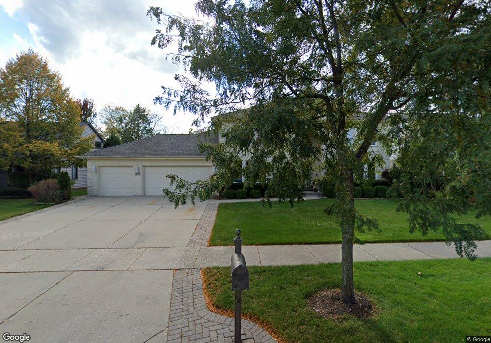
2079 Sheridan Rd Buffalo Grove, IL 60089
Rolling Hills NeighborhoodEstimated Value: $850,000 - $911,000
--
Bed
4
Baths
3,158
Sq Ft
$279/Sq Ft
Est. Value
About This Home
This home is located at 2079 Sheridan Rd, Buffalo Grove, IL 60089 and is currently estimated at $880,996, approximately $278 per square foot. 2079 Sheridan Rd is a home located in Lake County with nearby schools including Ivy Hall Elementary School, Twin Groves Middle School, and Adlai E Stevenson High School.
Ownership History
Date
Name
Owned For
Owner Type
Purchase Details
Closed on
Mar 24, 1997
Sold by
American National Bk & Tr Co Of Chicago
Bought by
Vukotic Branko and Vukotic Slavica
Current Estimated Value
Home Financials for this Owner
Home Financials are based on the most recent Mortgage that was taken out on this home.
Original Mortgage
$291,300
Outstanding Balance
$34,169
Interest Rate
7.37%
Estimated Equity
$846,827
Create a Home Valuation Report for This Property
The Home Valuation Report is an in-depth analysis detailing your home's value as well as a comparison with similar homes in the area
Home Values in the Area
Average Home Value in this Area
Purchase History
| Date | Buyer | Sale Price | Title Company |
|---|---|---|---|
| Vukotic Branko | $438,000 | Chicago Title Insurance Co |
Source: Public Records
Mortgage History
| Date | Status | Borrower | Loan Amount |
|---|---|---|---|
| Open | Vukotic Branko | $291,300 |
Source: Public Records
Tax History Compared to Growth
Tax History
| Year | Tax Paid | Tax Assessment Tax Assessment Total Assessment is a certain percentage of the fair market value that is determined by local assessors to be the total taxable value of land and additions on the property. | Land | Improvement |
|---|---|---|---|---|
| 2024 | $20,729 | $235,594 | $54,463 | $181,131 |
| 2023 | $19,513 | $211,715 | $48,943 | $162,772 |
| 2022 | $19,513 | $197,097 | $45,564 | $151,533 |
| 2021 | $18,890 | $194,972 | $45,073 | $149,899 |
| 2020 | $18,520 | $195,637 | $45,227 | $150,410 |
| 2019 | $18,071 | $194,916 | $45,060 | $149,856 |
| 2018 | $19,690 | $217,505 | $48,983 | $168,522 |
| 2017 | $19,377 | $212,428 | $47,840 | $164,588 |
| 2016 | $18,691 | $203,417 | $45,811 | $157,606 |
| 2015 | $18,303 | $190,234 | $42,842 | $147,392 |
| 2014 | $18,615 | $190,332 | $46,013 | $144,319 |
| 2012 | $18,513 | $190,713 | $46,105 | $144,608 |
Source: Public Records
Map
Nearby Homes
- 1903 Sheridan Rd
- 1998 Sheridan Ct
- 5255 Danbury Ct
- 1901 Brandywyn Ln
- 486 Satinwood Terrace Unit 11
- 538 Lasalle Ct
- 890 Knollwood Dr
- 327 Lasalle Ln
- 333 Didier Ct
- 5328 Oak Grove Dr
- 268 Hoffmann Dr
- 361 Hoffmann Dr
- 896 Chaucer Way Unit 2
- 1265 Devonshire Rd
- 1265 Ranchview Ct
- 5107 N Arlington Heights Rd
- 1118 Larraway Dr
- 259 Willow Pkwy Unit 403
- 4143 3 Lakes Ct
- 361 Willow Pkwy Unit 234
- 2075 Sheridan Rd
- 2083 Sheridan Rd
- 2087 Sheridan Rd
- 2071 Sheridan Rd
- 817 Summer Ct
- 2082 Sheridan Rd
- 2086 Sheridan Rd
- 815 Summer Ct
- 2067 Sheridan Rd
- 2091 Sheridan Rd
- 801 Summer Ct
- 2090 Sheridan Rd
- 813 Summer Ct
- 803 Summer Ct
- 2095 Sheridan Rd
- 2063 Sheridan Rd
- 2094 Sheridan Rd
- 805 Summer Ct
- 1930 Twin Oaks Ct
- 2042 Sheridan Rd