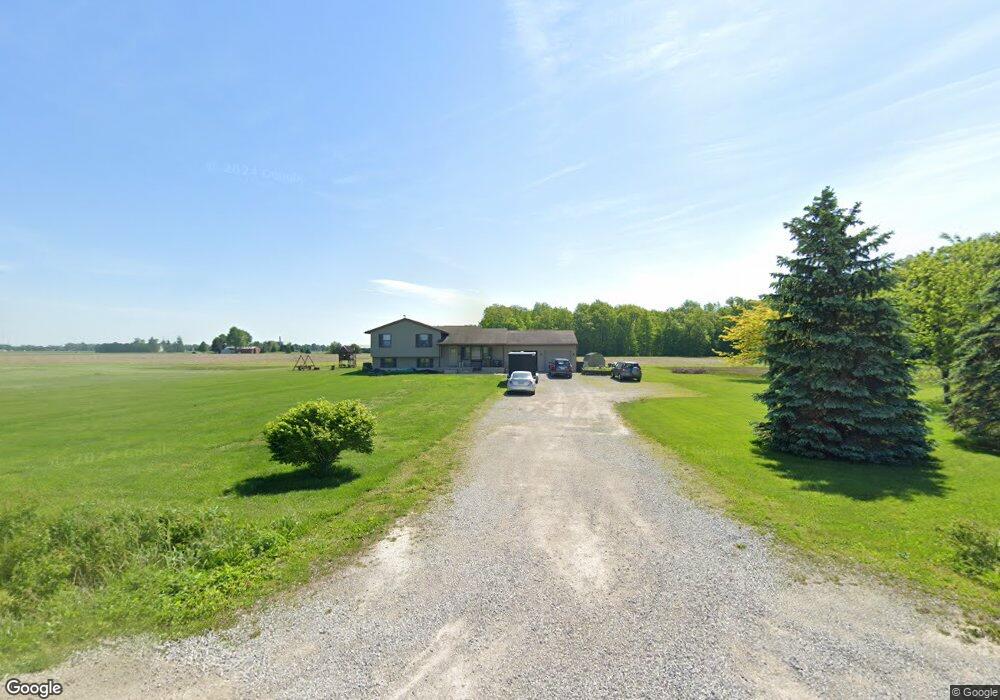
20798 Green Rd Bowling Green, OH 43402
Estimated Value: $280,000 - $382,664
3
Beds
2
Baths
1,946
Sq Ft
$170/Sq Ft
Est. Value
About This Home
This home is located at 20798 Green Rd, Bowling Green, OH 43402 and is currently estimated at $331,166, approximately $170 per square foot. 20798 Green Rd is a home located in Wood County with nearby schools including Otsego Elementary School, Otsego Junior High School, and Otsego High School.
Ownership History
Date
Name
Owned For
Owner Type
Purchase Details
Closed on
Mar 15, 2004
Sold by
Foster Daniel A and Foster Holly A
Bought by
Kitchen Shad D and Kitchen Michelle L
Current Estimated Value
Purchase Details
Closed on
Oct 14, 2003
Sold by
Foster Daniel A and Foster Holly A
Bought by
Thomas James J and Thomas Heidi M
Home Financials for this Owner
Home Financials are based on the most recent Mortgage that was taken out on this home.
Original Mortgage
$203,300
Outstanding Balance
$96,690
Interest Rate
6.49%
Mortgage Type
Purchase Money Mortgage
Estimated Equity
$234,476
Create a Home Valuation Report for This Property
The Home Valuation Report is an in-depth analysis detailing your home's value as well as a comparison with similar homes in the area
Home Values in the Area
Average Home Value in this Area
Purchase History
| Date | Buyer | Sale Price | Title Company |
|---|---|---|---|
| Kitchen Shad D | $34,500 | -- | |
| Thomas James J | $214,000 | American Title Agency |
Source: Public Records
Mortgage History
| Date | Status | Borrower | Loan Amount |
|---|---|---|---|
| Open | Thomas James J | $203,300 |
Source: Public Records
Tax History Compared to Growth
Tax History
| Year | Tax Paid | Tax Assessment Tax Assessment Total Assessment is a certain percentage of the fair market value that is determined by local assessors to be the total taxable value of land and additions on the property. | Land | Improvement |
|---|---|---|---|---|
| 2024 | $5,138 | $89,390 | $14,945 | $74,445 |
| 2023 | $5,138 | $89,400 | $14,950 | $74,450 |
| 2021 | $4,788 | $71,340 | $14,040 | $57,300 |
| 2020 | $4,860 | $71,340 | $14,040 | $57,300 |
| 2019 | $4,851 | $68,150 | $13,480 | $54,670 |
| 2018 | $4,911 | $68,150 | $13,480 | $54,670 |
| 2017 | $4,710 | $68,150 | $13,480 | $54,670 |
| 2016 | $4,342 | $56,710 | $13,620 | $43,090 |
| 2015 | $4,342 | $56,710 | $13,620 | $43,090 |
| 2014 | $4,438 | $56,710 | $13,620 | $43,090 |
| 2013 | $4,716 | $56,710 | $13,620 | $43,090 |
Source: Public Records
Map
Nearby Homes
- 109 High St
- 104 E Main St
- 19537 Liberty Hi Rd
- 16890 W River Rd
- 0 River Rd W
- 335 S River Rd
- 18555 Crom St
- 18142 Tontogany Rd
- 18735 Main St
- 0 Wall St
- 35 S River Rd
- 0 Scott Rd
- 0 W River Rd Unit 10000155
- 320 Ridgepoint Cir
- 132 Wilkshire Dr
- 1248 Applegate St
- 131 N River Rd
- 513 North St
- 0 W River Rd Unit 6134934
- 0 W River Rd Unit 6133310
- 20860 Green Rd
- 20748 Green Rd
- 20710 Green Rd
- 20950 Green Rd
- 20640 Green Rd
- 16505 Middleton Pike
- 16480 Middleton Pike
- 16984 Robinson Rd
- 20425 Green Rd
- 16535 Robinson Rd
- 16362 Middleton Pike
- 20398 Green Rd
- 20398 Green Rd
- 17121 Middleton Pike
- 20363 Green Rd
- 17055 Robinson Rd
- 20311 Green Rd
- 17071 Robinson Rd
- 17210 Robinson Rd
- 17285 Middleton Pike