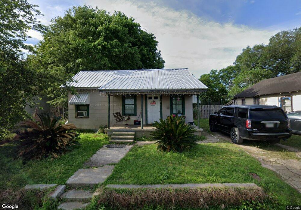
208 21st Ave NE Moultrie, GA 31768
Estimated Value: $58,955 - $95,000
--
Bed
1
Bath
924
Sq Ft
$78/Sq Ft
Est. Value
About This Home
This home is located at 208 21st Ave NE, Moultrie, GA 31768 and is currently estimated at $72,239, approximately $78 per square foot. 208 21st Ave NE is a home located in Colquitt County with nearby schools including Doerun Elementary School, C.A. Gray Junior High School, and Willie J. Williams Middle School.
Ownership History
Date
Name
Owned For
Owner Type
Purchase Details
Closed on
Apr 17, 2006
Sold by
Johnson Gayle T
Bought by
Singletary Tammy
Current Estimated Value
Home Financials for this Owner
Home Financials are based on the most recent Mortgage that was taken out on this home.
Original Mortgage
$19,391
Outstanding Balance
$11,111
Interest Rate
6.31%
Mortgage Type
New Conventional
Estimated Equity
$61,128
Purchase Details
Closed on
Jun 26, 1995
Bought by
Johnson Gayle T
Purchase Details
Closed on
Dec 3, 1993
Bought by
Barfield Joseph B
Purchase Details
Closed on
Jul 27, 1992
Bought by
May Clentis C
Create a Home Valuation Report for This Property
The Home Valuation Report is an in-depth analysis detailing your home's value as well as a comparison with similar homes in the area
Home Values in the Area
Average Home Value in this Area
Purchase History
| Date | Buyer | Sale Price | Title Company |
|---|---|---|---|
| Singletary Tammy | $18,000 | -- | |
| Johnson Gayle T | $7,500 | -- | |
| Barfield Joseph B | -- | -- | |
| May Clentis C | $8,000 | -- |
Source: Public Records
Mortgage History
| Date | Status | Borrower | Loan Amount |
|---|---|---|---|
| Open | Singletary Tammy | $19,391 |
Source: Public Records
Tax History Compared to Growth
Tax History
| Year | Tax Paid | Tax Assessment Tax Assessment Total Assessment is a certain percentage of the fair market value that is determined by local assessors to be the total taxable value of land and additions on the property. | Land | Improvement |
|---|---|---|---|---|
| 2024 | $390 | $21,769 | $480 | $21,289 |
| 2023 | $459 | $11,069 | $480 | $10,589 |
| 2022 | $208 | $8,750 | $480 | $8,270 |
| 2021 | $174 | $7,174 | $480 | $6,694 |
| 2020 | $177 | $7,174 | $480 | $6,694 |
| 2019 | $194 | $7,060 | $480 | $6,580 |
| 2018 | $181 | $7,060 | $480 | $6,580 |
| 2017 | $192 | $7,060 | $480 | $6,580 |
| 2016 | $195 | $7,060 | $480 | $6,580 |
| 2015 | $141 | $7,060 | $480 | $6,580 |
| 2014 | $139 | $7,100 | $480 | $6,620 |
| 2013 | -- | $7,100 | $480 | $6,620 |
Source: Public Records
Map
Nearby Homes
- 0 S U Highway 319 N
- 1208 Maple St
- 15,23,27 29th Ave NW
- 107 30th Ave NW
- 615 1st St NW
- 722 Martin Luther King jr Dr
- 503 2nd St NW
- 316 5th Ave NW
- 521 5th Ave NW
- 3233 Sylvester Dr
- 417 9th St NW
- 408 9th St NW
- 614 2nd Ave NW
- 410 W Bypass Pass NW
- 610 1st Ave NW
- 410 West Bypass NW
- 310 1st Ave SW
- 00 1st Ave SW
- 619 E Central Ave
- 1321 Hallmark Dr
- 202 21st Ave NE
- 304 21st Ave NE
- 306 21st Ave NE
- 2112 Sylvester Dr
- 323 21st Ave NE
- 2120 Sylvester Dr
- 2111 Sylvester Dr
- 2202 Sylvester Dr
- 146 Vinson St
- 2121 Sylvester Dr
- 1511 Sylvester Hwy
- 2206 Sylvester Dr
- 2201 Sylvester Dr
- 2205 Sylvester Dr
- 2212 Sylvester Dr
- 124 Vinson St
- 1418 N Main St
- 2211 Sylvester Dr
- 2220 Sylvester Dr
- 2217 Sylvester Dr