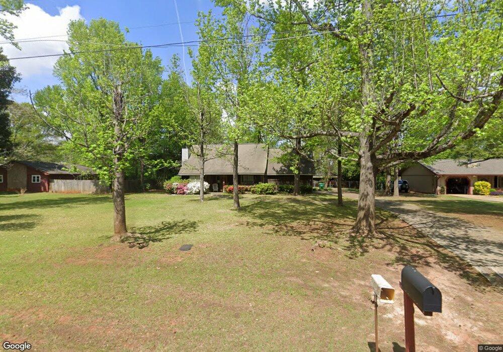
208 Air Park Dr Warner Robins, GA 31088
Estimated Value: $248,770 - $309,000
4
Beds
2
Baths
1,829
Sq Ft
$153/Sq Ft
Est. Value
About This Home
This home is located at 208 Air Park Dr, Warner Robins, GA 31088 and is currently estimated at $278,943, approximately $152 per square foot. 208 Air Park Dr is a home located in Houston County with nearby schools including David A. Perdue Primary School, David A. Perdue Elementary School, and Feagin Mill Middle School.
Ownership History
Date
Name
Owned For
Owner Type
Purchase Details
Closed on
Jun 10, 1987
Sold by
Moone Dolores Dorsey and Moone Carlton
Bought by
Horne E Wayne
Current Estimated Value
Purchase Details
Closed on
Aug 11, 1978
Sold by
Warner Robins Air Park Estates
Bought by
Moone Dolores Dorsey and Carlton G*
Purchase Details
Closed on
Feb 22, 1974
Sold by
Gottschalk & Gottschalk Inc
Bought by
Warner Robins Air Park Estates
Create a Home Valuation Report for This Property
The Home Valuation Report is an in-depth analysis detailing your home's value as well as a comparison with similar homes in the area
Home Values in the Area
Average Home Value in this Area
Purchase History
| Date | Buyer | Sale Price | Title Company |
|---|---|---|---|
| Horne E Wayne | -- | -- | |
| Moone Dolores Dorsey | $46,900 | -- | |
| Warner Robins Air Park Estates | -- | -- |
Source: Public Records
Tax History Compared to Growth
Tax History
| Year | Tax Paid | Tax Assessment Tax Assessment Total Assessment is a certain percentage of the fair market value that is determined by local assessors to be the total taxable value of land and additions on the property. | Land | Improvement |
|---|---|---|---|---|
| 2024 | $1,692 | $70,720 | $9,480 | $61,240 |
| 2023 | $1,473 | $60,960 | $9,480 | $51,480 |
| 2022 | $1,352 | $55,920 | $9,480 | $46,440 |
| 2021 | $1,130 | $46,520 | $8,520 | $38,000 |
| 2020 | $1,116 | $45,720 | $8,520 | $37,200 |
| 2019 | $1,116 | $45,720 | $8,520 | $37,200 |
| 2018 | $1,116 | $45,720 | $8,520 | $37,200 |
| 2017 | $1,117 | $45,720 | $8,520 | $37,200 |
| 2016 | $1,119 | $45,720 | $8,520 | $37,200 |
| 2015 | $1,123 | $45,800 | $8,520 | $37,280 |
| 2014 | -- | $45,800 | $8,520 | $37,280 |
| 2013 | -- | $45,800 | $8,520 | $37,280 |
Source: Public Records
Map
Nearby Homes
- 110 Mayberry Ln
- 108 Mayberry Ln
- 104 Mayberry Ln
- 102 Mayberry Ln
- 102 Mayberry Ln Unit LOT 1 MB
- 401 Bella Notte Cir Unit 5D
- 401 Bella Notte Cir
- 207 Courthouse Ln
- 414 Bella Notte Cir
- 414 Bella Notte Cir Unit 23A
- 416 Bella Notte Cir
- 416 Bella Notte Cir Unit 22A
- 404 Minter Dr
- 418 Bella Notte Cir Unit 21A
- 409 Bella Notte Cir Unit 1D
- 409 Bella Notte Cir
- 1148 Thornblade Dr
- 500 Bella Notte Cir Unit 16A
- 500 Bella Notte Cir
- 502 Bella Notte Cir
- 210 Air Park Dr
- 206 Air Park Dr
- 212 Air Park Dr
- 204 Air Park Dr
- 207 Air Park Dr
- 205 Air Park Dr
- 214 Air Park Dr
- 209 Air Park Dr
- 203 Air Park Dr
- 202 Air Park Dr
- 211 Air Park Dr
- 216 Air Park Dr
- 201 Air Park Dr
- 703 Haverhill Cir
- 213 Air Park Dr
- 709 Haverhill Cir
- 805 Haverhill Cir
- 801 Haverhill Cir
- 707 Haverhill Cir
- 705 Haverhill Cir