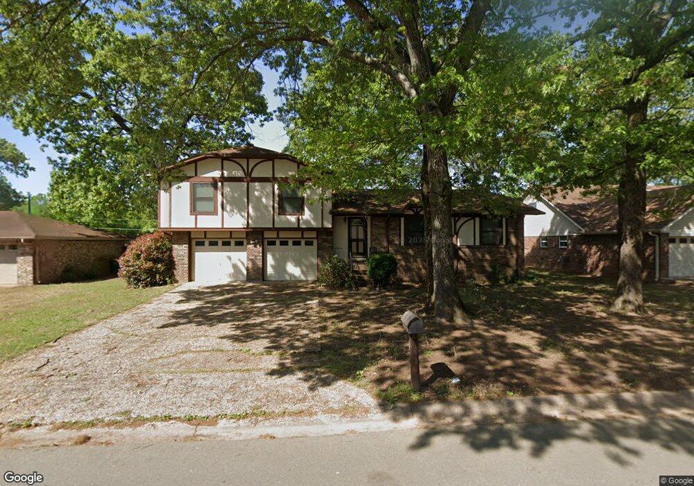
208 Alanbrook Ave Sherwood, AR 72120
Estimated Value: $204,900 - $234,000
--
Bed
3
Baths
1,793
Sq Ft
$122/Sq Ft
Est. Value
About This Home
This home is located at 208 Alanbrook Ave, Sherwood, AR 72120 and is currently estimated at $217,975, approximately $121 per square foot. 208 Alanbrook Ave is a home located in Pulaski County with nearby schools including Sherwood Elementary School, Sylvan Hills Middle School, and Sylvan Hills High School.
Ownership History
Date
Name
Owned For
Owner Type
Purchase Details
Closed on
Dec 8, 2023
Sold by
Jimmie Vaughn Golden and Jimmie Johnny Lou
Bought by
Miller Steven M and Miller Ramona
Current Estimated Value
Home Financials for this Owner
Home Financials are based on the most recent Mortgage that was taken out on this home.
Original Mortgage
$148,000
Outstanding Balance
$137,099
Interest Rate
7.03%
Mortgage Type
Balloon
Estimated Equity
$80,876
Create a Home Valuation Report for This Property
The Home Valuation Report is an in-depth analysis detailing your home's value as well as a comparison with similar homes in the area
Home Values in the Area
Average Home Value in this Area
Purchase History
| Date | Buyer | Sale Price | Title Company |
|---|---|---|---|
| Miller Steven M | $185,000 | Beach Abstract & Guaranty | |
| Miller Steven M | -- | Beach Abstract & Guaranty |
Source: Public Records
Mortgage History
| Date | Status | Borrower | Loan Amount |
|---|---|---|---|
| Open | Miller Steven M | $148,000 |
Source: Public Records
Tax History Compared to Growth
Tax History
| Year | Tax Paid | Tax Assessment Tax Assessment Total Assessment is a certain percentage of the fair market value that is determined by local assessors to be the total taxable value of land and additions on the property. | Land | Improvement |
|---|---|---|---|---|
| 2025 | $1,863 | $35,750 | $6,600 | $29,150 |
| 2024 | $1,545 | $35,750 | $6,600 | $29,150 |
| 2023 | $1,545 | $35,750 | $6,600 | $29,150 |
| 2022 | $1,656 | $35,750 | $6,600 | $29,150 |
| 2021 | $1,533 | $26,960 | $6,000 | $20,960 |
| 2020 | $1,151 | $26,960 | $6,000 | $20,960 |
| 2019 | $1,151 | $26,960 | $6,000 | $20,960 |
| 2018 | $1,176 | $26,960 | $6,000 | $20,960 |
| 2017 | $1,163 | $26,960 | $6,000 | $20,960 |
| 2016 | $1,117 | $26,090 | $6,600 | $19,490 |
| 2015 | $1,325 | $26,090 | $6,600 | $19,490 |
| 2014 | $1,325 | $26,090 | $6,600 | $19,490 |
Source: Public Records
Map
Nearby Homes
- 11 Daniel Dr
- +/- 8.16 Acres Windchime Ave
- 1301 Stafford Rd
- 1300 Stafford Rd
- 609 Newcastle Dr
- 619 Newcastle Dr
- 4636 Brandywine Cove
- 618 & 620 Newcastle Dr
- 626 Newcastle Dr
- 622 Newcastle Dr
- 1800 Palomino Dr
- 615 & 617 Brierly Dr
- 615 Brierly Dr
- 304 Verona Ave
- 1415 Stafford Rd
- 8000 Pinto Trail
- 1419 Stafford Rd
- 1406 Coolhurst Ave
- 1423 Stafford Rd
- 1501 Stafford Rd
- 206 Alanbrook Ave
- 210 Alanbrook Ave
- 5 Daniel Dr
- 204 Alanbrook Ave
- 212 Alanbrook Ave
- 207 Alanbrook Ave
- 202 Alanbrook Ave
- 7 Daniel Dr
- 214 Alanbrook Ave
- 205 Alanbrook Ave
- 9 Daniel Dr
- 203 Alanbrook Ave
- 200 Alanbrook Ave
- 216 Alanbrook Ave
- 301 Alanbrook Ave
- 8 Daniel Dr
- 00 Beverly Ave
- 0 Daniel Dr
- 201 Alanbrook Ave
- 10 Daniel Dr