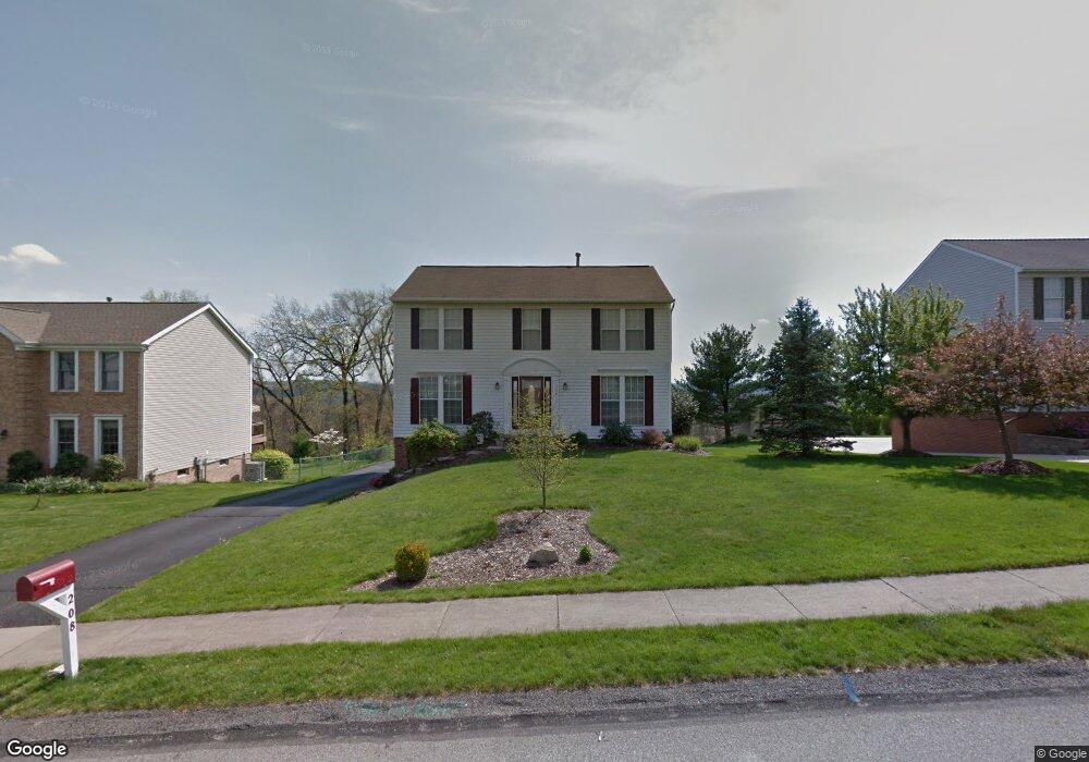
208 Bluestone Dr Bethel Park, PA 15102
Estimated Value: $401,680 - $435,000
4
Beds
3
Baths
1,886
Sq Ft
$225/Sq Ft
Est. Value
About This Home
This home is located at 208 Bluestone Dr, Bethel Park, PA 15102 and is currently estimated at $423,920, approximately $224 per square foot. 208 Bluestone Dr is a home located in Washington County with nearby schools including McMurray Elementary School, Bower Hill Elementary School, and Peters Township Middle School.
Ownership History
Date
Name
Owned For
Owner Type
Purchase Details
Closed on
Sep 14, 2001
Sold by
Rupinsky David and Rupinsky Linda S
Bought by
Rupinsky David L and Rupinsky Linda S
Current Estimated Value
Purchase Details
Closed on
Jun 14, 2001
Sold by
Ward Troy G and Ward Sheila M
Bought by
Rupinsky David and Rupinsky Linda
Purchase Details
Closed on
Oct 2, 1997
Sold by
Dginto Domenic L and Dginto Jill A
Bought by
Ward Troy G and Ward Sheila M
Purchase Details
Closed on
Dec 13, 1996
Sold by
Quach Lang
Bought by
Dginto Domenic L and Dginto Jill A
Create a Home Valuation Report for This Property
The Home Valuation Report is an in-depth analysis detailing your home's value as well as a comparison with similar homes in the area
Home Values in the Area
Average Home Value in this Area
Purchase History
| Date | Buyer | Sale Price | Title Company |
|---|---|---|---|
| Rupinsky David L | -- | -- | |
| Rupinsky David | $169,000 | -- | |
| Ward Troy G | $151,000 | -- | |
| Dginto Domenic L | $148,000 | -- |
Source: Public Records
Tax History Compared to Growth
Tax History
| Year | Tax Paid | Tax Assessment Tax Assessment Total Assessment is a certain percentage of the fair market value that is determined by local assessors to be the total taxable value of land and additions on the property. | Land | Improvement |
|---|---|---|---|---|
| 2025 | $5,723 | $174,400 | $55,100 | $119,300 |
| 2024 | $5,723 | $174,400 | $55,100 | $119,300 |
| 2023 | $5,396 | $174,400 | $55,100 | $119,300 |
| 2022 | $5,238 | $174,400 | $55,100 | $119,300 |
| 2021 | $825 | $174,400 | $55,100 | $119,300 |
| 2020 | $4,972 | $174,400 | $55,100 | $119,300 |
| 2019 | $5,299 | $174,400 | $55,100 | $119,300 |
| 2018 | $825 | $174,400 | $55,100 | $119,300 |
| 2017 | $5,256 | $174,400 | $55,100 | $119,300 |
| 2016 | $825 | $174,400 | $55,100 | $119,300 |
| 2015 | $825 | $174,400 | $55,100 | $119,300 |
| 2014 | $5,141 | $174,400 | $55,100 | $119,300 |
Source: Public Records
Map
Nearby Homes
- 416 Magnolia Dr
- 418 Magnolia Dr
- 412 Magnolia Dr
- 414 Magnolia Dr
- The Brownstone Plan at Brookwood Brownstones
- 423 Magnolia Dr
- 425 Magnolia Dr
- 202 Kousa Ln
- 185 Stonewood Dr
- 740 Mcmurray Rd
- 129 Judith Dr
- 143 Fair Acres Dr
- 768 Greenhaven Dr
- 421 Hays Rd
- 110 Springbrooke Dr
- 284 Brookwood Rd
- 492 Lorlita Ln
- 111 (Lot 125) Fair Acres Dr
- 115 (Lot 124) Fair Acres Dr
- 120 (Lot 106) Fair Acres Dr
- 202 Bluestone Dr
- 214 Bluestone Dr
- 220 Bluestone Dr
- 196 Bluestone Dr
- 346 Rocky Ridge Rd
- 226 Bluestone Dr
- 348 Rocky Ridge Rd
- 209 Bluestone Dr
- 197 Bluestone Dr
- 203 Bluestone Dr
- 190 Bluestone Dr
- 215 Bluestone Dr
- 221 Bluestone Dr
- 191 Bluestone Dr
- 227 Bluestone Dr
- 184 Bluestone Dr
- 343 Rocky Ridge Rd
- 345 Rocky Ridge Rd
- 350 Rocky Ridge Rd
- 185 Bluestone Dr