Estimated Value: $480,000 - $678,000
Studio
2
Baths
2,448
Sq Ft
$225/Sq Ft
Est. Value
About This Home
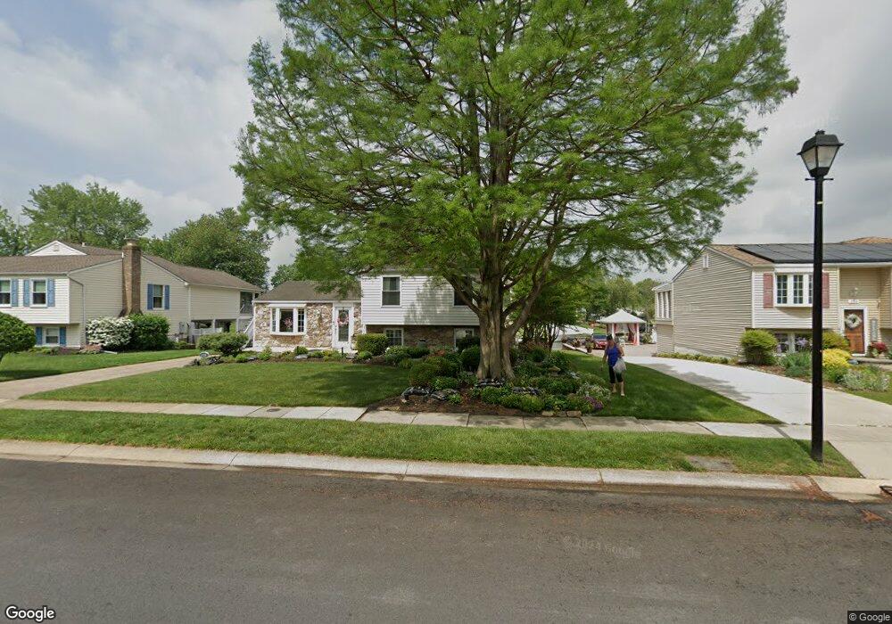
This home is located at 208 Bridge Dr, Joppa, MD 21085 and is currently estimated at $551,291, approximately $225 per square foot. 208 Bridge Dr is a home located in Harford County with nearby schools including Joppatowne Elementary School, Magnolia Middle School, and Joppatowne High School.
Ownership History
Date
Name
Owned For
Owner Type
Purchase Details
Closed on
Jul 19, 2022
Sold by
Berkey Bruce G
Bought by
Wachter Kimberly Ann and Berkey Dale John
Current Estimated Value
Purchase Details
Closed on
Jul 21, 2005
Sold by
Wills Charles A
Bought by
Berkey Bruce G and Berkey Marie D
Home Financials for this Owner
Home Financials are based on the most recent Mortgage that was taken out on this home.
Original Mortgage
$349,000
Interest Rate
5.25%
Mortgage Type
Adjustable Rate Mortgage/ARM
Purchase Details
Closed on
Jun 1, 1999
Sold by
Jacobs Donald N
Bought by
Wills Charles A and Wills Jeannine B
Purchase Details
Closed on
Sep 9, 1988
Sold by
Letke David J and Letke Wf
Bought by
Jacobs Donald N
Home Financials for this Owner
Home Financials are based on the most recent Mortgage that was taken out on this home.
Original Mortgage
$153,750
Interest Rate
10.53%
Create a Home Valuation Report for This Property
The Home Valuation Report is an in-depth analysis detailing your home's value as well as a comparison with similar homes in the area
Home Values in the Area
Average Home Value in this Area
Purchase History
| Date | Buyer | Sale Price | Title Company |
|---|---|---|---|
| Wachter Kimberly Ann | -- | Advantage Title Company | |
| Wachter Kimberly Ann | -- | Advantage Title Company | |
| Berkey Bruce G | $499,000 | -- | |
| Wills Charles A | $239,000 | -- | |
| Jacobs Donald N | $210,000 | -- |
Source: Public Records
Mortgage History
| Date | Status | Borrower | Loan Amount |
|---|---|---|---|
| Previous Owner | Berkey Bruce G | $349,000 | |
| Previous Owner | Jacobs Donald N | $153,750 | |
| Closed | Wills Charles A | -- |
Source: Public Records
Tax History
| Year | Tax Paid | Tax Assessment Tax Assessment Total Assessment is a certain percentage of the fair market value that is determined by local assessors to be the total taxable value of land and additions on the property. | Land | Improvement |
|---|---|---|---|---|
| 2025 | $4,103 | $391,000 | $0 | $0 |
| 2024 | $4,103 | $376,500 | $159,500 | $217,000 |
| 2023 | $4,065 | $372,967 | $0 | $0 |
| 2022 | $4,026 | $369,433 | $0 | $0 |
| 2021 | $8,053 | $365,900 | $159,500 | $206,400 |
| 2020 | $4,222 | $365,900 | $159,500 | $206,400 |
| 2019 | $4,222 | $365,900 | $159,500 | $206,400 |
| 2018 | $4,473 | $387,600 | $192,500 | $195,100 |
| 2017 | $4,110 | $387,600 | $0 | $0 |
| 2016 | -- | $359,400 | $0 | $0 |
| 2015 | $5,016 | $345,300 | $0 | $0 |
| 2014 | $5,016 | $345,300 | $0 | $0 |
Source: Public Records
Map
Nearby Homes
- 737 Shore Dr
- 722 Shore Dr
- 130 Ravenswood Ct
- 800 Ferguson Rd
- 521 Anchor Dr
- 207 Duryea Dr
- 3 Old Sound Rd
- 4 Old Sound Rd
- 546 Riviera Dr Unit B
- 415 Shore Dr
- 819 Chatfield Rd
- 304 Barksdale Rd
- 612 Baldwin Dr
- 415 Trimble Rd
- Hamilton Plan at Harford County Homes
- Pearl Plan at Harford County Homes
- Raleigh Plan at Harford County Homes
- Sussex Plan at Harford County Homes
- Bradford Plan at Harford County Homes
- Hanover Plan at Harford County Homes
Your Personal Tour Guide
Ask me questions while you tour the home.