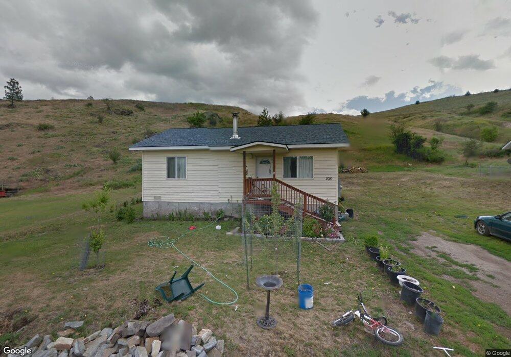
208 Carr Ln Plains, MT 59859
Estimated Value: $274,000 - $412,000
2
Beds
1
Bath
816
Sq Ft
$398/Sq Ft
Est. Value
About This Home
This home is located at 208 Carr Ln, Plains, MT 59859 and is currently estimated at $324,911, approximately $398 per square foot. 208 Carr Ln is a home located in Sanders County with nearby schools including Plains High School.
Ownership History
Date
Name
Owned For
Owner Type
Purchase Details
Closed on
Feb 16, 2011
Sold by
Dossett John F
Bought by
Reyes Octavio Reyes Y and Reyes Lisa Fried De
Current Estimated Value
Home Financials for this Owner
Home Financials are based on the most recent Mortgage that was taken out on this home.
Original Mortgage
$56,000
Outstanding Balance
$2,151
Interest Rate
4.74%
Mortgage Type
New Conventional
Estimated Equity
$322,760
Purchase Details
Closed on
Aug 17, 2006
Sold by
Tvaruzek Norlene A
Bought by
Dossett John F
Home Financials for this Owner
Home Financials are based on the most recent Mortgage that was taken out on this home.
Original Mortgage
$82,000
Interest Rate
7%
Mortgage Type
Assumption
Create a Home Valuation Report for This Property
The Home Valuation Report is an in-depth analysis detailing your home's value as well as a comparison with similar homes in the area
Purchase History
| Date | Buyer | Sale Price | Title Company |
|---|---|---|---|
| Reyes Octavio Reyes Y | -- | None Available | |
| Dossett John F | -- | None Available |
Source: Public Records
Mortgage History
| Date | Status | Borrower | Loan Amount |
|---|---|---|---|
| Open | Reyes Octavio Reyes Y | $56,000 | |
| Previous Owner | Dossett John F | $82,000 |
Source: Public Records
Tax History
| Year | Tax Paid | Tax Assessment Tax Assessment Total Assessment is a certain percentage of the fair market value that is determined by local assessors to be the total taxable value of land and additions on the property. | Land | Improvement |
|---|---|---|---|---|
| 2025 | $1,438 | $318,900 | $0 | $0 |
| 2024 | $1,520 | $225,200 | $0 | $0 |
| 2023 | $2,019 | $225,200 | $0 | $0 |
| 2022 | $1,562 | $130,700 | $0 | $0 |
| 2021 | $1,304 | $130,700 | $0 | $0 |
| 2020 | $1,606 | $143,400 | $0 | $0 |
| 2019 | $1,575 | $143,400 | $0 | $0 |
| 2018 | $1,489 | $134,900 | $0 | $0 |
| 2017 | $1,424 | $134,900 | $0 | $0 |
| 2016 | $1,067 | $100,300 | $0 | $0 |
| 2015 | $822 | $100,300 | $0 | $0 |
| 2014 | $806 | $55,332 | $0 | $0 |
Source: Public Records
Map
Nearby Homes
- lot 5 Yosyrian Ln
- 104 Graceland Dr
- 306 N Central Ave
- Plat K3 Montana 200
- Lot 1 Montana 200
- 7927 Montana 200
- Lot 2 Montana 200
- NHN High Country Rd
- Nhn Dragonfly Ln
- 108 E Meany St
- Lot 2 Railroad Ave
- 303 Rittenour St
- 103 W Oak St
- Lot 3 Stonebrook Ln
- Lot 2 Stonebrook Ln
- Lot 4 Stonebrook Ln
- Nhn Third St
- 805 S 5th Ave
- 906 S 4th Ave
- 132 Hillview Rd
- 204 Carr Ln
- 305 Carr Ln
- Nhn Lot 13 - Woodside Ln
- 501 Cook St
- 606 Carr Ln
- C-3 Carr Ln
- Lot C-2 Carr Ln
- 306,308 Carr Ln
- Nhn McNeil Lane 20 Acre Parcel
- 108 Blake St
- 108 Blake St Unit Corner Of Cook And B
- 410 Central Ave
- 108 Graceland Dr
- 409 Central Ave
- 109 Blake St
- 405 Cook St
- 406 Central Ave
- 102 E Blake St
- 107 Blake St
- NHN Cook St
Your Personal Tour Guide
Ask me questions while you tour the home.