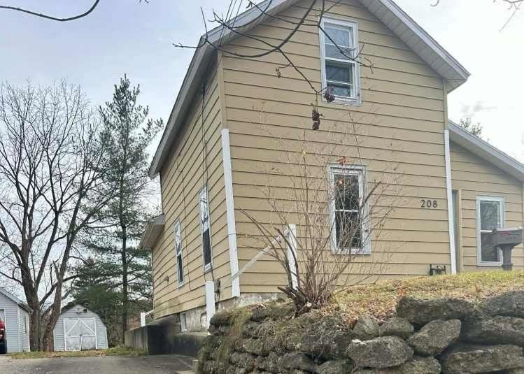


208 Central St Battle Creek, MI 49017
Northeast Battle Creek Neighborhood
2
Beds
1
Bath
765
Sq Ft
9,540
Sq Ft Lot
About This Home
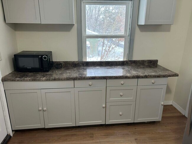
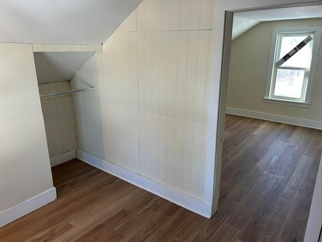
Beautiful updated 2-bedroom 1 bath home in a prime location. This impressive updated home in one of Battle Creek's most desirable neighborhoods. Large yard with off-street parking. The upstairs bedroom offers an additional room that can be used a connected office or sitting area. New flooring throughout the home and new appliances along with central air. Located next to Bronson Hospital and Kellogg Community College. The tenant pays for all utilities and will care for lawn maintenance and snow removal. Rent is $1,075 a month with a $1,075 deposit.
Listing Provided By

Map
Property History
| Date | Event | Price | List to Sale | Price per Sq Ft | Prior Sale |
|---|---|---|---|---|---|
| 12/11/2025 12/11/25 | For Rent | $1,075 | 0.0% | -- | |
| 09/11/2025 09/11/25 | Sold | $36,900 | 0.0% | $48 / Sq Ft | View Prior Sale |
| 08/19/2025 08/19/25 | Pending | -- | -- | -- | |
| 08/16/2025 08/16/25 | For Sale | $36,900 | -- | $48 / Sq Ft |
Nearby Homes
- 236 Central St
- 274 Central St
- 78 Central St
- 261 Emmett St E
- 72 Latta St
- 323 Garfield Ave
- 266 North Ave
- 160 Harvard St
- 157 Orchard Ave
- 276 Mckinley Ave N
- 162 Orchard Ave
- 19 Central St
- 143 Orchard Ave
- 14 Elizabeth St
- 176 Union St N
- 87 Sherman Rd
- 91 Sherman Rd
- 94 Chestnut St
- 135 Seedorff St
- V/L Seedorf St Unit 22
- 511 North Ave
- 115 West St
- 572 Limewood Dr
- 695 Capital Ave NE Unit 32
- 695 Capital Ave NE Unit 24
- 25 W Michigan Ave
- 795 Wagner Dr
- 120 Riverside Dr
- 685 Michigan Ave E Unit 208
- 685 Michigan Ave E Unit 209
- 744 E Michigan Ave Unit 6
- 744 E Michigan Ave Unit 10
- 750 Michigan Ave E Unit 4
- 750 Michigan Ave E Unit 5
- 1975 Columbia Ave E
- 180 Carl Ave
- 226 Taft Ct
- 1317 Michigan Ave W Unit 9
- 1317 Michigan Ave W Unit 1
- 1103 Michigan Ave E