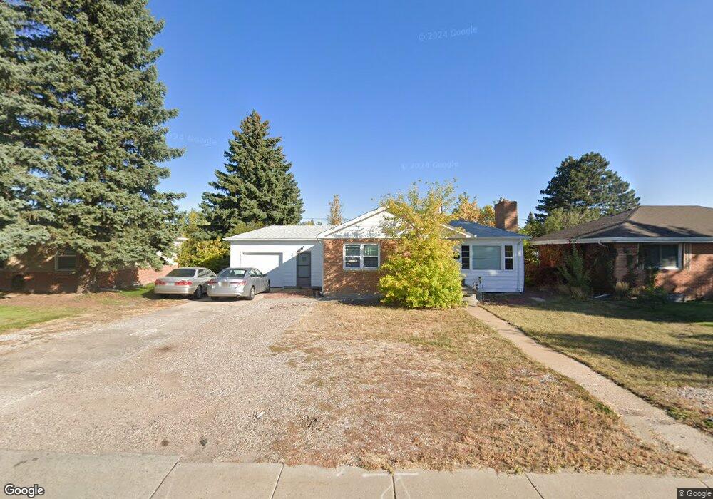
208 Dell Range Blvd Cheyenne, WY 82009
Estimated Value: $305,000 - $351,000
--
Bed
--
Bath
1,058
Sq Ft
$310/Sq Ft
Est. Value
About This Home
This home is located at 208 Dell Range Blvd, Cheyenne, WY 82009 and is currently estimated at $327,946, approximately $309 per square foot. 208 Dell Range Blvd is a home located in Laramie County with nearby schools including Hobbs Elementary School, McCormick Junior High School, and Central High School.
Ownership History
Date
Name
Owned For
Owner Type
Purchase Details
Closed on
Apr 18, 2003
Sold by
Crader James W and Crader Josephine M
Bought by
Caltagirone Michael P and Caltagirone Christine M
Current Estimated Value
Purchase Details
Closed on
Mar 28, 2001
Sold by
Hud
Bought by
Caltagirone Michael P and Caltagirone Christine M
Purchase Details
Closed on
Nov 13, 2000
Sold by
Wyoming Community Development Authority
Bought by
Hud
Purchase Details
Closed on
Oct 30, 2000
Sold by
Ringwald Patricia C
Bought by
Wyoming Community Development Authority
Create a Home Valuation Report for This Property
The Home Valuation Report is an in-depth analysis detailing your home's value as well as a comparison with similar homes in the area
Home Values in the Area
Average Home Value in this Area
Purchase History
| Date | Buyer | Sale Price | Title Company |
|---|---|---|---|
| Caltagirone Michael P | -- | -- | |
| Caltagirone Michael P | -- | -- | |
| Hud | -- | -- | |
| Wyoming Community Development Authority | $83,687 | -- |
Source: Public Records
Tax History Compared to Growth
Tax History
| Year | Tax Paid | Tax Assessment Tax Assessment Total Assessment is a certain percentage of the fair market value that is determined by local assessors to be the total taxable value of land and additions on the property. | Land | Improvement |
|---|---|---|---|---|
| 2025 | $1,679 | $18,398 | $3,227 | $15,171 |
| 2024 | $1,679 | $23,747 | $4,303 | $19,444 |
| 2023 | $1,626 | $23,000 | $4,303 | $18,697 |
| 2022 | $1,587 | $21,991 | $4,303 | $17,688 |
| 2021 | $1,396 | $19,304 | $4,303 | $15,001 |
| 2020 | $1,356 | $18,798 | $4,303 | $14,495 |
| 2019 | $1,245 | $17,242 | $4,303 | $12,939 |
| 2018 | $1,131 | $15,819 | $3,853 | $11,966 |
| 2017 | $1,130 | $15,652 | $3,853 | $11,799 |
| 2016 | $1,022 | $14,153 | $3,594 | $10,559 |
| 2015 | $983 | $13,609 | $3,594 | $10,015 |
| 2014 | $1,044 | $14,369 | $3,594 | $10,775 |
Source: Public Records
Map
Nearby Homes
- 5211 Fawn Pass
- 5211 Fishing Bridge
- 249 Shoshoni St
- 5404 Sunset Dr
- 5413 Frederick Dr
- 5620 Sunset Dr
- 706 Mylar Park Dr
- 245 Lakeshore Dr
- 722 Mylar Park Dr
- 247 Miller Ln
- 5711 Townsend Place
- 707 Arapaho St
- 234 Miller Ln Unit A
- 148 Kornegay Ct Unit 2
- TBD E Carlson St
- 485 Andra Ct
- 5120 Syracuse Rd
- 5907 Townsend Place
- 1462 Trent Ct
- Lot 8 Hynds Blvd
- 214 Dell Range Blvd
- 200 Dell Range Blvd
- 220 Dell Range Blvd
- 207 Carroll Ave
- 213 Carroll Ave
- 203 Carroll Ave
- 5000 Sunset Dr
- 226 Dell Range Blvd
- 219 Carroll Ave
- 149 Carroll Ave
- 146 Dell Range Blvd
- 227 Carroll Ave
- 232 Dell Range Blvd
- 145 Carroll Ave
- 138 Dell Range Blvd
- 231 Carroll Ave
- 208 Carroll Ave
- 200 Carroll Ave
- 214 Carroll Ave
- 137 Carroll Ave