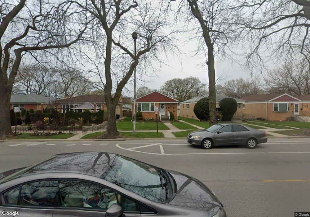
208 Dodge Ave Evanston, IL 60202
Southwest Evanston NeighborhoodEstimated Value: $367,000 - $442,000
3
Beds
1
Bath
1,148
Sq Ft
$351/Sq Ft
Est. Value
About This Home
This home is located at 208 Dodge Ave, Evanston, IL 60202 and is currently estimated at $403,430, approximately $351 per square foot. 208 Dodge Ave is a home located in Cook County with nearby schools including Dawes Elementary School, Chute Middle School, and Evanston Township High School.
Ownership History
Date
Name
Owned For
Owner Type
Purchase Details
Closed on
Jun 26, 2003
Sold by
Senecal Patrick P
Bought by
Senecal Patrick P and Senecal Maria I
Current Estimated Value
Home Financials for this Owner
Home Financials are based on the most recent Mortgage that was taken out on this home.
Original Mortgage
$105,500
Interest Rate
5.62%
Mortgage Type
Unknown
Create a Home Valuation Report for This Property
The Home Valuation Report is an in-depth analysis detailing your home's value as well as a comparison with similar homes in the area
Home Values in the Area
Average Home Value in this Area
Purchase History
| Date | Buyer | Sale Price | Title Company |
|---|---|---|---|
| Senecal Patrick P | -- | Lawyers Title Insurance Corp |
Source: Public Records
Mortgage History
| Date | Status | Borrower | Loan Amount |
|---|---|---|---|
| Closed | Senecal Patrick P | $105,500 |
Source: Public Records
Tax History Compared to Growth
Tax History
| Year | Tax Paid | Tax Assessment Tax Assessment Total Assessment is a certain percentage of the fair market value that is determined by local assessors to be the total taxable value of land and additions on the property. | Land | Improvement |
|---|---|---|---|---|
| 2024 | $6,791 | $31,000 | $6,720 | $24,280 |
| 2023 | $6,490 | $31,000 | $6,720 | $24,280 |
| 2022 | $6,490 | $31,000 | $6,720 | $24,280 |
| 2021 | $5,097 | $22,283 | $3,570 | $18,713 |
| 2020 | $5,088 | $22,283 | $3,570 | $18,713 |
| 2019 | $5,491 | $26,561 | $3,570 | $22,991 |
| 2018 | $5,121 | $21,882 | $2,940 | $18,942 |
| 2017 | $5,003 | $21,882 | $2,940 | $18,942 |
| 2016 | $5,531 | $24,075 | $2,940 | $21,135 |
| 2015 | $4,244 | $18,230 | $2,520 | $15,710 |
| 2014 | $4,218 | $18,230 | $2,520 | $15,710 |
| 2013 | $4,105 | $18,230 | $2,520 | $15,710 |
Source: Public Records
Map
Nearby Homes
- 215 Brown Ave
- 2011 Brummel St
- 235 Richmond St
- 220 Richmond St
- 309 Darrow Ave
- 1615 W Howard St Unit 303
- 7433 N Washtenaw Ave
- 401 Dewey Ave
- 3024 W Fargo Ave
- 347 Florence Ave
- 1406 Brummel St
- 419 Florence Ave
- 2522 W Jarvis Ave
- 1810 South Blvd
- 1927 Warren St
- 604 Dodge Ave
- 2650 W Touhy Ave
- 1217 Hull Terrace Unit 3A
- 7249 N Campbell Ave Unit B
- 7546 N Oakley Ave
- 212 Dodge Ave
- 204 Dodge Ave
- 214 Dodge Ave
- 200 Dodge Ave
- 216 Dodge Ave
- 10185 Dodge Ave
- 10085 Dodge Ave
- 209 Brown Ave
- 207 Brown Ave
- 211 Brown Ave
- 201 Brown Ave
- 220 Dodge Ave Unit E
- 230 Dodge Ave Unit A
- 230 Dodge Ave
- 220 Dodge Ave
- 217 Brown Ave
- 231 Brown Ave
- 231 Brown Ave
- 231 Brown Ave
- 231 Brown Ave Unit B