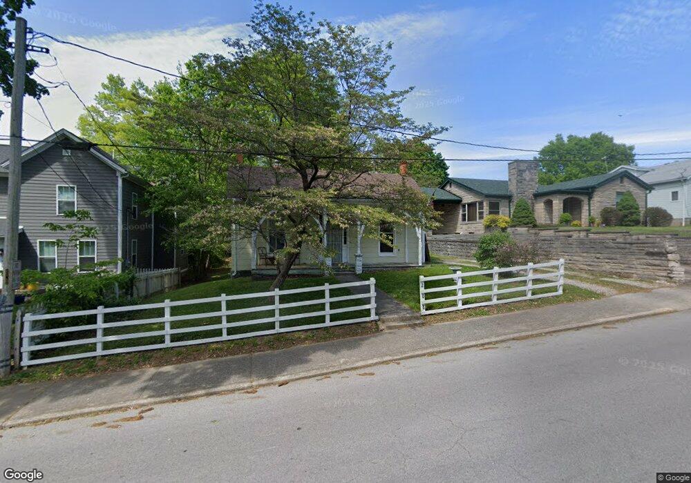
208 E High St Corydon, IN 47112
Estimated Value: $171,000 - $221,000
2
Beds
2
Baths
1,336
Sq Ft
$141/Sq Ft
Est. Value
About This Home
This home is located at 208 E High St, Corydon, IN 47112 and is currently estimated at $188,353, approximately $140 per square foot. 208 E High St is a home located in Harrison County with nearby schools including Corydon Elementary School, Corydon Intermediate School, and Corydon Central Junior High School.
Ownership History
Date
Name
Owned For
Owner Type
Purchase Details
Closed on
Dec 8, 2011
Sold by
Michael G Allen
Bought by
Donna M Hograve
Current Estimated Value
Purchase Details
Closed on
Aug 6, 2010
Sold by
Federal Association
Bought by
Michael G Allen
Purchase Details
Closed on
Apr 21, 2010
Sold by
Sheriff Mike Deatrick
Bought by
Federal Association
Create a Home Valuation Report for This Property
The Home Valuation Report is an in-depth analysis detailing your home's value as well as a comparison with similar homes in the area
Home Values in the Area
Average Home Value in this Area
Purchase History
| Date | Buyer | Sale Price | Title Company |
|---|---|---|---|
| Donna M Hograve | $72,000 | Davis, Davis & Layson | |
| Michael G Allen | $25,000 | Statewide Title Company Inc | |
| Federal Association | $39,400 | Feiwell & Hannoy |
Source: Public Records
Tax History
| Year | Tax Paid | Tax Assessment Tax Assessment Total Assessment is a certain percentage of the fair market value that is determined by local assessors to be the total taxable value of land and additions on the property. | Land | Improvement |
|---|---|---|---|---|
| 2025 | $830 | $132,200 | $25,700 | $106,500 |
| 2024 | $830 | $126,100 | $25,700 | $100,400 |
| 2023 | $872 | $130,200 | $26,300 | $103,900 |
| 2022 | $887 | $121,000 | $23,300 | $97,700 |
| 2021 | $684 | $99,900 | $11,700 | $88,200 |
| 2020 | $714 | $101,500 | $11,700 | $89,800 |
| 2019 | $322 | $61,500 | $11,700 | $49,800 |
| 2018 | $306 | $58,800 | $11,700 | $47,100 |
| 2017 | $300 | $58,500 | $11,700 | $46,800 |
| 2016 | $269 | $58,000 | $11,700 | $46,300 |
| 2014 | $256 | $58,200 | $11,700 | $46,500 |
| 2013 | $256 | $56,700 | $11,700 | $45,000 |
Source: Public Records
Map
Nearby Homes
- 600 Farquar Ave
- 524 N Capitol Ave
- 622 N Capitol Ave
- 717 N Capitol Ave
- 334 Summit St
- 300 N Maple St
- 807 Woodland Ave
- 517 E Walnut St
- 427 E Chestnut St
- 965 Woodland Ave
- 511 E Chestnut St
- 0 Atwood St Unit 2025012067
- 87 Big Indian Rd NE
- 104 Cook St
- 1335 Grace St NE
- 865 Capitol Blvd
- 0 N Highway 337 NE
- 23 Indiana 337
- 12 Hollye Dr SE
- 1557 Cypress Cove NW
- 200 E High St
- 214 E High St
- 514 Farquar Ave
- 501 N Mulberry St
- 522 Farquar Ave
- 521 N Mulberry St
- 120 E High St
- 531 N Mulberry St
- 601 N Mulberry St
- 500 N Capitol Ave
- 508 N Capitol Ave
- 417 N Mulberry St
- 514 N Capitol Ave
- 426 N Capitol Ave
- 605 N Mulberry St
- 610 Farquar Ave
- 604 N Capitol Ave
- 611 N Mulberry St
- 600 N Mulberry St
- 116 E Walnut St
Your Personal Tour Guide
Ask me questions while you tour the home.