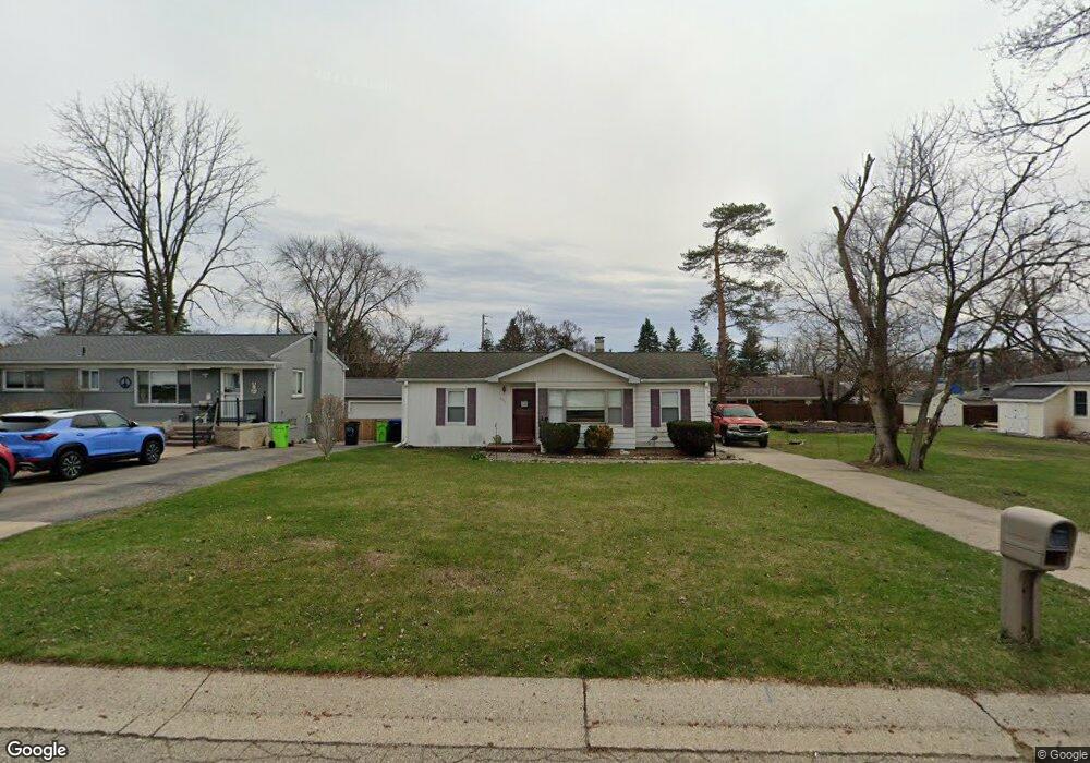
208 Elm Place South Lyon, MI 48178
Estimated Value: $232,693 - $270,000
2
Beds
1
Bath
1,135
Sq Ft
$219/Sq Ft
Est. Value
About This Home
This home is located at 208 Elm Place, South Lyon, MI 48178 and is currently estimated at $248,423, approximately $218 per square foot. 208 Elm Place is a home located in Oakland County with nearby schools including Frank E. Bartlett School, Centennial Middle School, and South Lyon High School.
Ownership History
Date
Name
Owned For
Owner Type
Purchase Details
Closed on
Apr 10, 2019
Sold by
Frese Pamela A and Chope Pamela Ann
Bought by
Chope Pamela Ann
Current Estimated Value
Purchase Details
Closed on
Apr 29, 2003
Sold by
Dobbie Mack A and Dobbie Angela L
Bought by
Frese Pamela A
Purchase Details
Closed on
Jan 30, 2001
Sold by
Werner Thomas S
Bought by
Dobbie Mack A
Home Financials for this Owner
Home Financials are based on the most recent Mortgage that was taken out on this home.
Original Mortgage
$131,000
Interest Rate
7.06%
Create a Home Valuation Report for This Property
The Home Valuation Report is an in-depth analysis detailing your home's value as well as a comparison with similar homes in the area
Home Values in the Area
Average Home Value in this Area
Purchase History
| Date | Buyer | Sale Price | Title Company |
|---|---|---|---|
| Chope Pamela Ann | -- | Progressive Title | |
| Frese Pamela A | $154,500 | Landmark Title Services | |
| Dobbie Mack A | $138,000 | -- |
Source: Public Records
Mortgage History
| Date | Status | Borrower | Loan Amount |
|---|---|---|---|
| Previous Owner | Dobbie Mack A | $131,000 |
Source: Public Records
Tax History Compared to Growth
Tax History
| Year | Tax Paid | Tax Assessment Tax Assessment Total Assessment is a certain percentage of the fair market value that is determined by local assessors to be the total taxable value of land and additions on the property. | Land | Improvement |
|---|---|---|---|---|
| 2024 | $2,014 | $86,040 | $0 | $0 |
| 2023 | $1,890 | $80,750 | $0 | $0 |
| 2022 | $1,830 | $72,920 | $0 | $0 |
| 2021 | $1,741 | $75,230 | $0 | $0 |
| 2020 | $1,684 | $75,910 | $0 | $0 |
| 2019 | $1,723 | $74,120 | $0 | $0 |
| 2018 | $1,678 | $67,430 | $0 | $0 |
| 2017 | $1,686 | $64,850 | $0 | $0 |
| 2016 | $1,672 | $59,300 | $0 | $0 |
| 2015 | -- | $49,570 | $0 | $0 |
| 2014 | -- | $41,130 | $0 | $0 |
| 2011 | -- | $45,770 | $0 | $0 |
Source: Public Records
Map
Nearby Homes
- 225 E Liberty St
- 415 W Lake St
- 436 N Reese St
- 27487 Pontiac Trail
- 501 N Reese St Unit 1
- 351 Hampton Ct Unit 8
- 204 Maplewood Ct Unit 4
- 229 Brookwood Dr Unit 16
- 577 W Lake St
- 186 Wellington Dr
- 429 Cambridge Ave
- 285 Ash Ct Unit 14
- 110 Princeton Dr
- 61049 Heritage Blvd Unit 8
- 61021 Heritage Blvd Unit 4
- 162 Princeton Dr
- 108 Princeton Dr Unit 4
- 61119 Heritage Blvd Unit 3
- 59550 10 Mile Rd
- 667 Allegheny Dr