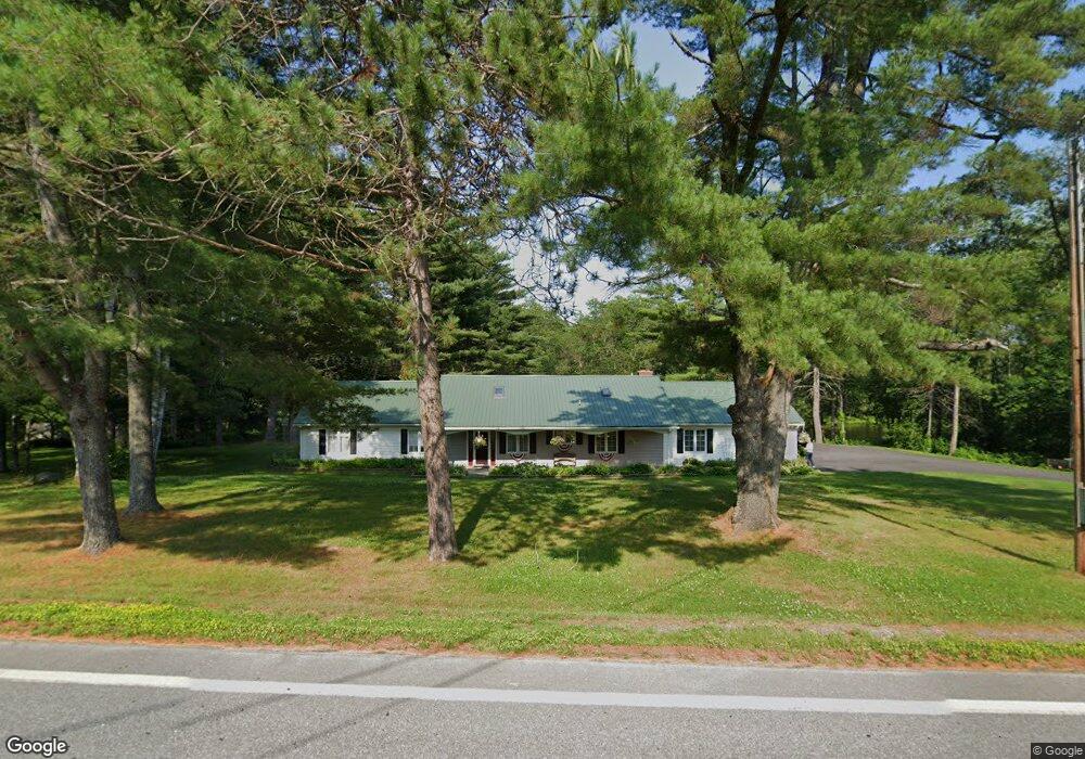
208 Finson Rd Bangor, ME 04401
Capehart NeighborhoodEstimated Value: $338,000 - $560,000
4
Beds
3
Baths
2,288
Sq Ft
$212/Sq Ft
Est. Value
About This Home
This home is located at 208 Finson Rd, Bangor, ME 04401 and is currently estimated at $485,985, approximately $212 per square foot. 208 Finson Rd is a home located in Penobscot County with nearby schools including Downeast School, Fairmount School, and James F. Doughty School.
Ownership History
Date
Name
Owned For
Owner Type
Purchase Details
Closed on
May 16, 2006
Sold by
Stewart Wendy A and King Susan M
Bought by
Shumaker Beverly and Daniels Stephen G
Current Estimated Value
Home Financials for this Owner
Home Financials are based on the most recent Mortgage that was taken out on this home.
Original Mortgage
$185,000
Outstanding Balance
$107,144
Interest Rate
6.4%
Mortgage Type
Purchase Money Mortgage
Estimated Equity
$378,841
Create a Home Valuation Report for This Property
The Home Valuation Report is an in-depth analysis detailing your home's value as well as a comparison with similar homes in the area
Home Values in the Area
Average Home Value in this Area
Purchase History
| Date | Buyer | Sale Price | Title Company |
|---|---|---|---|
| Shumaker Beverly | -- | -- |
Source: Public Records
Mortgage History
| Date | Status | Borrower | Loan Amount |
|---|---|---|---|
| Open | Shumaker Beverly | $185,000 |
Source: Public Records
Tax History Compared to Growth
Tax History
| Year | Tax Paid | Tax Assessment Tax Assessment Total Assessment is a certain percentage of the fair market value that is determined by local assessors to be the total taxable value of land and additions on the property. | Land | Improvement |
|---|---|---|---|---|
| 2024 | $7,220 | $389,200 | $40,800 | $348,400 |
| 2023 | $6,431 | $335,800 | $38,500 | $297,300 |
| 2022 | $5,989 | $293,600 | $38,500 | $255,100 |
| 2021 | $5,802 | $260,200 | $35,600 | $224,600 |
| 2020 | $5,603 | $241,500 | $33,900 | $207,600 |
| 2019 | $5,380 | $233,900 | $33,900 | $200,000 |
| 2018 | $4,634 | $221,900 | $35,400 | $186,500 |
| 2017 | $4,401 | $217,600 | $35,400 | $182,200 |
| 2016 | $4,685 | $208,200 | $35,400 | $172,800 |
| 2015 | $4,645 | $211,600 | $35,400 | $176,200 |
| 2014 | $4,713 | $216,200 | $35,400 | $180,800 |
| 2013 | $4,499 | $216,300 | $35,400 | $180,900 |
Source: Public Records
Map
Nearby Homes
- 153 Finson Rd
- 2317&2327 Broadway
- 2101 Ohio St
- 2541 Union (00 Union) St
- 20 Hunter Dr
- 1765 Ohio St
- 1677 Ohio Res St
- 70 Shepherd Dr
- 10 Pushaw Rd
- 1677 Ohio St
- 80 (#7) Hornbeam Way
- 175 (#12) Hornbeam Way
- 165 (#10) Hornbeam Way
- 30 (#3) Hornbeam Way
- 25 (#4) Hornbeam Way
- 15 (#2) Hornbeam Way
- 1 (#1) Hornbeam Way
- 200 Davis Rd
- 30 Moonbeam Way
- 45 (#16) Moonbeam Way
- 178 Finson Rd
- 179 Finson Rd
- 173 Finson Rd
- 229 Finson Rd
- 207 Finson Rd
- 12 Wildwood Dr
- 14 Wildwood Dr
- 235 Finson Rd
- 160 Finson Rd
- 252 Finson Rd
- 10 Cole Circle Dr
- 251 Finson Rd
- 260 Finson Rd
- 256 Cedar Fall Mobile Home Finson Rd
- 136 Finson Rd
- 272 Finson Rd
- 282 Finson Rd
- 129 Finson Rd
- 124 Finson Rd
- 292 Finson Rd