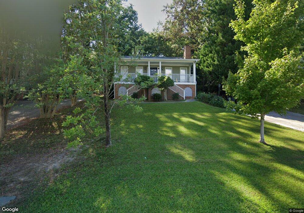
208 Kemsing Rd Columbia, SC 29212
Northwest Columbia NeighborhoodEstimated Value: $209,000 - $231,000
3
Beds
2
Baths
1,319
Sq Ft
$165/Sq Ft
Est. Value
About This Home
This home is located at 208 Kemsing Rd, Columbia, SC 29212 and is currently estimated at $217,702, approximately $165 per square foot. 208 Kemsing Rd is a home located in Lexington County with nearby schools including Irmo Elementary School, Irmo Middle, and Irmo High.
Ownership History
Date
Name
Owned For
Owner Type
Purchase Details
Closed on
May 22, 2020
Sold by
Horizon Property Management Corp
Bought by
Mcginnis Sharon V
Current Estimated Value
Home Financials for this Owner
Home Financials are based on the most recent Mortgage that was taken out on this home.
Original Mortgage
$147,283
Outstanding Balance
$130,513
Interest Rate
3.3%
Mortgage Type
FHA
Estimated Equity
$87,189
Purchase Details
Closed on
Dec 12, 2019
Sold by
Savitz Russel L
Bought by
Horizon Property Management Corp
Create a Home Valuation Report for This Property
The Home Valuation Report is an in-depth analysis detailing your home's value as well as a comparison with similar homes in the area
Home Values in the Area
Average Home Value in this Area
Purchase History
| Date | Buyer | Sale Price | Title Company |
|---|---|---|---|
| Mcginnis Sharon V | $150,000 | None Available | |
| Horizon Property Management Corp | $45,400 | None Available |
Source: Public Records
Mortgage History
| Date | Status | Borrower | Loan Amount |
|---|---|---|---|
| Open | Mcginnis Sharon V | $147,283 |
Source: Public Records
Tax History
| Year | Tax Paid | Tax Assessment Tax Assessment Total Assessment is a certain percentage of the fair market value that is determined by local assessors to be the total taxable value of land and additions on the property. | Land | Improvement |
|---|---|---|---|---|
| 2024 | $619 | $6,000 | $1,000 | $5,000 |
| 2023 | $526 | $6,000 | $1,000 | $5,000 |
| 2022 | $545 | $6,000 | $1,000 | $5,000 |
| 2020 | $824 | $5,104 | $1,000 | $4,104 |
| 2019 | $694 | $4,216 | $800 | $3,416 |
| 2018 | $611 | $4,216 | $800 | $3,416 |
| 2017 | $595 | $4,216 | $800 | $3,416 |
| 2016 | $610 | $4,215 | $800 | $3,415 |
| 2014 | $676 | $4,690 | $1,056 | $3,634 |
| 2013 | -- | $4,690 | $1,060 | $3,630 |
Source: Public Records
Map
Nearby Homes
- 425 Silver Anchor Dr
- 263 Sandstone Rd
- 2 Carl Weed Ct
- 7841 Irmo Dr
- 300 Castle Vale Rd
- 308 Silver Anchor Dr
- 135 Shoals Landing Dr
- 139 Shoals Landing Dr
- 271 Sheringham Rd
- 338 Silver Anchor Dr
- 166 Stockmoor Rd
- 256 Sheringham Rd
- 2 Woodshaw Ct
- 345 Amstar Rd
- 149 Artic Ct
- 725 Green Branch Ct
- 205 Palm Lake Dr
- 520 Sail Point Way
- 625 Bay Harbor Cir
- 812 N Royal Tower Dr
- 204 Kemsing Rd
- 212 Kemsing Rd
- 105 Torbay Rd
- 446 Silver Anchor Dr
- 422 Silver Anchor Dr
- 442 Silver Anchor Dr
- 454 Silver Anchor Dr
- 430 Silver Anchor Dr
- 421 Silver Anchor Dr
- 437 Silver Anchor Dr
- 429 Silver Anchor Dr
- 433 Silver Anchor Dr
- 409 Silver Anchor Dr
- 417 Silver Anchor Dr
- 438 Silver Anchor Dr
- 426 Silver Anchor Dr
- 413 Silver Anchor Dr
- 109 Torbay Rd
- 216 Kemsing Rd
- 209 Torbay Rd
Your Personal Tour Guide
Ask me questions while you tour the home.