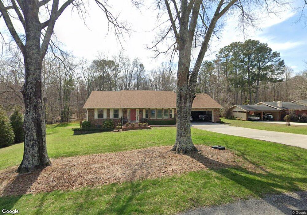
208 Meadow Brook Dr Rock Spring, GA 30739
Rock Spring NeighborhoodEstimated Value: $326,000 - $398,000
3
Beds
3
Baths
2,156
Sq Ft
$165/Sq Ft
Est. Value
About This Home
This home is located at 208 Meadow Brook Dr, Rock Spring, GA 30739 and is currently estimated at $356,049, approximately $165 per square foot. 208 Meadow Brook Dr is a home located in Walker County with nearby schools including Rock Spring Elementary School, Lafayette High School, and Alice M Daley Adventist School.
Ownership History
Date
Name
Owned For
Owner Type
Purchase Details
Closed on
Mar 11, 2005
Sold by
Not Provided
Bought by
Breeden Charles R and Breeden Darlene E
Current Estimated Value
Purchase Details
Closed on
Mar 24, 1978
Sold by
Martin Larry E
Bought by
Ashworth Alvin C and Ashworth Betty
Purchase Details
Closed on
Jan 27, 1976
Sold by
Mathis Frances M
Bought by
Mathis Miles A
Purchase Details
Closed on
Jan 1, 1976
Sold by
Stephenson Donald Larry
Bought by
Mathis Frances M
Purchase Details
Closed on
Apr 9, 1974
Sold by
Cook Eva H
Bought by
Stephenson Donald Larry
Purchase Details
Closed on
Oct 2, 1972
Sold by
Wilhelm Joseph P and Wilhelm Wanda
Bought by
Cook Eva H
Purchase Details
Closed on
May 2, 1968
Bought by
Wilhelm Joseph P and Wilhelm Wanda
Create a Home Valuation Report for This Property
The Home Valuation Report is an in-depth analysis detailing your home's value as well as a comparison with similar homes in the area
Home Values in the Area
Average Home Value in this Area
Purchase History
| Date | Buyer | Sale Price | Title Company |
|---|---|---|---|
| Breeden Charles R | $175,000 | -- | |
| Ashworth Alvin C | $52,000 | -- | |
| Mathis Miles A | -- | -- | |
| Martin Larry E | -- | -- | |
| Mathis Frances M | -- | -- | |
| Stephenson Donald Larry | -- | -- | |
| Cook Eva H | -- | -- | |
| Wilhelm Joseph P | -- | -- |
Source: Public Records
Tax History
| Year | Tax Paid | Tax Assessment Tax Assessment Total Assessment is a certain percentage of the fair market value that is determined by local assessors to be the total taxable value of land and additions on the property. | Land | Improvement |
|---|---|---|---|---|
| 2024 | $350 | $94,420 | $5,630 | $88,790 |
| 2023 | $350 | $89,838 | $5,630 | $84,208 |
| 2022 | $261 | $78,304 | $5,630 | $72,674 |
| 2021 | $336 | $65,348 | $5,630 | $59,718 |
| 2020 | $244 | $52,856 | $5,630 | $47,226 |
| 2019 | $243 | $52,856 | $5,630 | $47,226 |
| 2018 | $1,399 | $52,856 | $5,630 | $47,226 |
| 2017 | $1,374 | $52,856 | $5,630 | $47,226 |
| 2016 | $140 | $52,856 | $5,630 | $47,226 |
| 2015 | $141 | $59,886 | $6,160 | $53,726 |
| 2014 | $649 | $59,886 | $6,160 | $53,726 |
| 2013 | $1,399 | $59,886 | $6,160 | $53,726 |
Source: Public Records
Map
Nearby Homes
- 00 Georgia 95
- 1003 Highway N Old 27
- 0 Bicentennial Trail Unit 7707994
- 0 Bicentennial Trail Unit 7707991
- 0 Bicentennial Trail Unit 10680206
- 0 Bicentennial Trail Unit 10687168
- 0 Bicentennial Trail Unit 10687173
- 0 Bicentennial Trail Unit 7707992
- 0 Bicentennial Trail Unit 10687176
- 0 Bicentennial Trail Unit 7707995
- 10180 Us Highway 27
- 40 Blessed Way
- 701 Bicentennial Trail
- 1902 Long Hollow Rd
- 59 Honeysuckle Dr
- 195 Honeysuckle Dr
- 1909 Old Lafayette Rd
- 23 Willow Cir
- 11 Willow Cir
- 16 Willow Cir
- 234 Meadow Brook Dr
- 184 Meadow Brook Dr
- 221 Meadow Brook Dr
- 221 Meadowbrook Dr
- 0 Meadowbrook Dr
- 258 Meadow Brook Dr
- 247 Meadow Brook Dr
- 163 Meadow Brook Dr
- 148 Meadow Brook Dr
- 137 Meadow Brook Dr
- 7403 N Highway 27
- 102 Meadow Brook Dr
- 301 Meadow Brook Dr
- 77 Meadow Brook Dr
- 661 Highway 95
- 661 Highway 95
- 64 Meadow Brook Dr
- 64 Meadowbrook Dr
- 28 Meadowbrook Dr
- 28 Meadow Brook Dr
Your Personal Tour Guide
Ask me questions while you tour the home.