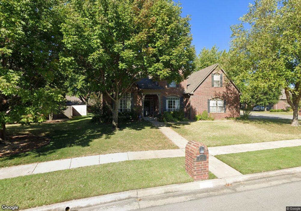
208 N Butternut Cir Broken Arrow, OK 74012
Country Aire Estates NeighborhoodEstimated Value: $396,000 - $429,000
--
Bed
4
Baths
3,400
Sq Ft
$120/Sq Ft
Est. Value
About This Home
This home is located at 208 N Butternut Cir, Broken Arrow, OK 74012 and is currently estimated at $408,035, approximately $120 per square foot. 208 N Butternut Cir is a home located in Tulsa County with nearby schools including Marshall T. Moore Elementary School, Union 8th Grade Center, and Union 6th-7th Grade Center.
Ownership History
Date
Name
Owned For
Owner Type
Purchase Details
Closed on
Feb 18, 2016
Sold by
Nix Tucker A and Nix Jamie L
Bought by
Nix Tucker A and Nix Jamie L
Current Estimated Value
Purchase Details
Closed on
Sep 24, 2004
Sold by
Esser Richard A and Esser Stacey M
Bought by
Nix Tucker A and Hammack Jamie L
Purchase Details
Closed on
May 21, 1998
Sold by
Gem Properties Inc
Bought by
Esser Richard A and Esser Stacey M
Purchase Details
Closed on
Dec 9, 1997
Sold by
American Land 71St Street Company
Bought by
Gem Properties Inc
Create a Home Valuation Report for This Property
The Home Valuation Report is an in-depth analysis detailing your home's value as well as a comparison with similar homes in the area
Home Values in the Area
Average Home Value in this Area
Purchase History
| Date | Buyer | Sale Price | Title Company |
|---|---|---|---|
| Nix Tucker A | -- | None Available | |
| Nix Tucker A | $230,000 | Tulsa Abstract & Title Co | |
| Esser Richard A | $199,500 | Delta Title & Escrow Company | |
| Gem Properties Inc | $36,000 | -- |
Source: Public Records
Tax History Compared to Growth
Tax History
| Year | Tax Paid | Tax Assessment Tax Assessment Total Assessment is a certain percentage of the fair market value that is determined by local assessors to be the total taxable value of land and additions on the property. | Land | Improvement |
|---|---|---|---|---|
| 2024 | $3,606 | $29,337 | $2,476 | $26,861 |
| 2023 | $3,606 | $27,940 | $3,850 | $24,090 |
| 2022 | $3,292 | $25,300 | $3,850 | $21,450 |
| 2021 | $3,303 | $25,300 | $3,850 | $21,450 |
| 2020 | $3,325 | $25,300 | $3,850 | $21,450 |
| 2019 | $3,319 | $25,300 | $3,850 | $21,450 |
| 2018 | $3,309 | $25,300 | $3,850 | $21,450 |
| 2017 | $3,354 | $25,300 | $3,850 | $21,450 |
| 2016 | $3,309 | $25,300 | $3,850 | $21,450 |
| 2015 | $3,311 | $25,300 | $3,850 | $21,450 |
| 2014 | $3,292 | $25,300 | $3,850 | $21,450 |
Source: Public Records
Map
Nearby Homes
- 4408 W Elgin St
- 4400 W Freeport Cir
- 4201 W Detroit St
- 4501 W Hartford St
- 708 N Aster Ave
- 4932 W Commercial St
- 418 S Butternut Ave
- 905 N Butternut Ave
- 10942 E 76th St
- 910 N Butternut Ct
- 0 W Houston St Unit 2538461
- 4416 W Indianola St
- 3812 W El Paso St
- 1109 N Cypress Ave
- 2416 W Lansing Place
- 808 S Butternut Ave
- 4419 W Madison St
- 3843 W Galveston Place
- 409 N Palm Ave
- 208 N Nyssa Ave
- 204 N Butternut Cir
- 215 N Butternut Ave
- 219 N Butternut Ave
- 213 N Butternut Ave
- 4504 W Detroit St
- 4500 W Detroit St
- 4412 W Detroit St
- 4508 W Detroit St
- 200 N Butternut Cir
- 209 N Butternut Ave
- 4512 W Detroit St
- 4408 W Detroit St
- 205 N Butternut Cir
- 201 N Butternut Cir
- 4516 W Detroit St
- 4415 W Detroit Place
- 4411 W Detroit Place
- 4419 W Detroit Place
- 4407 W Detroit Place
- 220 N Butternut Ave
