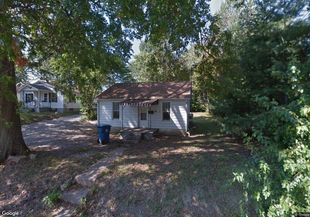
208 N Locust St Mc Leansboro, IL 62859
McLeansboro NeighborhoodEstimated Value: $104,523
--
Bed
--
Bath
--
Sq Ft
0.5
Acres
About This Home
This home is located at 208 N Locust St, Mc Leansboro, IL 62859 and is currently priced at $104,523. 208 N Locust St is a home located in Hamilton County with nearby schools including Hamilton County Junior/Senior High School.
Ownership History
Date
Name
Owned For
Owner Type
Purchase Details
Closed on
Oct 22, 2023
Sold by
Gholson James T
Bought by
Coleman Jay K and Coleman Tabitha S
Current Estimated Value
Purchase Details
Closed on
Mar 31, 2022
Sold by
Blackhawk Land And Resources Llc
Bought by
Wildcat Coal Llc
Purchase Details
Closed on
Feb 24, 2020
Sold by
Hamilton County
Bought by
Gholson James T
Purchase Details
Closed on
Jan 8, 2020
Sold by
Hamilton County Clerk
Bought by
Hamilton County Trust
Purchase Details
Closed on
Aug 14, 2006
Sold by
Wheeler Mary
Bought by
Barker Robert David
Create a Home Valuation Report for This Property
The Home Valuation Report is an in-depth analysis detailing your home's value as well as a comparison with similar homes in the area
Home Values in the Area
Average Home Value in this Area
Purchase History
| Date | Buyer | Sale Price | Title Company |
|---|---|---|---|
| Coleman Jay K | $20,000 | None Listed On Document | |
| Wildcat Coal Llc | -- | Trombley Ryan M | |
| Gholson James T | -- | None Available | |
| Hamilton County Trust | -- | None Available | |
| Barker Robert David | -- | None Available |
Source: Public Records
Tax History Compared to Growth
Tax History
| Year | Tax Paid | Tax Assessment Tax Assessment Total Assessment is a certain percentage of the fair market value that is determined by local assessors to be the total taxable value of land and additions on the property. | Land | Improvement |
|---|---|---|---|---|
| 2022 | $117 | $1,397 | $845 | $552 |
| 2021 | $114 | $1,344 | $813 | $531 |
| 2020 | $320 | $3,404 | $765 | $2,639 |
| 2019 | $316 | $3,404 | $765 | $2,639 |
| 2018 | $325 | $3,404 | $765 | $2,639 |
| 2017 | $325 | $3,404 | $765 | $2,639 |
| 2015 | $320 | $3,426 | $770 | $2,656 |
| 2014 | $294 | $3,305 | $743 | $2,562 |
| 2013 | -- | $3,208 | $721 | $2,487 |
| 2012 | -- | $2,742 | $616 | $2,126 |
Source: Public Records
Map
Nearby Homes
- 201 N Washington St
- 16128 Cr 1030 N
- 210 N Virginia St
- 708 E Foote St
- 312 E Randolph St
- 000 E Maple St
- 54 Meadow Hills Ln
- 1010 E Randolph St
- 000 Memory Ln
- 000 Eric Ln
- 000 County Road 1000
- 0 County Road 1000 N Unit Lot WP001
- 12324 Rd
- 0 County Road 900 N
- 0 County Road 750 N Unit RMAEB457700
- 0000 Campbell's Corner Rd
- 7505 Cr 1800e
- 722 W Main St
- 000 Jacob St
- 402 Mae Orr St
- 206 N Locust St
- 207 E Broadway St
- 204 N Locust St
- 209 N Locust St
- 203 N Locust St
- 206 E Broadway St
- 206 E Broadway St
- 204 E Broadway St
- 104 N Locust St
- 304 E Broadway St
- 200 E Broadway St
- 200 E Broadway St
- 210 N Walnut St
- 204 N Walnut St
- 108 N Locust St
- 208 N Walnut St
- 206 N Walnut St
- 200 N Walnut St
- 110 N Walnut St
- 108 N Walnut St