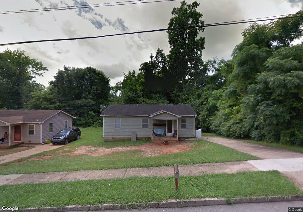
208 Newnan St Lagrange, GA 30241
Estimated Value: $92,000 - $125,000
3
Beds
1
Bath
1,179
Sq Ft
$90/Sq Ft
Est. Value
About This Home
This home is located at 208 Newnan St, Lagrange, GA 30241 and is currently estimated at $106,206, approximately $90 per square foot. 208 Newnan St is a home located in Troup County with nearby schools including Franklin Forest Elementary School, Hollis Hand Elementary School, and Ethel W. Kight Elementary School.
Ownership History
Date
Name
Owned For
Owner Type
Purchase Details
Closed on
Feb 1, 1989
Sold by
Charles V Brown
Bought by
Strickland Milton H
Current Estimated Value
Purchase Details
Closed on
Apr 1, 1988
Sold by
Foster
Bought by
Charles V Brown
Purchase Details
Closed on
Aug 10, 1979
Sold by
Alger
Bought by
Foster
Purchase Details
Closed on
Jan 1, 1973
Sold by
Pepperell
Bought by
Alger
Create a Home Valuation Report for This Property
The Home Valuation Report is an in-depth analysis detailing your home's value as well as a comparison with similar homes in the area
Purchase History
| Date | Buyer | Sale Price | Title Company |
|---|---|---|---|
| Strickland Milton H | -- | -- | |
| Charles V Brown | $6,500 | -- | |
| Foster | -- | -- | |
| Alger | -- | -- |
Source: Public Records
Tax History
| Year | Tax Paid | Tax Assessment Tax Assessment Total Assessment is a certain percentage of the fair market value that is determined by local assessors to be the total taxable value of land and additions on the property. | Land | Improvement |
|---|---|---|---|---|
| 2025 | $739 | $27,080 | $4,480 | $22,600 |
| 2024 | $691 | $25,320 | $4,480 | $20,840 |
| 2023 | $652 | $23,920 | $4,480 | $19,440 |
| 2022 | $639 | $22,880 | $4,480 | $18,400 |
| 2021 | $415 | $13,760 | $2,240 | $11,520 |
| 2020 | $415 | $13,760 | $2,240 | $11,520 |
| 2019 | $402 | $13,328 | $1,688 | $11,640 |
| 2018 | $402 | $13,328 | $1,688 | $11,640 |
| 2017 | $402 | $13,328 | $1,688 | $11,640 |
| 2016 | $386 | $12,785 | $1,688 | $11,098 |
| 2015 | $386 | $12,781 | $1,683 | $11,098 |
| 2014 | $372 | $12,290 | $1,683 | $10,607 |
| 2013 | -- | $13,256 | $1,683 | $11,573 |
Source: Public Records
Map
Nearby Homes
- 5 Curran Ave
- 4 1/2 Barnard Ave
- 204 Cleveland Dr
- 15 Fulton St
- 212 Cleveland Dr
- 3 Gulfstream Dr
- 5 Gulfstream Dr
- 0 N Barnard Ave
- 147 Shenandoah Ln
- 146 Shenandoah Ln
- 115 Clara Jean Ct
- 143 Shenandoah Ln
- 87 Youngs Mill Rd
- 141 Shenandoah Ln
- 139 Shenandoah Ln
- 142 Shenandoah Ln
- 107 N Barnard Ave
- 110 Lenox Cir
- 136 Shenandoah Ln
- 2 Louise St
Your Personal Tour Guide
Ask me questions while you tour the home.