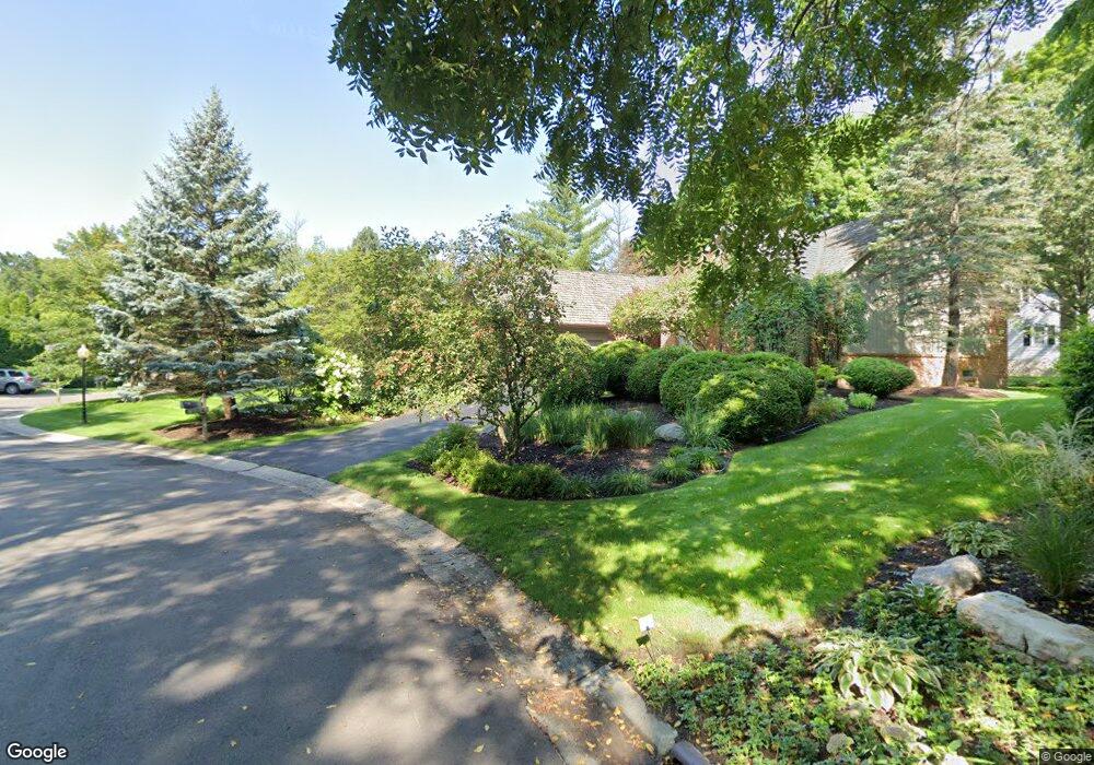
208 Norcliff Dr Unit Bldg-Unit Bloomfield Hills, MI 48302
Estimated Value: $794,000 - $1,154,261
4
Beds
3
Baths
3,688
Sq Ft
$276/Sq Ft
Est. Value
About This Home
This home is located at 208 Norcliff Dr Unit Bldg-Unit, Bloomfield Hills, MI 48302 and is currently estimated at $1,017,315, approximately $275 per square foot. 208 Norcliff Dr Unit Bldg-Unit is a home located in Oakland County with nearby schools including Way Elementary School, South Hills Middle School, and Bloomfield Hills High School.
Ownership History
Date
Name
Owned For
Owner Type
Purchase Details
Closed on
Feb 11, 2019
Sold by
Bonds Karen S and Karen S Bonds Living Trust
Bought by
Mcglothin Claudine A and Claudine A Moglothin Revocable
Current Estimated Value
Purchase Details
Closed on
Jul 23, 2015
Sold by
Bonds Karen S and Bonds William D
Bought by
Bonds Karen S and Karen S Bonds Living Trust
Purchase Details
Closed on
Nov 14, 1996
Sold by
Gordon Frederick
Bought by
Bonds William D
Create a Home Valuation Report for This Property
The Home Valuation Report is an in-depth analysis detailing your home's value as well as a comparison with similar homes in the area
Home Values in the Area
Average Home Value in this Area
Purchase History
| Date | Buyer | Sale Price | Title Company |
|---|---|---|---|
| Mcglothin Claudine A | $600,000 | Equity Title Agency Llc | |
| Bonds Karen S | -- | Attorney | |
| Bonds William D | -- | -- |
Source: Public Records
Tax History Compared to Growth
Tax History
| Year | Tax Paid | Tax Assessment Tax Assessment Total Assessment is a certain percentage of the fair market value that is determined by local assessors to be the total taxable value of land and additions on the property. | Land | Improvement |
|---|---|---|---|---|
| 2024 | $7,845 | $467,010 | $0 | $0 |
| 2023 | $7,592 | $441,600 | $0 | $0 |
| 2022 | $14,268 | $431,120 | $0 | $0 |
| 2021 | $14,165 | $400,750 | $0 | $0 |
| 2020 | $6,944 | $365,000 | $0 | $0 |
| 2019 | $10,417 | $409,980 | $0 | $0 |
| 2018 | $10,276 | $381,700 | $0 | $0 |
| 2017 | $10,203 | $387,610 | $0 | $0 |
| 2016 | $10,222 | $372,350 | $0 | $0 |
| 2015 | -- | $335,940 | $0 | $0 |
| 2014 | -- | $277,360 | $0 | $0 |
| 2011 | -- | $279,870 | $0 | $0 |
Source: Public Records
Map
Nearby Homes
- 284 Woodwind Dr
- 240 Applewood Ln
- 164 Timber Trace Ln
- 136 Belroi Place
- 42285 Woodward Ave # S1-3
- 559 Barrington Park
- 3515 Brookside Dr
- 3531 Brookside Dr
- 3715 Lahser Rd
- 2665 Lahser Rd
- 3403 Chickering Ln
- 42160 Woodward Ave Unit 8
- 42160 Woodward Ave
- 3060 Chickering Ln
- 112 E Hickory Grove Rd Unit 26
- 2863 Meadowood Ln
- 41350 Woodward Ave Unit 8
- 3627 Shallow Brook Dr
- 3435 Devon Brook Dr
- 3797 Burning Tree Dr
- 208 Norcliff Dr
- 204 Norcliff Dr
- 204 Norcliff Dr Unit 15
- 226 Norcliff Dr
- 209 Norcliff Dr
- 213 Norcliff Dr
- 205 Norcliff Dr Unit 1
- 217 Norcliff Dr
- 217 Norcliff Dr Unit 4
- 225 Norcliff Dr
- 221 Norcliff Dr
- 229 Norcliff Dr
- 3140 Lahser Rd
- 233 Norcliff Dr Unit 8
- 237 Norcliff Dr Unit 9
- 281 Chestnut Cir
- 291 Chestnut Cir
- 301 Orange Lake Dr
- 275 Chestnut Cir
- 241 Norcliff Dr