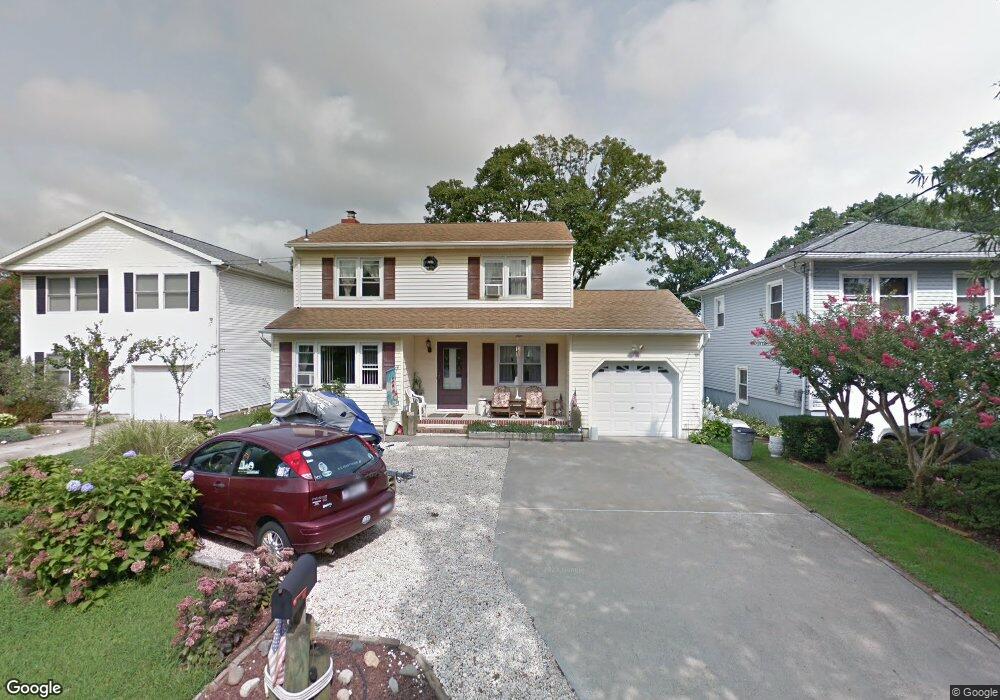
208 Osprey Ave Point Pleasant Beach, NJ 08742
Point Pleasant Beach NeighborhoodEstimated Value: $771,000 - $972,000
3
Beds
2
Baths
2,304
Sq Ft
$387/Sq Ft
Est. Value
About This Home
This home is located at 208 Osprey Ave, Point Pleasant Beach, NJ 08742 and is currently estimated at $891,150, approximately $386 per square foot. 208 Osprey Ave is a home located in Ocean County with nearby schools including G Harold Antrim Elementary School, Point Pleasant Beach High School, and St. Peter School.
Ownership History
Date
Name
Owned For
Owner Type
Purchase Details
Closed on
May 1, 2002
Sold by
James Mc Namara
Bought by
Babbini Eugene and Babbini Mary
Current Estimated Value
Home Financials for this Owner
Home Financials are based on the most recent Mortgage that was taken out on this home.
Original Mortgage
$60,000
Interest Rate
6.61%
Purchase Details
Closed on
Apr 7, 2000
Sold by
Zelinski Donald
Bought by
James Mc Namara and Mc Namara Audrey
Home Financials for this Owner
Home Financials are based on the most recent Mortgage that was taken out on this home.
Original Mortgage
$168,610
Interest Rate
8.26%
Mortgage Type
FHA
Create a Home Valuation Report for This Property
The Home Valuation Report is an in-depth analysis detailing your home's value as well as a comparison with similar homes in the area
Home Values in the Area
Average Home Value in this Area
Purchase History
| Date | Buyer | Sale Price | Title Company |
|---|---|---|---|
| Babbini Eugene | $260,000 | -- | |
| James Mc Namara | $169,000 | -- |
Source: Public Records
Mortgage History
| Date | Status | Borrower | Loan Amount |
|---|---|---|---|
| Previous Owner | Babbini Eugene | $60,000 | |
| Previous Owner | James Mc Namara | $168,610 |
Source: Public Records
Tax History Compared to Growth
Tax History
| Year | Tax Paid | Tax Assessment Tax Assessment Total Assessment is a certain percentage of the fair market value that is determined by local assessors to be the total taxable value of land and additions on the property. | Land | Improvement |
|---|---|---|---|---|
| 2025 | $7,554 | $439,700 | $271,500 | $168,200 |
| 2024 | $7,325 | $439,700 | $271,500 | $168,200 |
| 2023 | $7,119 | $439,700 | $271,500 | $168,200 |
| 2022 | $7,119 | $439,700 | $271,500 | $168,200 |
| 2021 | $6,954 | $439,700 | $271,500 | $168,200 |
| 2020 | $6,952 | $439,700 | $271,500 | $168,200 |
| 2019 | $6,855 | $439,700 | $271,500 | $168,200 |
| 2018 | $6,749 | $439,700 | $271,500 | $168,200 |
| 2017 | $6,644 | $439,700 | $271,500 | $168,200 |
| 2016 | $6,675 | $439,700 | $271,500 | $168,200 |
| 2015 | $6,622 | $439,700 | $271,500 | $168,200 |
| 2014 | $6,591 | $439,700 | $271,500 | $168,200 |
Source: Public Records
Map
Nearby Homes
- 303 Cooks Ln
- 325 Hawthorne Ave Unit 327
- 109 Griffiths Ave
- 326 Curtis Ave Unit Lot 27
- 328 Curtis Ave Unit Lot 28
- 204 Curtis Ave
- 305 Chicago Ave
- 202 Yale Ave
- 37 Arnold Ave
- 25 Niblick St
- 728 Arnold Ave
- 607 Richmond Ave Unit 4
- 606 Bay Ave Unit 2
- 845 Arnold Ave Unit 3
- 503 Atlantic Ave
- 201 Forman Ave
- 110 Trenton Ave
- 807 Trenton Ave
- 615 Atlantic Ave
- 704 Forman Ave