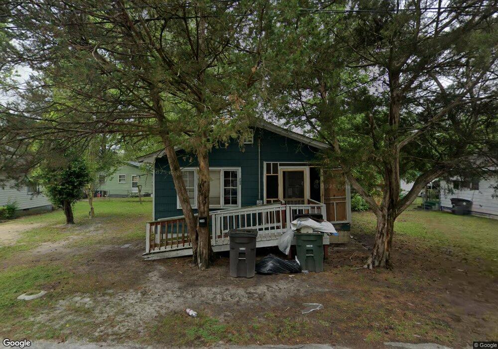
208 Phillips St La Grange, NC 28551
Estimated Value: $50,623 - $93,000
2
Beds
1
Bath
790
Sq Ft
$100/Sq Ft
Est. Value
About This Home
This home is located at 208 Phillips St, La Grange, NC 28551 and is currently estimated at $78,906, approximately $99 per square foot. 208 Phillips St is a home located in Lenoir County with nearby schools including La Grange Elementary School, E.B. Frink Middle School, and North Lenoir High School.
Ownership History
Date
Name
Owned For
Owner Type
Purchase Details
Closed on
Jun 3, 2015
Sold by
Hall Ray Stanley and Hall Joyce F
Bought by
Martin Tony
Current Estimated Value
Purchase Details
Closed on
Sep 11, 2007
Sold by
Bridges Virginia
Bought by
Bridges Virginia and Hall Ray Stanley
Purchase Details
Closed on
Jan 9, 2006
Sold by
Johnson Ethel L and Martin Carl E
Bought by
Bridges Virginia
Create a Home Valuation Report for This Property
The Home Valuation Report is an in-depth analysis detailing your home's value as well as a comparison with similar homes in the area
Home Values in the Area
Average Home Value in this Area
Purchase History
| Date | Buyer | Sale Price | Title Company |
|---|---|---|---|
| Martin Tony | -- | None Available | |
| Bridges Virginia | -- | None Available | |
| Bridges Virginia | -- | None Available |
Source: Public Records
Tax History Compared to Growth
Tax History
| Year | Tax Paid | Tax Assessment Tax Assessment Total Assessment is a certain percentage of the fair market value that is determined by local assessors to be the total taxable value of land and additions on the property. | Land | Improvement |
|---|---|---|---|---|
| 2025 | $427 | $42,518 | $6,144 | $36,374 |
| 2024 | $296 | $21,470 | $2,250 | $19,220 |
| 2023 | $296 | $21,470 | $2,250 | $19,220 |
| 2022 | $296 | $21,470 | $2,250 | $19,220 |
| 2021 | $296 | $21,470 | $2,250 | $19,220 |
| 2020 | $296 | $21,470 | $2,250 | $19,220 |
| 2019 | $296 | $21,470 | $2,250 | $19,220 |
| 2018 | $292 | $21,470 | $2,250 | $19,220 |
| 2017 | $293 | $21,470 | $2,250 | $19,220 |
| 2014 | $195 | $15,154 | $2,250 | $12,904 |
| 2013 | -- | $15,154 | $2,250 | $12,904 |
| 2011 | -- | $15,154 | $2,250 | $12,904 |
Source: Public Records
Map
Nearby Homes
- 302 S Caswell St
- 202 E Washington St
- 101 S Wooten St
- 128 E Railroad St
- 105 Circle Dr
- 219 Wood St
- 110 W Railroad St
- 217 Wood St
- 210 Wood St
- 208 Wood St
- 201 Wood St
- 204 Wood St
- 205 Wood St
- 206 Wood St
- 202 Wood St
- Belhaven Plan at Blair Ridge
- Hayden Plan at Blair Ridge
- Cali Plan at Blair Ridge
- Freeport Plan at Blair Ridge
- 614 S Caswell St
- 210 Phillips St
- 206 Phillips St
- 107 Spring Hill St
- 105 Spring Hill St
- 109 Spring Hill St
- 204 Phillips St
- 212 Phillips St
- 203 Phillips St
- 111 Spring Hill St
- 201 Phillips St
- 103 Spring Hill St
- 205 Phillips St
- 202 Phillips St
- 113 Spring Hill St
- 202 Lenoir St
- 214 Phillips St
- 209 Phillips St
- 115 Spring Hill St
- 410 S Wooten St
- 408 S Wooten St