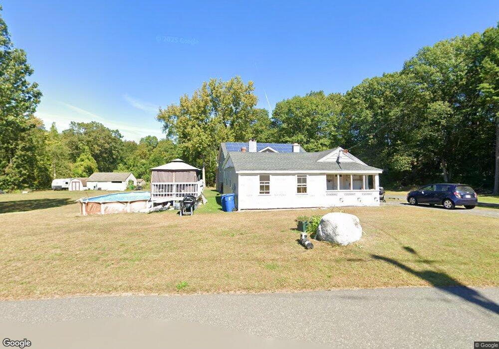
208 Quarry Rd West Springfield, MA 01089
Estimated Value: $502,684 - $708,000
1
Bed
1
Bath
3,176
Sq Ft
$184/Sq Ft
Est. Value
About This Home
This home is located at 208 Quarry Rd, West Springfield, MA 01089 and is currently estimated at $584,671, approximately $184 per square foot. 208 Quarry Rd is a home located in Hampden County with nearby schools including West Springfield High School, Holyoke Community Charter School, and Blessed Sacrament School.
Ownership History
Date
Name
Owned For
Owner Type
Purchase Details
Closed on
Aug 7, 2014
Sold by
Carr Lynn M and Carr David B
Bought by
Carr Lynn M and Carr David B
Current Estimated Value
Purchase Details
Closed on
Jan 22, 2010
Sold by
Kolodziej John J and Kolodziej Joseph J
Bought by
Carr Lynn M and Carr David B
Create a Home Valuation Report for This Property
The Home Valuation Report is an in-depth analysis detailing your home's value as well as a comparison with similar homes in the area
Home Values in the Area
Average Home Value in this Area
Purchase History
| Date | Buyer | Sale Price | Title Company |
|---|---|---|---|
| Carr Lynn M | -- | -- | |
| Carr Lynn M | -- | -- | |
| Carr Lynn M | -- | -- | |
| Carr Lynn M | $8,000 | -- | |
| Carr Lynn M | $8,000 | -- | |
| Carr Lynn M | $8,000 | -- | |
| Carr Lynn M | -- | -- | |
| Carr Lynn M | -- | -- |
Source: Public Records
Tax History
| Year | Tax Paid | Tax Assessment Tax Assessment Total Assessment is a certain percentage of the fair market value that is determined by local assessors to be the total taxable value of land and additions on the property. | Land | Improvement |
|---|---|---|---|---|
| 2025 | $6,317 | $424,800 | $146,100 | $278,700 |
| 2024 | $6,041 | $407,900 | $146,100 | $261,800 |
| 2023 | $5,905 | $380,000 | $153,300 | $226,700 |
| 2022 | $5,379 | $341,300 | $139,500 | $201,800 |
| 2021 | $5,280 | $312,400 | $132,900 | $179,500 |
| 2020 | $5,287 | $311,200 | $132,900 | $178,300 |
| 2019 | $5,278 | $311,200 | $132,900 | $178,300 |
| 2018 | $5,306 | $311,200 | $132,900 | $178,300 |
| 2017 | $5,306 | $311,200 | $132,900 | $178,300 |
| 2016 | $5,318 | $313,000 | $127,800 | $185,200 |
| 2015 | $2,861 | $168,400 | $125,400 | $43,000 |
| 2014 | $694 | $168,400 | $125,400 | $43,000 |
Source: Public Records
Map
Nearby Homes
- 361 Prospect Ave
- 287 Whitney Ave
- 11 Annie's Way
- 89-111 Whitney Ave
- 48 Mountain Ave
- 1768 E Mountain Rd
- 60 Lower Westfield Rd
- 308 Apremont Hwy
- 80 Brush Hill Ave Unit 61
- 791 Morgan Rd
- 156 Canterbury Way
- 1173 E Mountain Rd
- 37 Sun Valley Rd
- 17 Vincent Dr
- 86 Beaumont Ave
- 655 Morgan Rd
- 34 High Meadow Dr
- 288 Buck Pond Rd
- 87 Blanchwood Ave
- 106 Vermont St
Your Personal Tour Guide
Ask me questions while you tour the home.