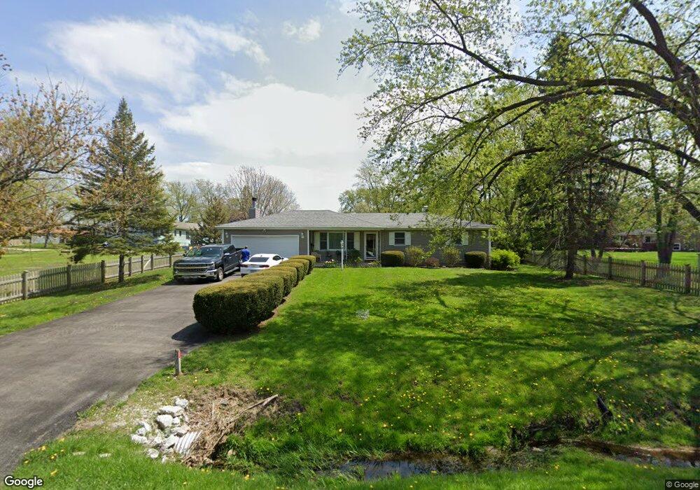
208 S Anderson Rd New Lenox, IL 60451
Estimated Value: $334,147 - $459,000
--
Bed
--
Bath
--
Sq Ft
0.45
Acres
About This Home
This home is located at 208 S Anderson Rd, New Lenox, IL 60451 and is currently estimated at $378,787. 208 S Anderson Rd is a home located in Will County with nearby schools including Bentley Elementary School, Arnold J Tyler School, and Alex M Martino Jr High School.
Ownership History
Date
Name
Owned For
Owner Type
Purchase Details
Closed on
Mar 20, 1997
Sold by
Hernandez Gary R and Hill Kandiss Bowen
Bought by
Calder Andrew R and Fitch Donna A
Current Estimated Value
Home Financials for this Owner
Home Financials are based on the most recent Mortgage that was taken out on this home.
Original Mortgage
$131,000
Outstanding Balance
$15,999
Interest Rate
7.82%
Estimated Equity
$362,788
Purchase Details
Closed on
May 13, 1996
Sold by
Butts Larry D and Butts Carolyn L
Bought by
Hernandez Gary R and Hill Kandiss Bowen
Home Financials for this Owner
Home Financials are based on the most recent Mortgage that was taken out on this home.
Original Mortgage
$48,000
Interest Rate
7.86%
Create a Home Valuation Report for This Property
The Home Valuation Report is an in-depth analysis detailing your home's value as well as a comparison with similar homes in the area
Home Values in the Area
Average Home Value in this Area
Purchase History
| Date | Buyer | Sale Price | Title Company |
|---|---|---|---|
| Calder Andrew R | $142,000 | -- | |
| Hernandez Gary R | $146,000 | Law Title Pick Up |
Source: Public Records
Mortgage History
| Date | Status | Borrower | Loan Amount |
|---|---|---|---|
| Open | Calder Andrew R | $131,000 | |
| Previous Owner | Hernandez Gary R | $48,000 |
Source: Public Records
Tax History Compared to Growth
Tax History
| Year | Tax Paid | Tax Assessment Tax Assessment Total Assessment is a certain percentage of the fair market value that is determined by local assessors to be the total taxable value of land and additions on the property. | Land | Improvement |
|---|---|---|---|---|
| 2024 | $7,272 | $100,943 | $33,966 | $66,977 |
| 2023 | $7,272 | $92,018 | $30,963 | $61,055 |
| 2022 | $6,570 | $84,770 | $28,524 | $56,246 |
| 2021 | $6,230 | $79,724 | $26,826 | $52,898 |
| 2020 | $6,047 | $76,880 | $25,869 | $51,011 |
| 2019 | $5,779 | $74,496 | $25,067 | $49,429 |
| 2018 | $5,639 | $71,928 | $24,203 | $47,725 |
| 2017 | $5,348 | $69,860 | $23,507 | $46,353 |
| 2016 | $5,187 | $67,990 | $22,878 | $45,112 |
| 2015 | $5,016 | $65,850 | $22,158 | $43,692 |
| 2014 | $5,016 | $65,037 | $21,884 | $43,153 |
| 2013 | $5,016 | $65,914 | $22,179 | $43,735 |
Source: Public Records
Map
Nearby Homes
- 214 Somerset Ct
- 125 N Anderson Rd
- 513 Somerset Ln
- 1017 E Lincoln Hwy
- 1351 E Lincoln Hwy
- 1535 Glenbrooke Ln
- 1212 Georgias Way
- 1245 Georgias Way
- 1193 Georgias Way
- 701 Bishops Gate
- 1139 Georgias Way
- 641 Lisson Grove
- 117 Walona Ave
- 1125 Georgias Way
- 203 Tonell Ave
- 621 Chatfield Rd
- 920 Barnside Rd
- 235 Roberts Rd
- 1920 Tessington Ct
- 1931 Tessington Ct
- 908 Somerset St
- 909 Chelsea Ct
- 912 Somerset St
- 913 Chelsea Ct
- 916 Somerset St
- 907 Somerset St
- 205 S Anderson Rd
- 915 Chelsea Ct
- 836 Somerset St
- 209 S Anderson Rd
- 911 Somerset St
- 920 Somerset St
- 146 S Anderson Rd
- 915 Somerset St
- 919 Chelsea Ct
- 841 Somerset St
- 832 Somerset St
- 912 Chelsea Ct
- 924 Somerset St
- 147 S Anderson Rd