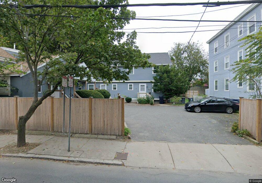
208 Sherman St Unit A Cambridge, MA 02140
North Cambridge NeighborhoodEstimated Value: $881,000 - $958,292
3
Beds
3
Baths
1,172
Sq Ft
$786/Sq Ft
Est. Value
About This Home
This home is located at 208 Sherman St Unit A, Cambridge, MA 02140 and is currently estimated at $920,823, approximately $785 per square foot. 208 Sherman St Unit A is a home located in Middlesex County with nearby schools including Benjamin Banneker Charter Public School, Cambridge Friends School, and Cambridge Montessori School.
Ownership History
Date
Name
Owned For
Owner Type
Purchase Details
Closed on
Dec 15, 2006
Sold by
Marden Leanne M
Bought by
Artwell-Doucette Deborah and Doucette Eugene
Current Estimated Value
Home Financials for this Owner
Home Financials are based on the most recent Mortgage that was taken out on this home.
Original Mortgage
$327,250
Outstanding Balance
$195,656
Interest Rate
6.31%
Mortgage Type
Purchase Money Mortgage
Estimated Equity
$725,167
Create a Home Valuation Report for This Property
The Home Valuation Report is an in-depth analysis detailing your home's value as well as a comparison with similar homes in the area
Home Values in the Area
Average Home Value in this Area
Purchase History
| Date | Buyer | Sale Price | Title Company |
|---|---|---|---|
| Artwell-Doucette Deborah | $385,000 | -- |
Source: Public Records
Mortgage History
| Date | Status | Borrower | Loan Amount |
|---|---|---|---|
| Open | Artwell-Doucette Deborah | $327,250 |
Source: Public Records
Tax History Compared to Growth
Tax History
| Year | Tax Paid | Tax Assessment Tax Assessment Total Assessment is a certain percentage of the fair market value that is determined by local assessors to be the total taxable value of land and additions on the property. | Land | Improvement |
|---|---|---|---|---|
| 2025 | $5,280 | $831,500 | $0 | $831,500 |
| 2024 | $4,798 | $810,500 | $0 | $810,500 |
| 2023 | $4,534 | $773,700 | $0 | $773,700 |
| 2022 | $4,387 | $741,100 | $0 | $741,100 |
| 2021 | $4,110 | $702,600 | $0 | $702,600 |
| 2020 | $3,866 | $672,300 | $0 | $672,300 |
| 2019 | $3,713 | $625,000 | $0 | $625,000 |
| 2018 | $3,625 | $576,300 | $0 | $576,300 |
| 2017 | $3,508 | $540,500 | $0 | $540,500 |
| 2016 | $3,459 | $494,900 | $0 | $494,900 |
| 2015 | $3,191 | $408,100 | $0 | $408,100 |
| 2014 | $3,163 | $377,500 | $0 | $377,500 |
Source: Public Records
Map
Nearby Homes
- 183 Rindge Ave Unit 1
- 179 Rindge Ave Unit 1
- 147 Sherman St Unit 201
- 61 Bolton St Unit 304
- 318 Rindge Ave Unit 103
- 49 Clifton St
- 124 Jackson St
- 22 Harrington Rd
- 110 Reed St
- 30 Dudley St
- 112 Jackson St
- 127 Harvey St
- 127 Harvey St Unit 127
- 69 Harvey St Unit 1
- 17 Shea Rd
- 12 Rindge Ave Unit 1
- 2456 Massachusetts Ave Unit 402
- 97 Elmwood St Unit 313
- 97 Elmwood St Unit 310
- 32 Cameron Ave
- 208 Sherman St Unit B
- 208 Sherman St Unit C
- 206 Rindge Ave Unit 206
- 206 Rindge Ave Unit C
- 206 Rindge Ave
- 198 Rindge Ave
- 200 Sherman St Unit 3
- 200 Sherman St Unit 2
- 200 Sherman St Unit 1
- 198 Sherman St
- 198 Sherman St Unit 3
- 198 Sherman St Unit 2
- 192 Rindge Ave
- 1 Sargent St
- 197 Sherman St
- 197 Sherman St Unit 3
- 205A Rindge Ave
- 205A Rindge Ave Unit A
- 196 Sherman St Unit 2
- 196 Sherman St