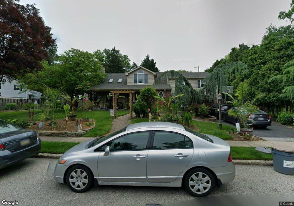
208 Spruce Rd Flourtown, PA 19031
Estimated Value: $499,000 - $627,000
4
Beds
2
Baths
2,314
Sq Ft
$247/Sq Ft
Est. Value
About This Home
This home is located at 208 Spruce Rd, Flourtown, PA 19031 and is currently estimated at $570,569, approximately $246 per square foot. 208 Spruce Rd is a home located in Montgomery County with nearby schools including Erdenheim Elementary School, Enfield Elementary School, and Springfield Township Middle School.
Ownership History
Date
Name
Owned For
Owner Type
Purchase Details
Closed on
Oct 20, 2005
Sold by
Peters Anna Maria and Peters Annamarie
Bought by
Peters Annamarie and Peters Brian
Current Estimated Value
Purchase Details
Closed on
Nov 23, 2002
Sold by
Peters Anna Maria and Chieffo Anna Maria
Bought by
Peters Anna Maria
Home Financials for this Owner
Home Financials are based on the most recent Mortgage that was taken out on this home.
Original Mortgage
$62,000
Interest Rate
6.34%
Create a Home Valuation Report for This Property
The Home Valuation Report is an in-depth analysis detailing your home's value as well as a comparison with similar homes in the area
Home Values in the Area
Average Home Value in this Area
Purchase History
| Date | Buyer | Sale Price | Title Company |
|---|---|---|---|
| Peters Annamarie | -- | -- | |
| Peters Anna Maria | -- | First American Title Co |
Source: Public Records
Mortgage History
| Date | Status | Borrower | Loan Amount |
|---|---|---|---|
| Closed | Peters Anna Maria | $62,000 |
Source: Public Records
Tax History
| Year | Tax Paid | Tax Assessment Tax Assessment Total Assessment is a certain percentage of the fair market value that is determined by local assessors to be the total taxable value of land and additions on the property. | Land | Improvement |
|---|---|---|---|---|
| 2025 | $7,700 | $163,470 | -- | -- |
| 2024 | $7,700 | $163,470 | -- | -- |
| 2023 | $7,432 | $163,470 | $0 | $0 |
| 2022 | $7,219 | $163,470 | $0 | $0 |
| 2021 | $7,030 | $163,470 | $0 | $0 |
| 2020 | $6,866 | $163,470 | $0 | $0 |
| 2019 | $6,760 | $163,470 | $0 | $0 |
Source: Public Records
Map
Nearby Homes
- 203 Spruce Rd
- 502 E Mill Rd
- 107 E Mill Rd
- 5 Highland Ave Unit 30
- 405 Pennybrook Ct Unit 3 REDFORD INTERIOR
- 407 Pennybrook Ct Unit 4 REDFORD END
- 401 Pennybrook Ct Unit 1 REDFORD END
- 001 Pennybrook Ct Unit REDFORD INTERIOR
- 421 Pennybrook Ct Unit 5 REDFORD END
- 423 Pennybrook Ct Unit 6 REDFORD INTERIOR
- 402 Pennybrook Ct
- 28 Grove Ave
- 305 Glenway Rd
- 418 Glenway Rd
- 111 Chesney Ln
- 442 Oreland Mill Rd
- 216 Heatherwood Rd
- 514 Kingston Rd
- 238 Plymouth Ave
- 404 Enfield Rd
Your Personal Tour Guide
Ask me questions while you tour the home.