
Seller's Agent in 2017
Karen Richter
Re/Max Of Albany
(229) 854-3730
2 in this area
137 Total Sales
Estimated Value: $10,805 - $186,000
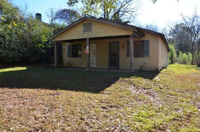
MOTIVATED SELLER - MAKE OFFER - DUPLEX IN THE HEART OF ALBANY! NEEDS WORK. SOLD AS IS.
Last Agent to Sell the Property
Re/Max Of Albany Brokerage Phone: 2294341600 License #213956 Listed on: 01/31/2017
Last Buyer's Agent
Re/Max Of Albany Brokerage Phone: 2294341600 License #213956 Listed on: 01/31/2017
| Date | Buyer | Sale Price | Title Company |
|---|---|---|---|
| Bagcvc Llc | $6,000 | -- | |
| Lane Donna M | $7,500 | -- | |
| Sb & T Bank | -- | -- | |
| Barfield Randy L | -- | -- | |
| Lubrin Callistas | $30,000 | -- | |
| Barfield Ceceila M | -- | -- | |
| Barfield Randy L | $17,500 | -- |
| Date | Event | Price | List to Sale | Price per Sq Ft |
|---|---|---|---|---|
| 03/21/2017 03/21/17 | Sold | $6,000 | -- | $4 / Sq Ft |
| 01/31/2017 01/31/17 | Pending | -- | -- | -- |
| Year | Tax Paid | Tax Assessment Tax Assessment Total Assessment is a certain percentage of the fair market value that is determined by local assessors to be the total taxable value of land and additions on the property. | Land | Improvement |
|---|---|---|---|---|
| 2024 | $191 | $4,000 | $4,000 | $0 |
| 2023 | $186 | $4,000 | $4,000 | $0 |
| 2022 | $187 | $4,000 | $4,000 | $0 |
| 2021 | $173 | $4,000 | $4,000 | $0 |
| 2020 | $174 | $4,000 | $4,000 | $0 |
| 2019 | $174 | $4,000 | $4,000 | $0 |
| 2018 | $105 | $7,560 | $4,000 | $3,560 |
| 2017 | $359 | $8,800 | $4,000 | $4,800 |
| 2016 | $359 | $8,800 | $4,000 | $4,800 |
| 2015 | $868 | $21,200 | $4,000 | $17,200 |
| 2014 | $857 | $21,200 | $4,000 | $17,200 |
Seller's Agent in 2017
Karen Richter
Re/Max Of Albany
(229) 854-3730
2 in this area
137 Total Sales
Seller Co-Listing Agent in 2017
Leigh Windham
Re/Max Of Albany
(229) 894-5177
9 Total Sales
Source: Albany Board of REALTORS®
MLS Number: 137592
APN: 000CC-00003-019